
MyTopo
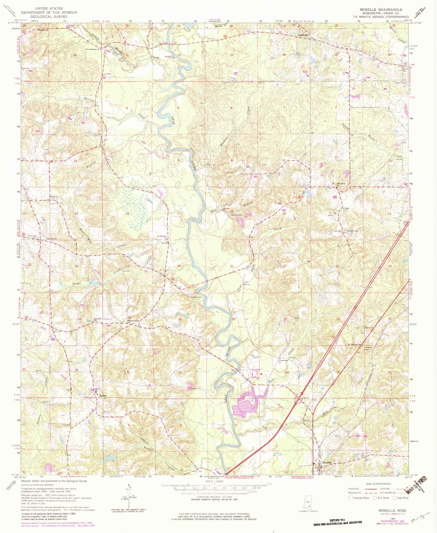
Classic USGS Moselle Mississippi 7.5'x7.5' Topo Map
Couldn't load pickup availability
Historical USGS topographic quad map of Moselle in the state of Mississippi. Map scale may vary for some years, but is generally around 1:24,000. Print size is approximately 24" x 27"
This quadrangle is in the following counties: Jones.
The map contains contour lines, roads, rivers, towns, and lakes. Printed on high-quality waterproof paper with UV fade-resistant inks, and shipped rolled.
Contains the following named places: Anderson Water Mill, Austin and Thrash Catfish Ponds Dam, Benson Cemetery, Burr Creek, Cranfords Bridge, Crosby Bridge, Crosby Cemetery, Crosby Store, Cross Roads School, Crossroads Cemetery, Crossroads Church, Fairfield Cemetery, Fairfield Church, Four Forks Creek, Francis Lowery Lake Dam, Gales Branch, Gandy Cemetery, Haskins Ferry, Hillcrest Church, Hinton Cemetery, Hinton Church, Hinton School, Hoskins Creek, Jordan Cemetery, L D Emmons Pond Dam, Lone Star Church, Lowery Creek, Mill Branch, Mill Creek, Moselle, Moselle Census Designated Place, Moselle Post Office, Moselle Volunteer Fire Department, Mount Pleasant Church, Napier Mills, New Bethany Cemetery, New Bethany Church, New Bethlehem Church, Oak Barry Church, Oakey Woods Creek, Parker Creek, Parkers Store, Pine Grove Cemetery, Pine Grove Church, Pine Grove School, Pleasant Ridge Church, Pleasant Ridge School, Rainey, Rainey School, Rice Mill Creek, Riverside Church, Sand Hill, Sand Hill School, Shiloh Church, Slidell School, Snows Creek, South Jones Volunteer Fire Department, Southwest Jones Volunteer Fire Department, Sweetwater Church, Sweetwater School, Tisdale Branch, Wallace Store, Windham Ferry


