MyTopo
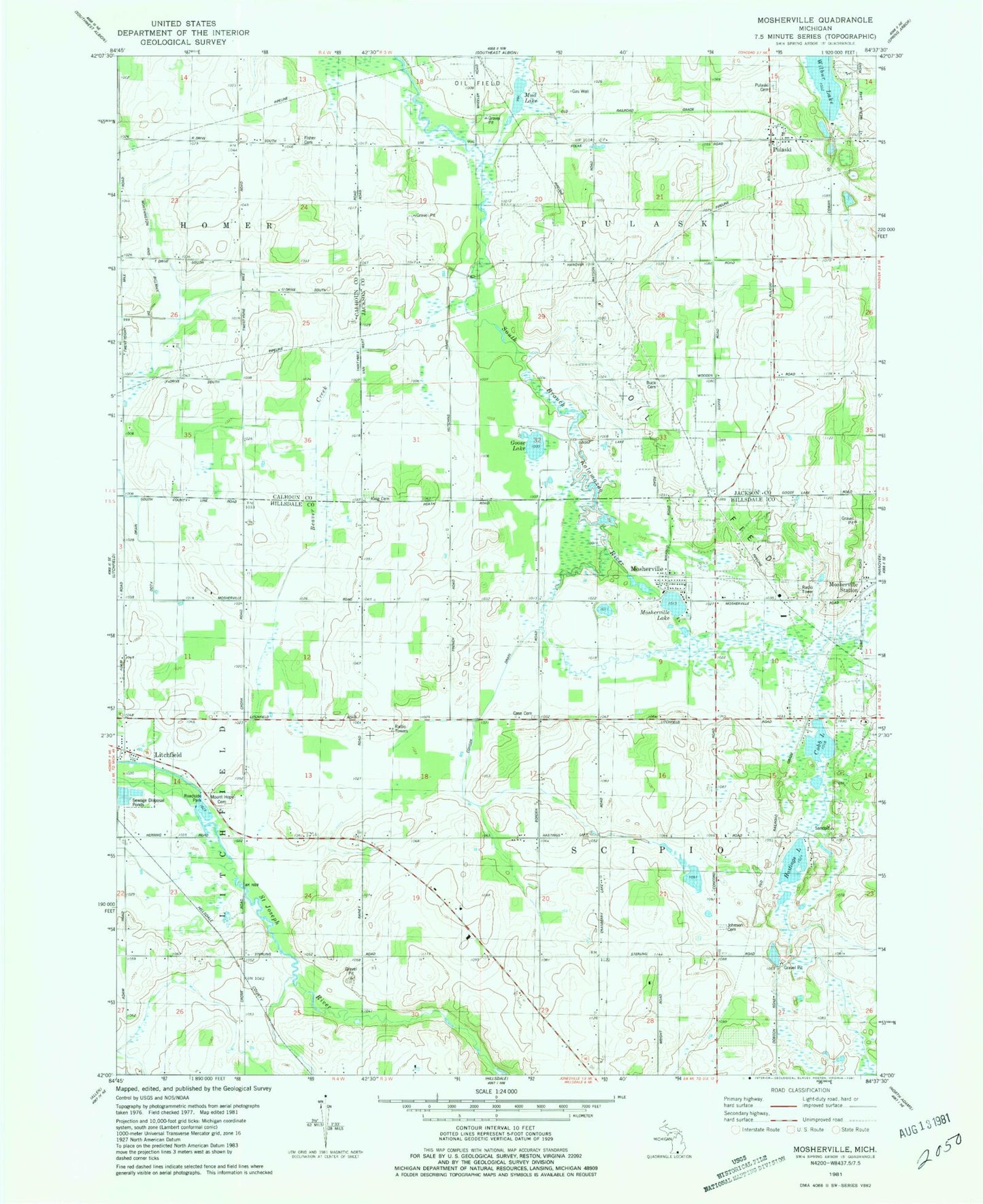
Classic USGS Mosherville Michigan 7.5'x7.5' Topo Map
Couldn't load pickup availability
Historical USGS topographic quad map of Mosherville in the state of Michigan. Map scale may vary for some years, but is generally around 1:24,000. Print size is approximately 24" x 27"
This quadrangle is in the following counties: Calhoun, Hillsdale, Jackson.
The map contains contour lines, roads, rivers, towns, and lakes. Printed on high-quality waterproof paper with UV fade-resistant inks, and shipped rolled.
Contains the following named places: Beaver Creek, Buck Cemetery, Case Cemetery, Cobb Lake, Conger Drain, Countryside Bible Church, Dresserville School, Fisher Cemetery, Fisher School, Goose Lake, Hastings Lake, Hiram King Cemetery, Hodges School, Johnson Cemetery, Johnson School, King School, Mason School, Mosherville, Mosherville Cemetery, Mosherville Church Historical Marker, Mosherville Lake, Mosherville Post Office, Mosherville School Historical Marker, Mosherville Station, Mount Hope Cemetery, Mud Lake, Proper School, Pulaski, Pulaski Cemetery, Pulaski Free Methodist Church, Pulaski Post Office, Pulaski Station, Pulaski Township Fire Department, Township of Pulaski, Township of Scipio, Twin Pine Campground, Wilbur Lake, Wildwood Acres Campground, ZIP Code: 49250