MyTopo
Classic USGS Moskee Wyoming 7.5'x7.5' Topo Map
Couldn't load pickup availability
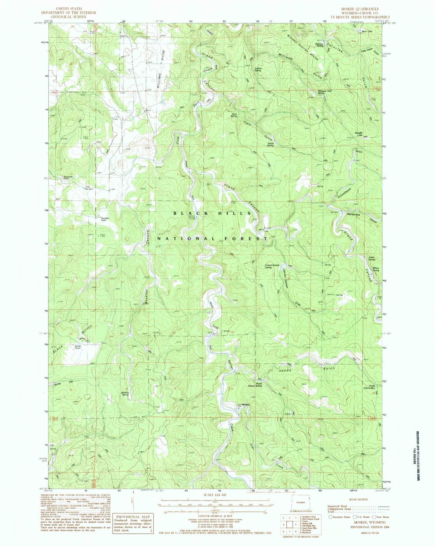
Historical USGS topographic quad map of Moskee in the state of Wyoming. Map scale may vary for some years, but is generally around 1:24,000. Print size is approximately 24" x 27"
This quadrangle is in the following counties: Crook.
The map contains contour lines, roads, rivers, towns, and lakes. Printed on high-quality waterproof paper with UV fade-resistant inks, and shipped rolled.
Contains the following named places: Adams Gulch, Bear Lake, Bearing Tree, Buckley Canyon, Buckley Spring, Calvary Sacket Draw, Calvert-Sacket Spring, Deer Creek, G Reynolds Ranch, Grand Canyon, H Reynolds Ranch, Jones Spring, Katan Spring, Kunath Ranch, Lehner Spring, Moskee, Plato Gulch, Plato Ranch, Pole Cabin Gulch, Rattlesnake Canyon, Schoolhouse Gulch, Straight Lake, Wagon Canyon, Williams Divide, Williams Gulch, Williams Number Two Spring, Williams Spring, Williams-Surprise Divide, Willow Spring, Willow Springs