MyTopo
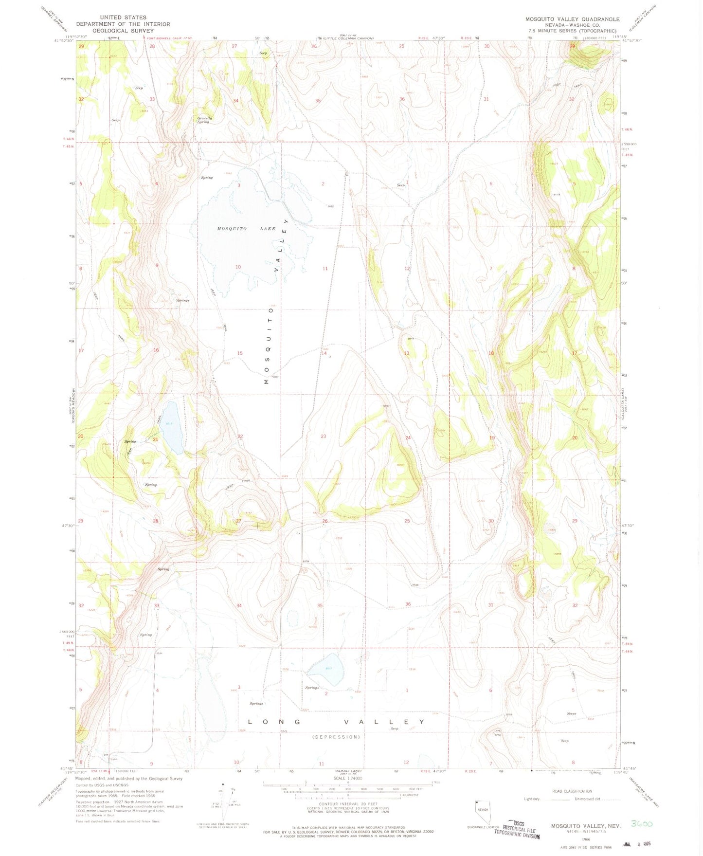
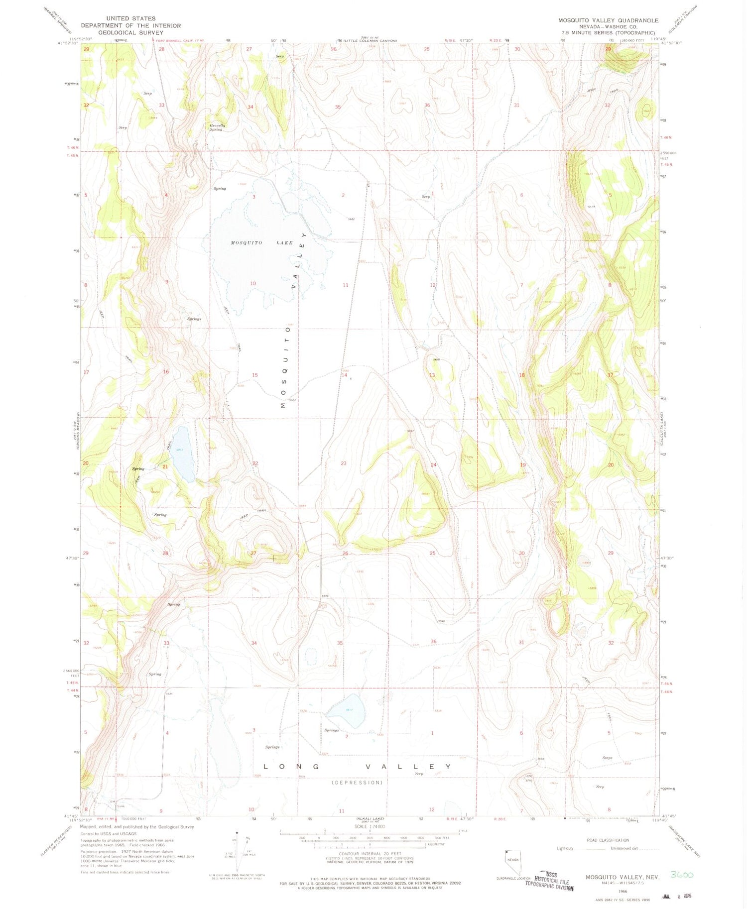
Classic USGS Mosquito Valley Nevada 7.5'x7.5' Topo Map
Couldn't load pickup availability
Historical USGS topographic quad map of Mosquito Valley in the state of Nevada. Map scale may vary for some years, but is generally around 1:24,000. Print size is approximately 24" x 27"
This quadrangle is in the following counties: Washoe.
The map contains contour lines, roads, rivers, towns, and lakes. Printed on high-quality waterproof paper with UV fade-resistant inks, and shipped rolled.
Contains the following named places: Beulah, Beulah Post Office, Broyles Ranch, Crawford Ranch, Diessner, Diessner Post Office, Drown Ranch, Gravelly Spring, Hill Dam Number One, Hill Ranch, Hill Reservoir, Howard C Davis Dam, Knoll Ranch, Long Valley School, Morris Ranch, Mosquito Lake, Mosquito Valley, Parry Ranch, Steward Ranch