
MyTopo
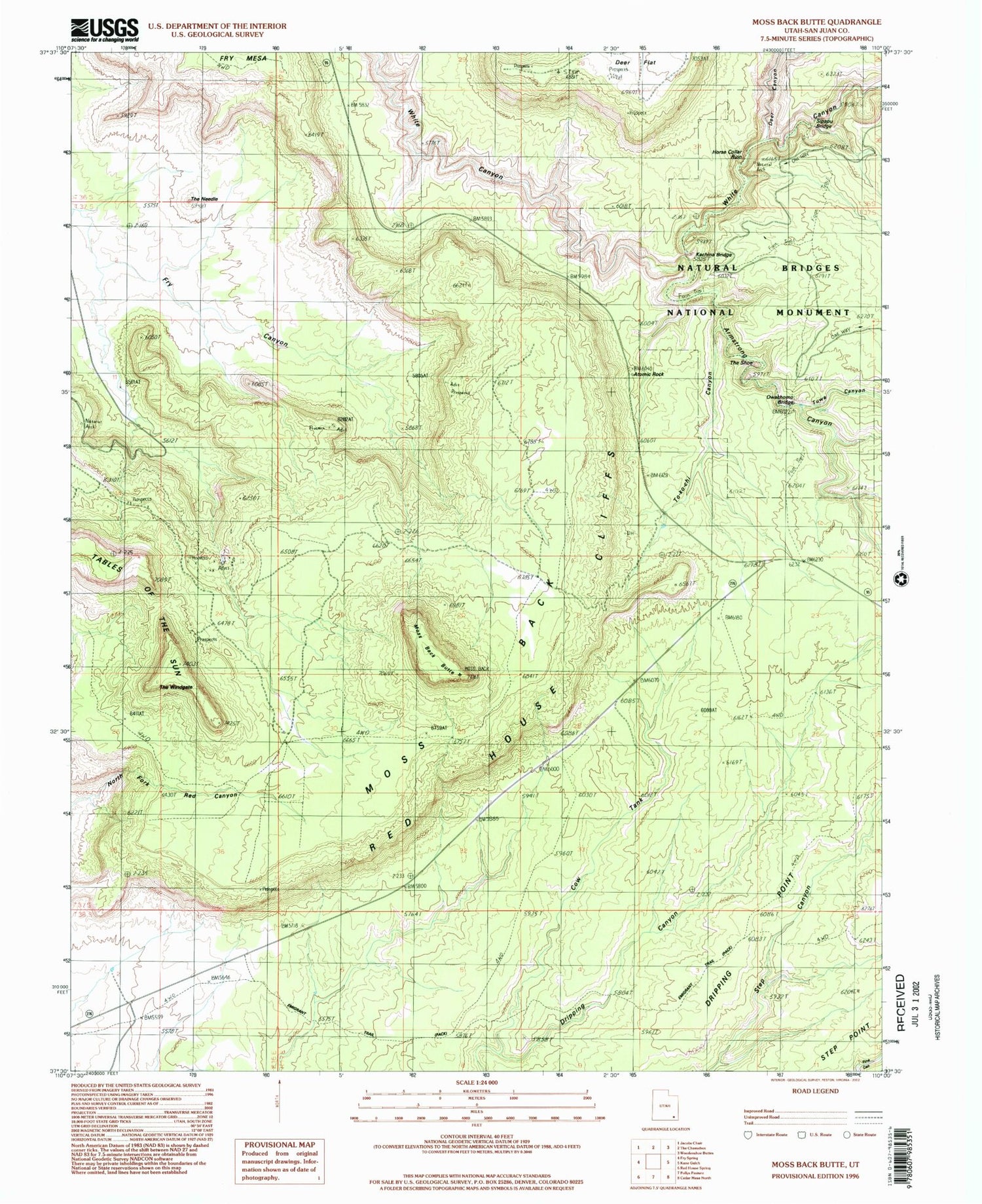
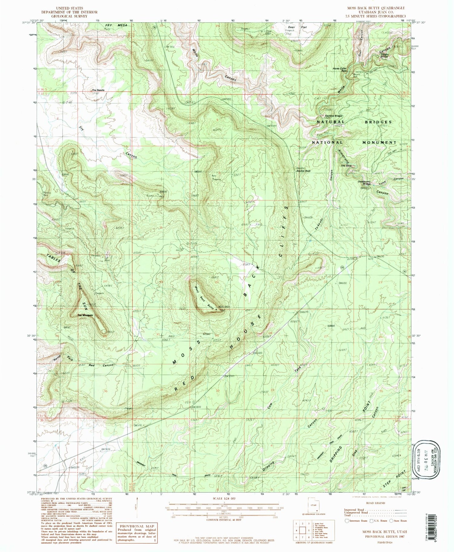
Classic USGS Moss Back Butte Utah 7.5'x7.5' Topo Map
Couldn't load pickup availability
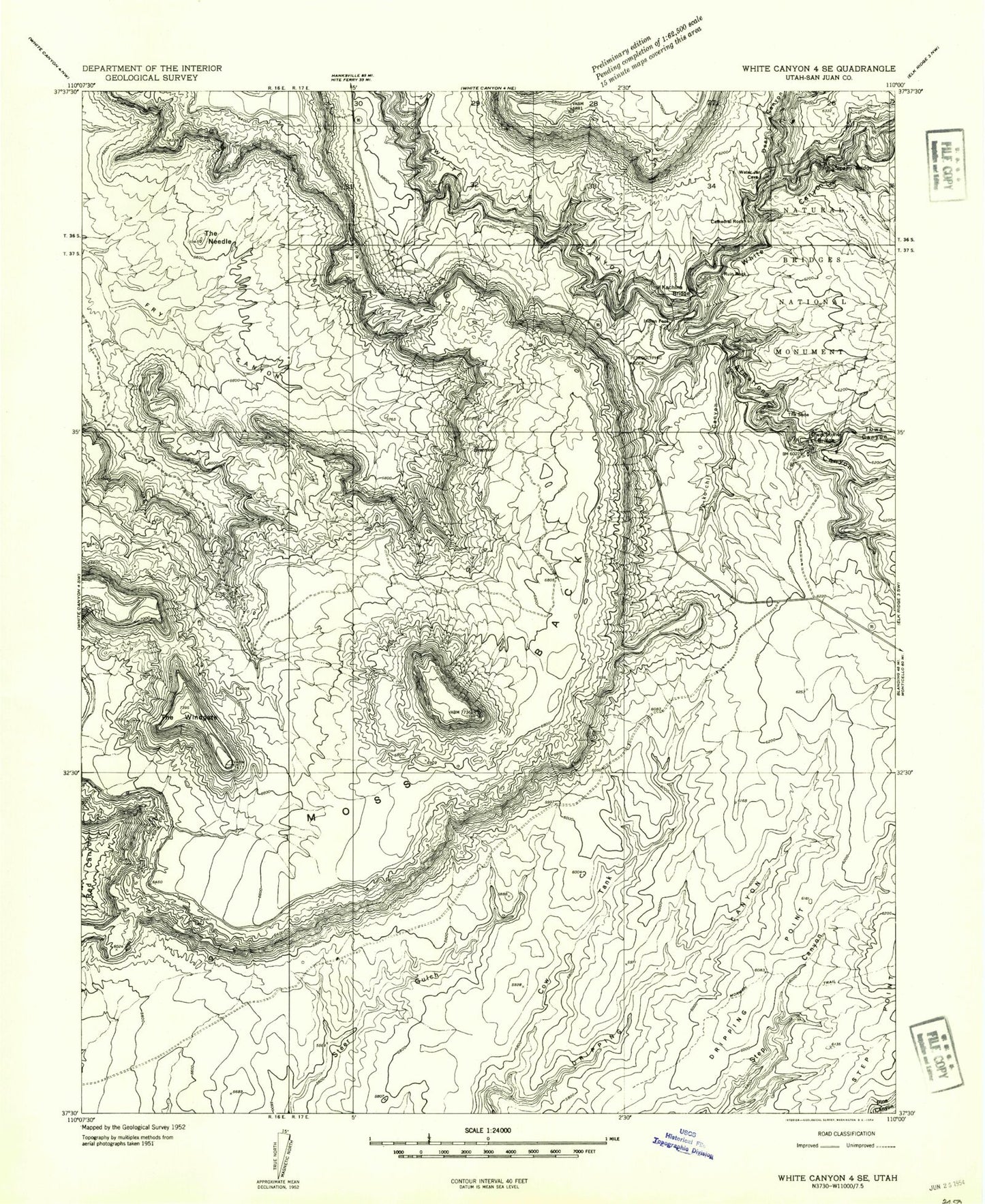
Historical USGS topographic quad map of Moss Back Butte in the state of Utah. Typical map scale is 1:24,000, but may vary for certain years, if available. Print size: 24" x 27"
This quadrangle is in the following counties: San Juan.
The map contains contour lines, roads, rivers, towns, and lakes. Printed on high-quality waterproof paper with UV fade-resistant inks, and shipped rolled.
Contains the following named places: Cathedral Rock, Cow Tank, Deer Canyon, Dripping Point, Moss Back, Ruin Rock, Sipapu Bridge, The Needle, The Shoe, The Windgate, To-ko-chi Canyon, Atomic Rock, Bridge View, Bridge View, Natural Bridges National Monument Picnic Area, Tables of the Sun, Armstrong Canyon, Indian Foot, Tuwa Canyon, Bridge View, Fry Mesa, Natural Bridges National Monument, Moss Back Butte, Kachina Bridge, Owachomo Bridge, Cathedral Rock, Cow Tank, Deer Canyon, Dripping Point, Moss Back, Ruin Rock, Sipapu Bridge, The Needle, The Shoe, The Windgate, To-ko-chi Canyon, Atomic Rock, Bridge View, Bridge View, Natural Bridges National Monument Picnic Area, Tables of the Sun, Armstrong Canyon, Indian Foot, Tuwa Canyon, Bridge View, Fry Mesa, Natural Bridges National Monument, Moss Back Butte, Kachina Bridge, Owachomo Bridge