
MyTopo
Classic USGS Moss Mississippi 7.5'x7.5' Topo Map
Couldn't load pickup availability
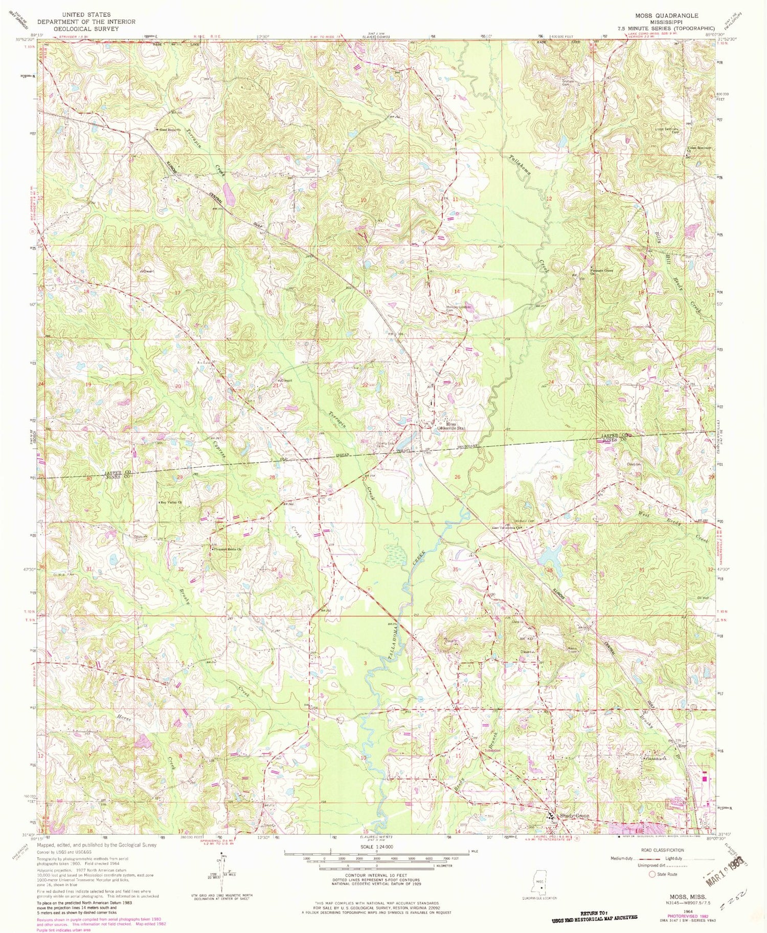
Historical USGS topographic quad map of Moss in the state of Mississippi. Map scale may vary for some years, but is generally around 1:24,000. Print size is approximately 24" x 27"
This quadrangle is in the following counties: Jasper, Jones.
The map contains contour lines, roads, rivers, towns, and lakes. Printed on high-quality waterproof paper with UV fade-resistant inks, and shipped rolled.
Contains the following named places: Andersons Mill, Brushy Creek, County Line Cemetery, Cypress Creek, East Tallahoma Church, Friendship Church, Good Hope Baptist Church, Graham Cemetery, Heritage Lake Dam, Hoy, Joe Welch Lake Dam, Lamar School, Martin Raegan Lake Dam, Matthews, Matthews Cemetery, Memory Gardens Cemetery, Moss, Moss Chapel, Moss Chapel School, Moss Lake Dam, Moss Post Office, Mossville Volunteer Fire Department, Newhope School, Pleasant Grove Church, Pleasant Home Baptist Church, Poore Store, Roy Valley Church, Sandridge School, Shady Grove, Shady Grove Cemetery, Shady Grove Church, Shady Grove Elementary School, Shady Grove Volunteer Fire Department, Sun Light Baptist Church, Supervisor District 1, Terrapin Creek, Union Seminary Baptist Cemetery, Union Seminary Missionary Baptist Church, Welborn Cemetery, ZIP Code: 39481


