MyTopo
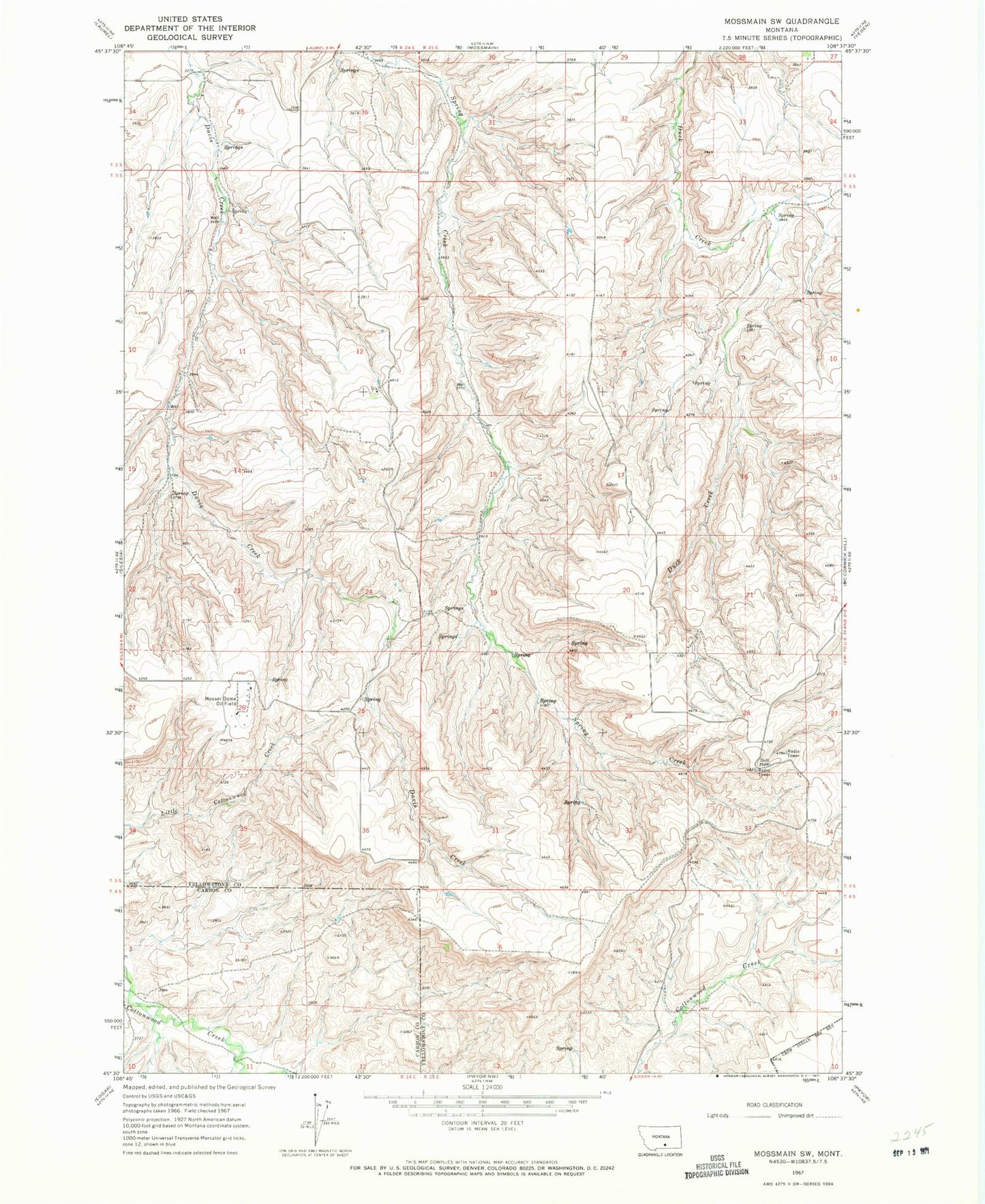
Classic USGS Mossmain SW Montana 7.5'x7.5' Topo Map
Regular price
$16.95
Regular price
Sale price
$16.95
Unit price
per
Couldn't load pickup availability
Historical USGS topographic quad map of Mossmain SW in the state of Montana. Map scale may vary for some years, but is generally around 1:24,000. Print size is approximately 24" x 27"
This quadrangle is in the following counties: Carbon, Yellowstone.
The map contains contour lines, roads, rivers, towns, and lakes. Printed on high-quality waterproof paper with UV fade-resistant inks, and shipped rolled.
Contains the following named places: 03S16E23ABDB01 Well, 03S24E01CAAB01 Well, 03S24E12A___01 Well, 03S25E04A___01 Well, 03S25E06B___01 Well, 03S25E07C___01 Well, 03S25E18A___01 Well, KRKX-FM (Billings), Mosser Dome Oil Field, Spring Creek School