MyTopo
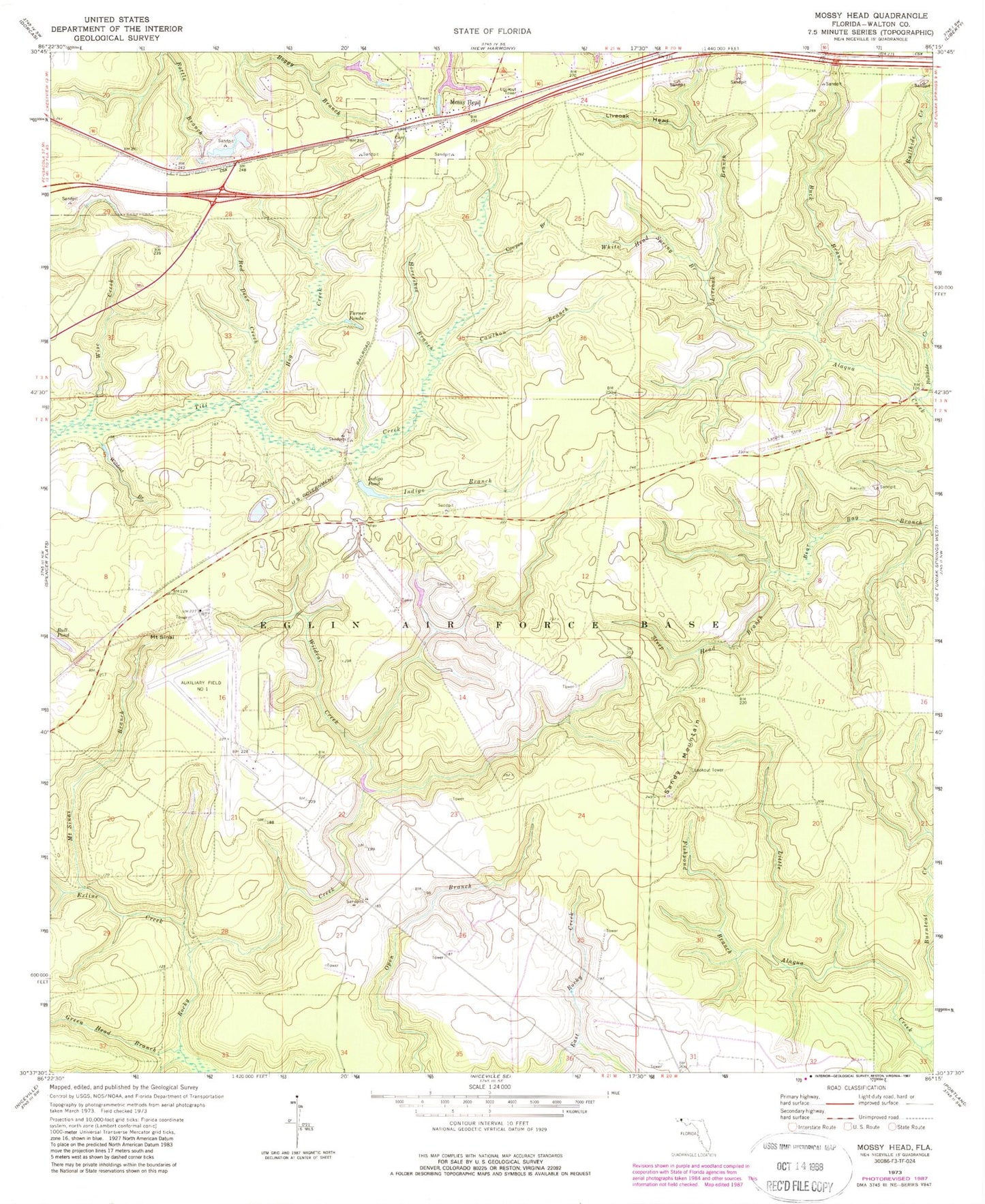
Classic USGS Mossy Head Florida 7.5'x7.5' Topo Map
Couldn't load pickup availability
Historical USGS topographic quad map of Mossy Head in the state of Florida. Map scale may vary for some years, but is generally around 1:24,000. Print size is approximately 24" x 27"
This quadrangle is in the following counties: Walton.
The map contains contour lines, roads, rivers, towns, and lakes. Printed on high-quality waterproof paper with UV fade-resistant inks, and shipped rolled.
Contains the following named places: Buck Branch, Bullhide Creek, Burntout Creek, Cawthon Branch, Cowpen Branch, Dogwood Head Branch, Exline Creek, Fishpond Branch, Green Head Branch, Hog Creek, Horseshoe Branch, Indigo Branch, Indigo Pond, Liveoak Branch, Liveoak Head, Mossy Head, Mossy Head Lookout Tower, Mount Sinai Branch, Red Deer Creek, Sandy Mountain, Sandy Mountain Lookout Tower, Steep Head Branch, Turner Ponds, White Head Spring Branch, Wildcat Branch, Wildcat Creek, Wise Creek