MyTopo
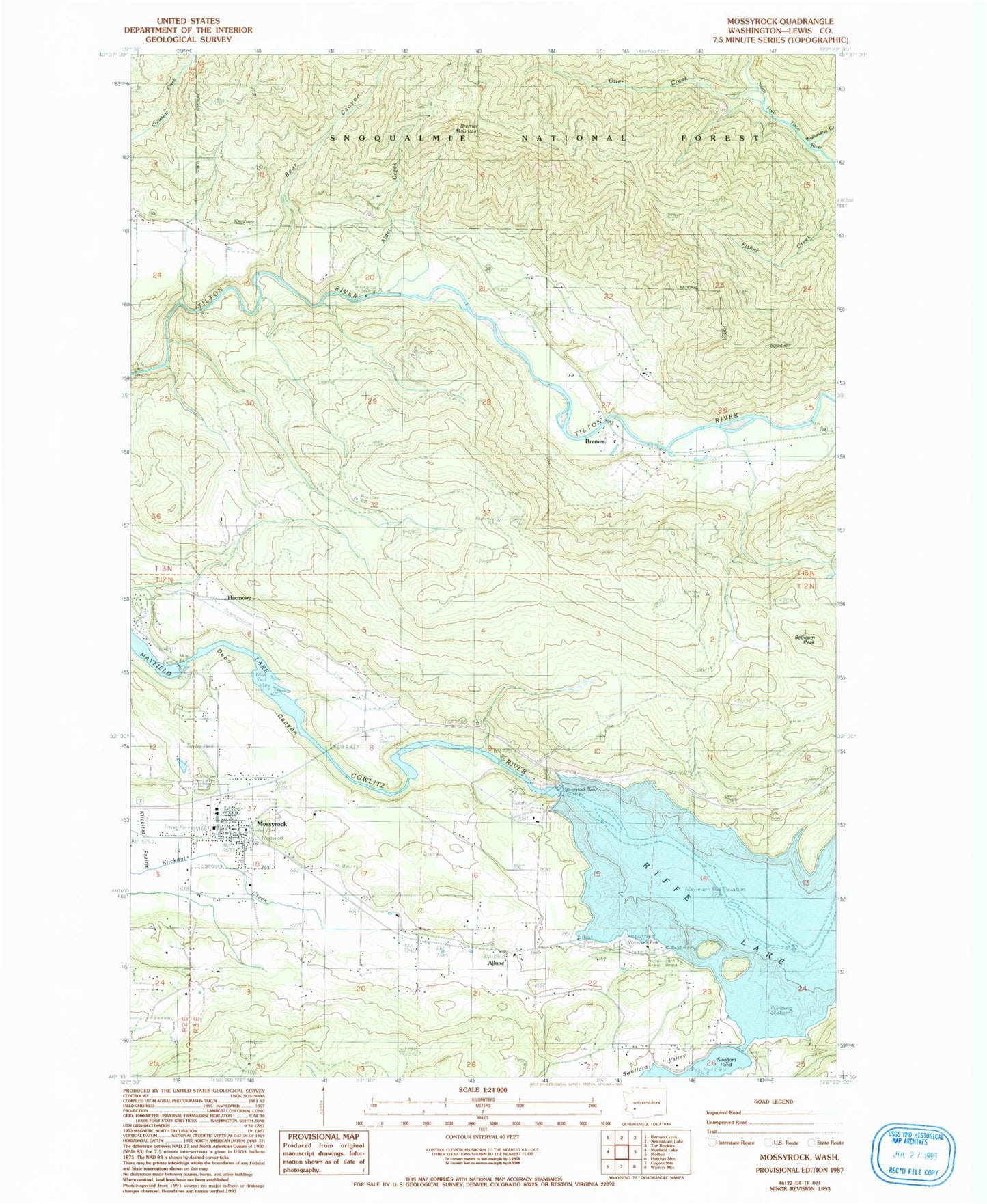
Classic USGS Mossyrock Washington 7.5'x7.5' Topo Map
Couldn't load pickup availability
Historical USGS topographic quad map of Mossyrock in the state of Washington. Map scale may vary for some years, but is generally around 1:24,000. Print size is approximately 24" x 27"
This quadrangle is in the following counties: Lewis.
The map contains contour lines, roads, rivers, towns, and lakes. Printed on high-quality waterproof paper with UV fade-resistant inks, and shipped rolled.
Contains the following named places: Ajlune, Alder Creek, Bear Canyon, Bear Canyon West Field Airport, Bellicum Peak, Bremer, Bremer Mountain, Brian Dam, City of Mossyrock, Doss Cemetery, Dunn Canyon, Dunn Cemetery, Harmony, Lewis County, Lewis County Fire District 3 Mossyrock Fire Department, Mossyrock, Mossyrock Dam, Mossyrock Elementary School, Mossyrock Junior - Senior High School, Mossyrock Middle School, Mossyrock Park, Mossyrock Police Department, Mossyrock Post Office, Otter Creek, Saint Yves Catholic Cemetery, Sulphur Creek, Swofford, Swofford Valley, Swofford Valley Rearing Pond Dam, Wallanding Creek, ZIP Code: 98585