MyTopo
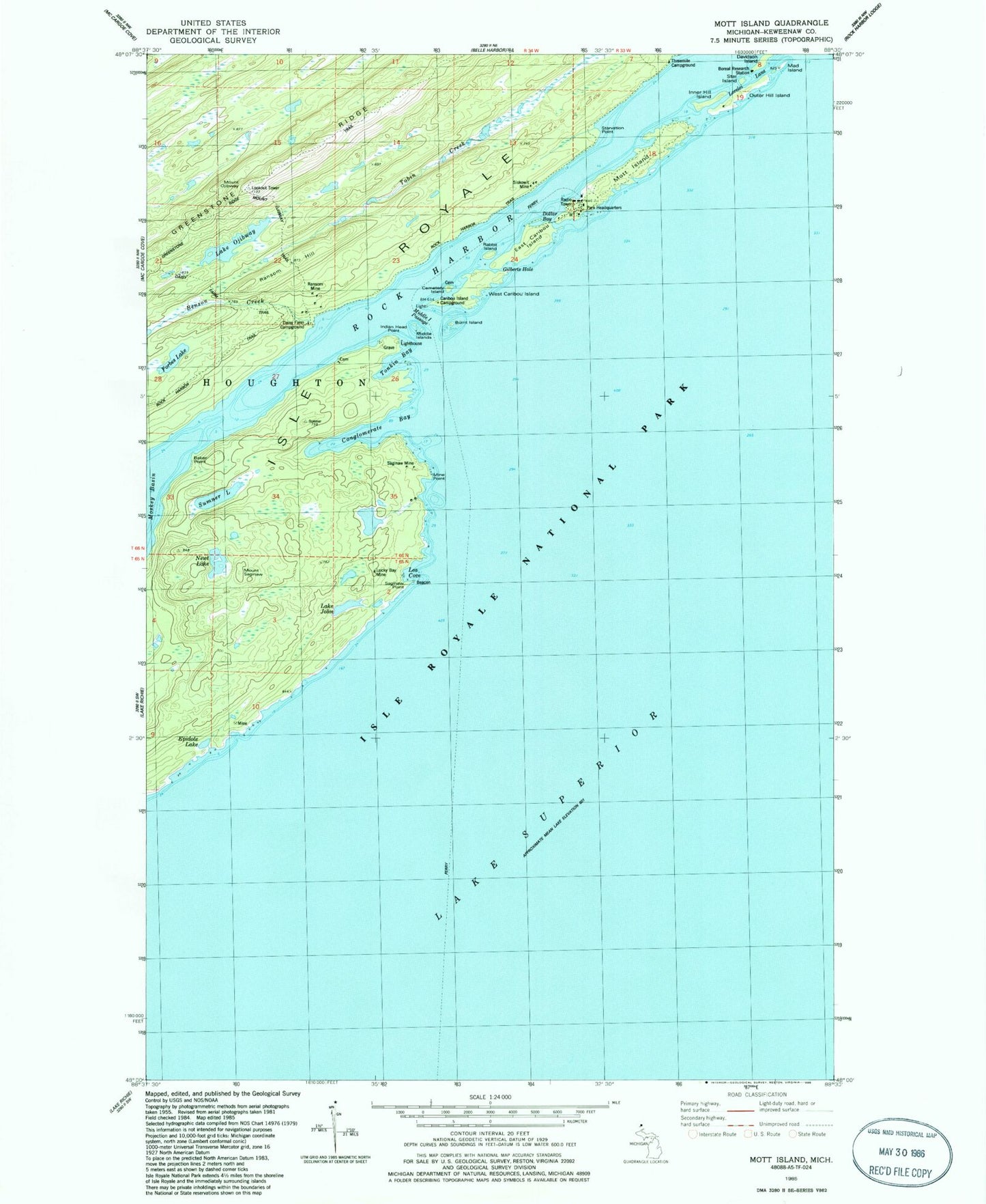
Classic USGS Mott Island Michigan 7.5'x7.5' Topo Map
Couldn't load pickup availability
Historical USGS topographic quad map of Mott Island in the state of Michigan. Typical map scale is 1:24,000, but may vary for certain years, if available. Print size: 24" x 27"
This quadrangle is in the following counties: Keweenaw.
The map contains contour lines, roads, rivers, towns, and lakes. Printed on high-quality waterproof paper with UV fade-resistant inks, and shipped rolled.
Contains the following named places: Baker Point, Benson Creek, Burnt Island, Caribou Island Campground, Cemetery Island, Conglomerate Bay, Daisy Farm Campground, Davidson Island, East Caribou Island, Epidote Lake, Epidote Mine, Forbes Lake, Gilberts Hole, Inner Hill Island, Lake John, Lea Cove, Lucky Bay Mine, Mad Island, Middle Islands, Middle Islands Passage, Mine Point, Mott Island, Newt Lake, Lake Ojibway, Mount Ojibway, Outer Hill Island, Rabbit Island, Ransom Hill, Ransom Mine, Saginaw Mine, Saginaw Point, Mount Saginaw, Siskowit Mine, Star Island, Starvation Point, Sumner Lake, Threemile Campground, Tonkin Bay, West Caribou Island, Rock Harbor, Rock Harbor Trail, Mount Ojibway Trail, Boreal Research Station, Indian Head Point, Dollar Bay, Lorelei Lane, Daisy Farm Trail, Township of Houghton, Cemetery Island Cemetery, Rock Harbor Lighthouse, Caribou Arch