MyTopo
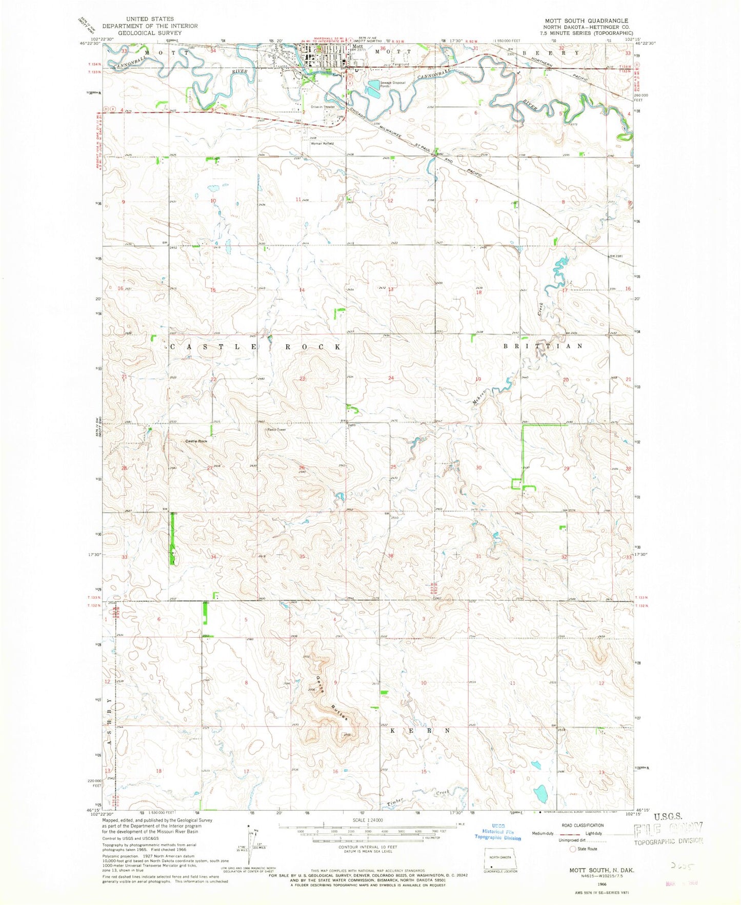
Classic USGS Mott South North Dakota 7.5'x7.5' Topo Map
Couldn't load pickup availability
Historical USGS topographic quad map of Mott South in the state of North Dakota. Map scale may vary for some years, but is generally around 1:24,000. Print size is approximately 24" x 27"
This quadrangle is in the following counties: Hettinger.
The map contains contour lines, roads, rivers, towns, and lakes. Printed on high-quality waterproof paper with UV fade-resistant inks, and shipped rolled.
Contains the following named places: Castle Rock, City of Mott, Gert Buttes, Good Samaritan Society-Mott, Hettinger County Courthouse, Hettinger County Sheriff's Office, Mott, Mott City Hall, Mott Municipal Airport, Mott Post Office, Mott Public Library, Mott Watershed Dam, Mott-Regent Public School, Township of Castle Rock