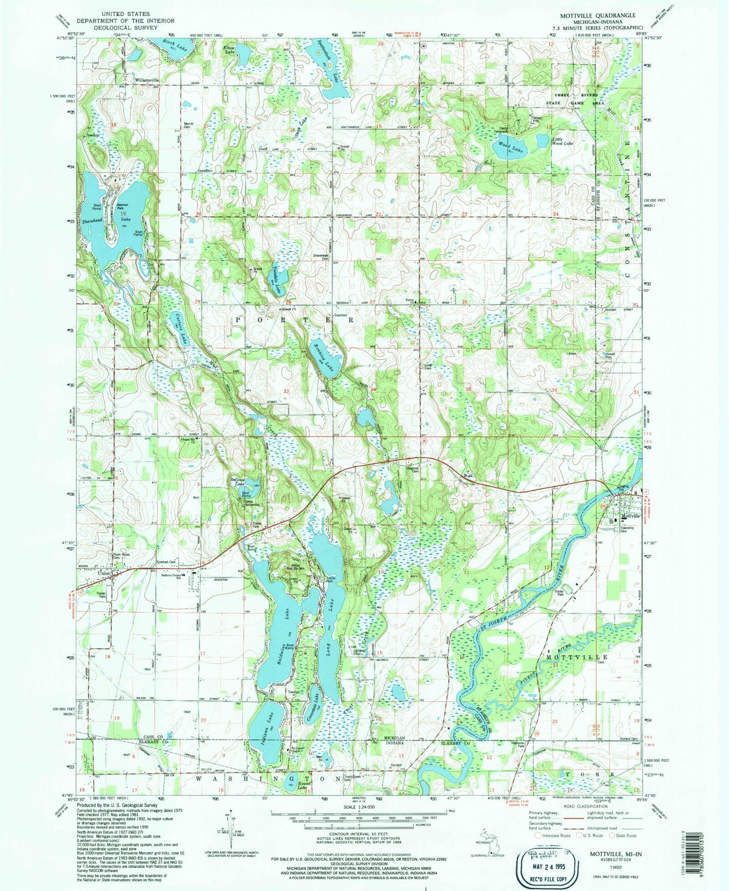
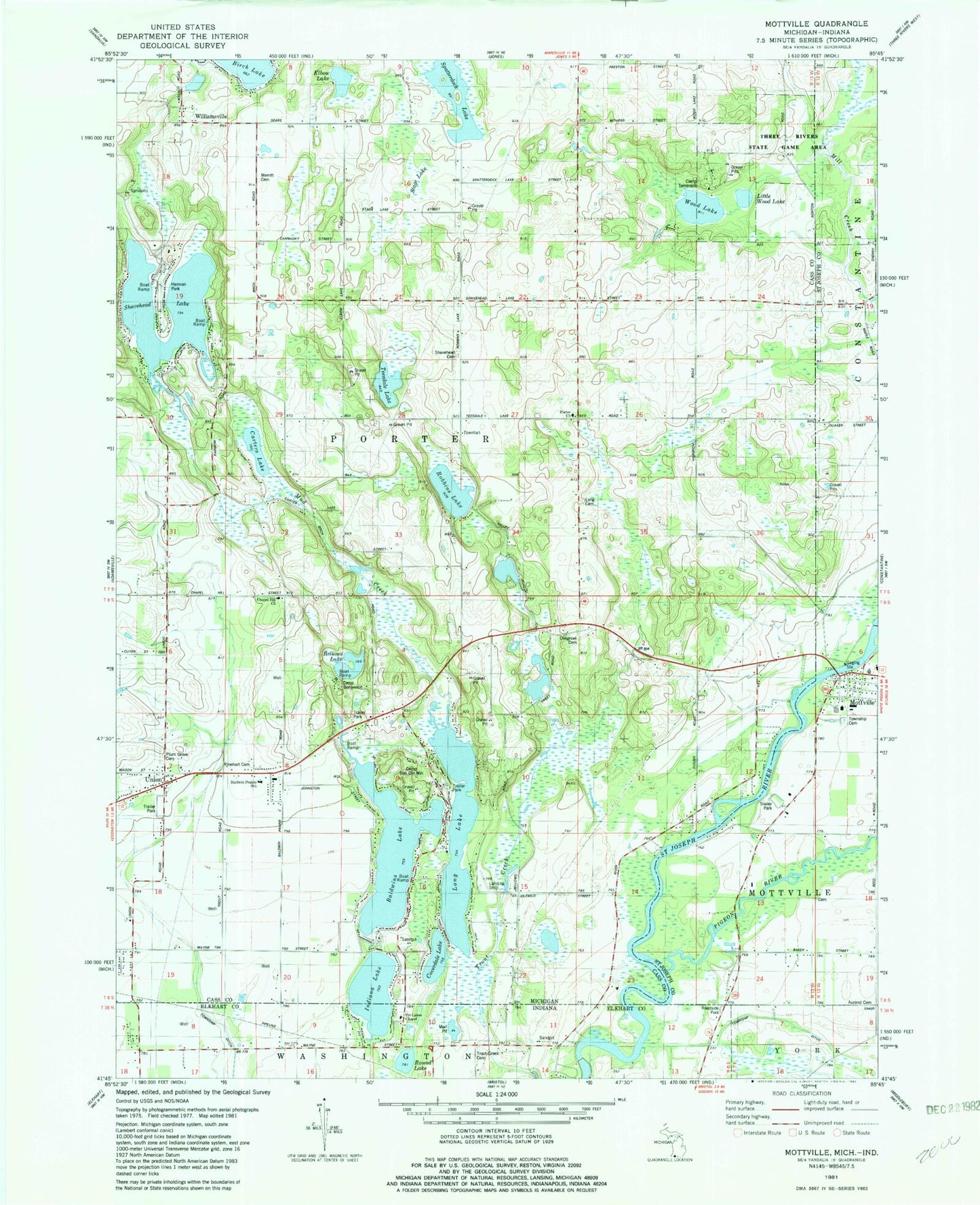
MyTopo
Classic USGS Mottville Michigan 7.5'x7.5' Topo Map
Couldn't load pickup availability
Historical USGS topographic quad map of Mottville in the states of Michigan, Indiana. Map scale may vary for some years, but is generally around 1:24,000. Print size is approximately 24" x 27"
This quadrangle is in the following counties: Cass, Elkhart, St. Joseph.
The map contains contour lines, roads, rivers, towns, and lakes. Printed on high-quality waterproof paper with UV fade-resistant inks, and shipped rolled.
Contains the following named places: Aurand Cemetery, Baldwin Lake Heliport, Baldwin Prairie School, Baldwins Lake, Bellows Lake, Camp Bellowood, Camp Sun Chi Win, Camp Tamarack, Carters Lake, Chapel Hill Church, Chapel Hill School, Coverdale Lake, East Union Cemetery, Elbow Lake, First Baptist Church, Harmon Park, Hebron School, Indiana Lake, King School, Little Wood Lake, Long Cemetery, Long Lake, Maple Grove School, Maple Street School, Marl Pit, Merritt Cemetery, Mill Pond, Mottville, Mottville Bible Church, Mottville Bridge Historical Marker, Mottville Community Church, Mottville Post Office, Mottville Township Cemetery, Mottville Township Hall, Mud Creek, New Song Community Church, Oak Grove School, Oakgrove Cemetery, Pigeon River, Plum Grove Cemetery, Porter Church, Porter Fire Department, Profile Lake Drain, Robbins Lake, Round Lake, Saint Joseph Bridge, Shave Head Post Office, Shavehead Cemetery, Shavehead Lake, Shavehead School, Spatterdock Lake, Stage Lake, Teesdale Lake, Thompson Cemetery, Thurston Woods Village Nursing Home, Township of Porter, Tri-Lakes Chapel, Trout Creek Cemetery, Union, Union Post Office, White Pigeon Cemetery, White School, Williamsville, Williamsville Post Office, Wood Lake, ZIP Codes: 49061, 49130