MyTopo
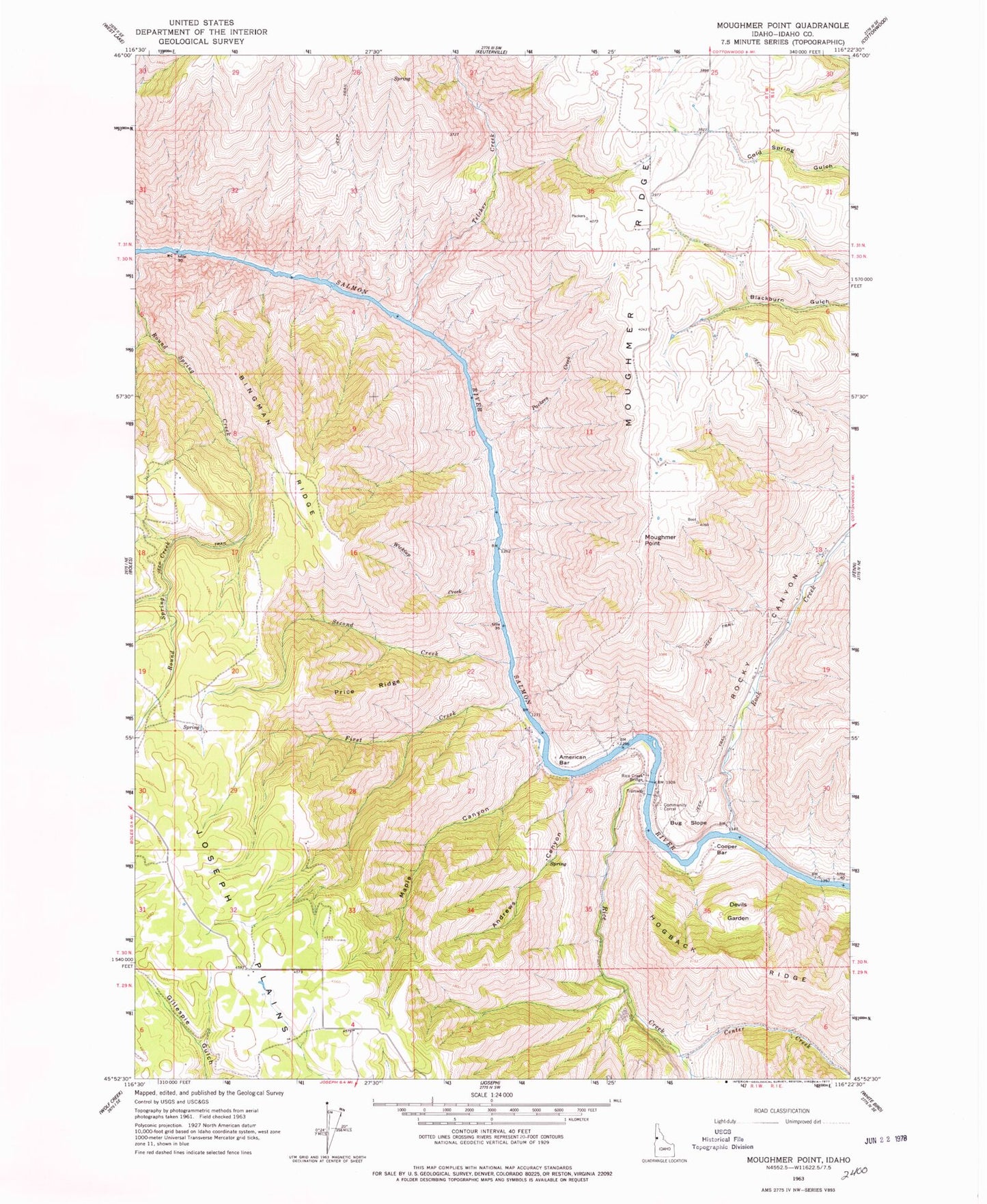
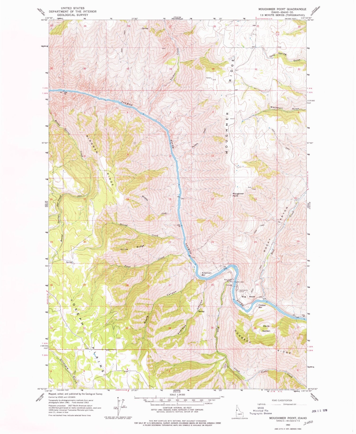
Classic USGS Moughmer Point Idaho 7.5'x7.5' Topo Map
Couldn't load pickup availability
Historical USGS topographic quad map of Moughmer Point in the state of Idaho. Map scale may vary for some years, but is generally around 1:24,000. Print size is approximately 24" x 27"
This quadrangle is in the following counties: Idaho.
The map contains contour lines, roads, rivers, towns, and lakes. Printed on high-quality waterproof paper with UV fade-resistant inks, and shipped rolled.
Contains the following named places: American Bar, Andrews Canyon, Bingman Ridge, Bug Slope, Center Creek, Cooper Bar, Devils Garden, First Creek, Maple Canyon, Moughmer Point, Moughmer Ridge, Packers Creek, Price Ridge, Rice Creek, Rice Creek Bridge, Rock Creek, Rocky Canyon, Second Creek, Telcher Creek, The Basin, Wickiup Creek