MyTopo
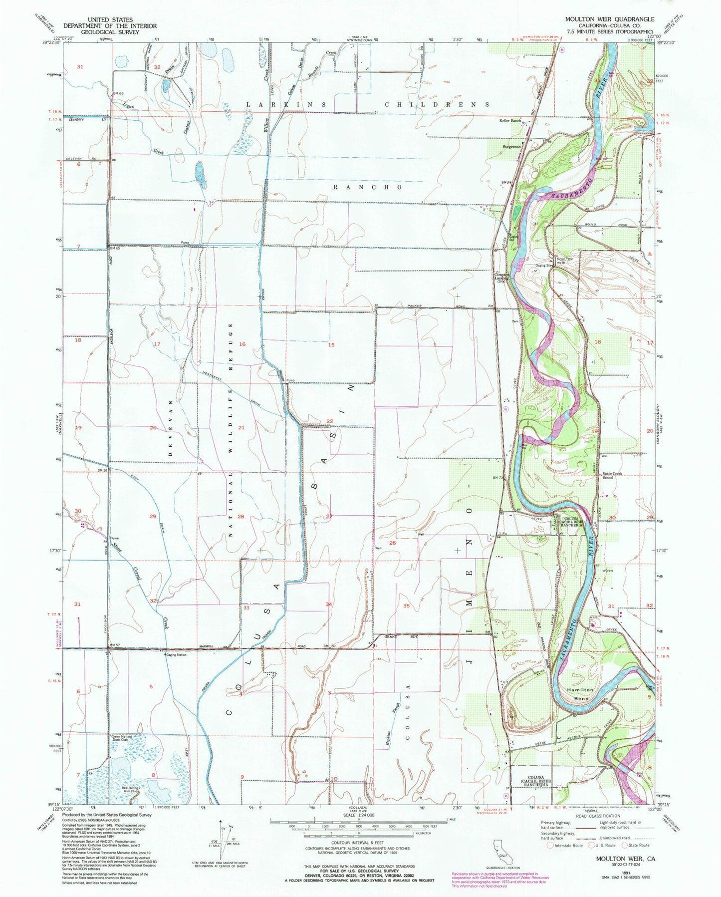
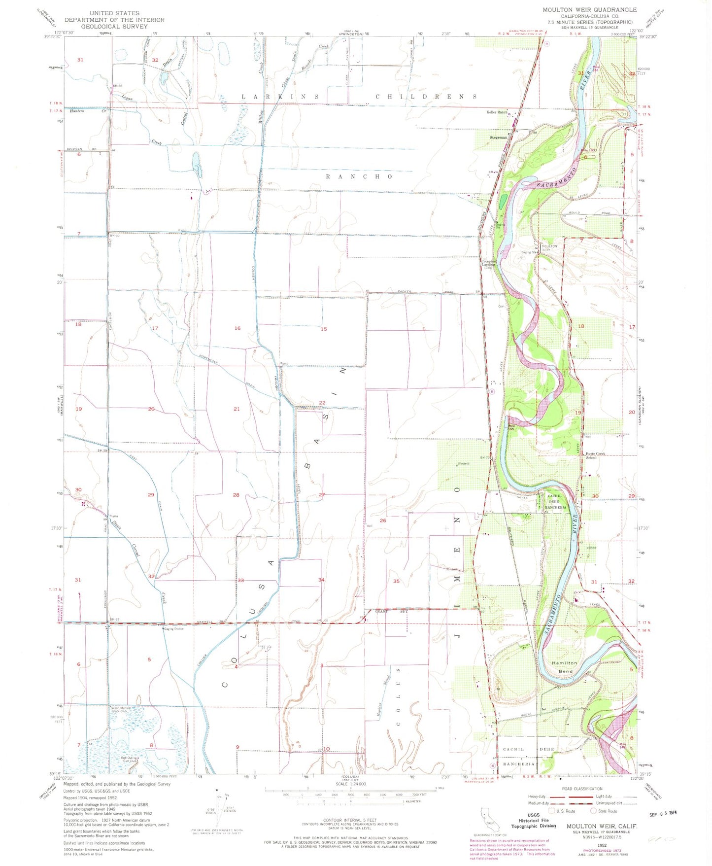
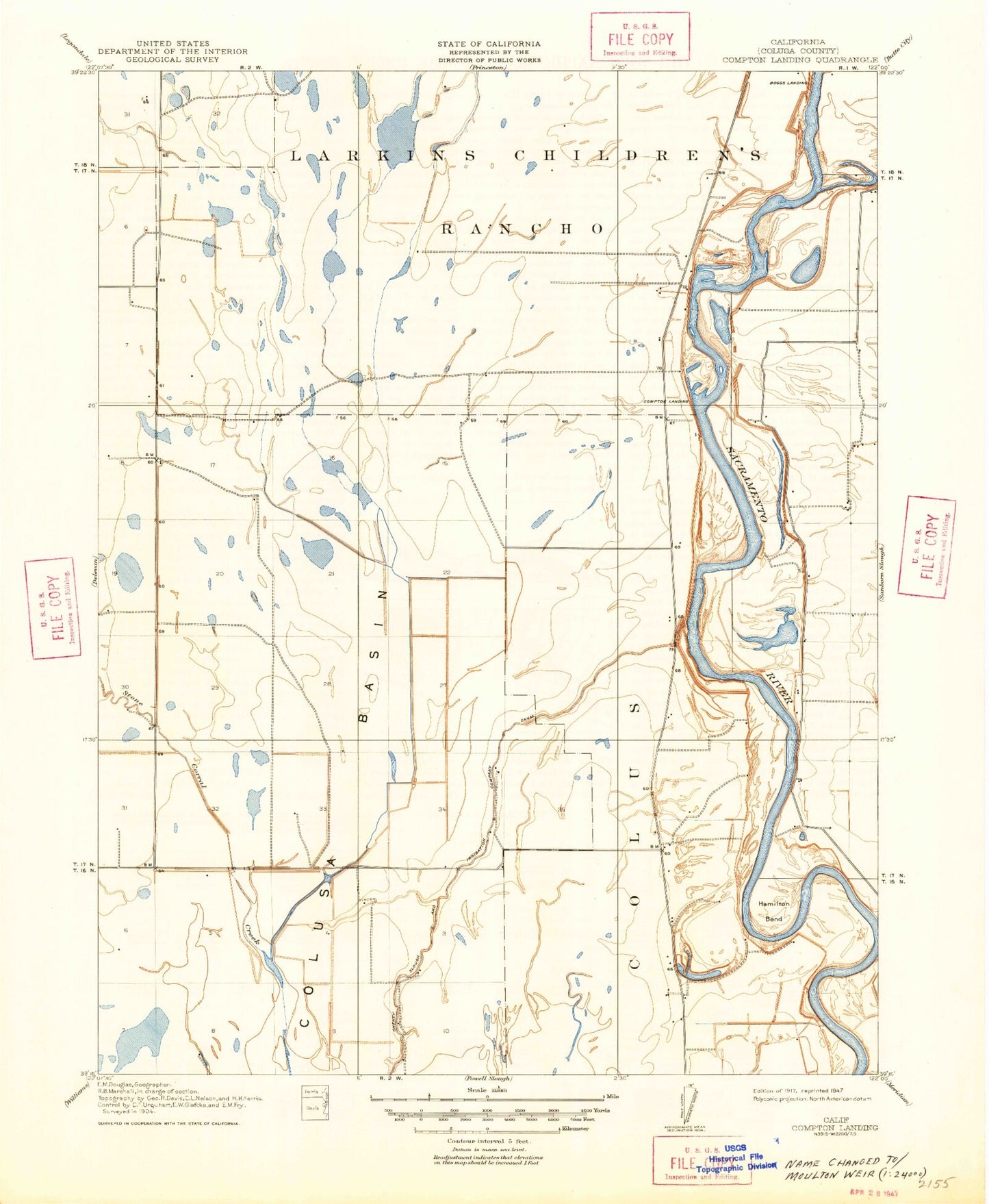
Classic USGS Moulton Weir California 7.5'x7.5' Topo Map
Couldn't load pickup availability
Historical USGS topographic quad map of Moulton Weir in the state of California. Map scale may vary for some years, but is generally around 1:24,000. Print size is approximately 24" x 27"
This quadrangle is in the following counties: Colusa.
The map contains contour lines, roads, rivers, towns, and lakes. Printed on high-quality waterproof paper with UV fade-resistant inks, and shipped rolled.
Contains the following named places: Bell Outing Gun Club, Boggs Landing, Bounde Creek, Butte Creek School, Cachil Dehe Rancheria, Colusa Rancheria, Colusa Trough, Compton Landing, Delevan National Wildlife Refuge, East Drain, Green Mallard Duck Club, Gunnersfield Ranch Airport, Hamilton Bend, Hunters Creek, Keller Ranch, Logan Creek, Moulton Weir, Northeast Drain, Richter Aviation, Stegeman, Stone Corral Creek, Willow Creek