MyTopo
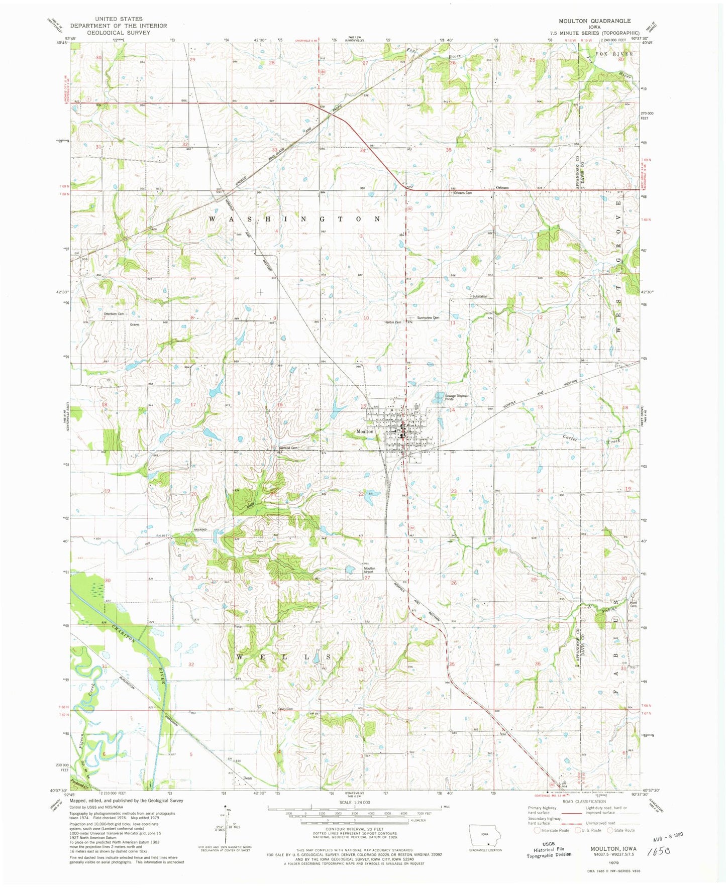
Classic USGS Moulton Iowa 7.5'x7.5' Topo Map
Couldn't load pickup availability
Historical USGS topographic quad map of Moulton in the state of Iowa. Map scale may vary for some years, but is generally around 1:24,000. Print size is approximately 24" x 27"
This quadrangle is in the following counties: Appanoose, Davis.
The map contains contour lines, roads, rivers, towns, and lakes. Printed on high-quality waterproof paper with UV fade-resistant inks, and shipped rolled.
Contains the following named places: Beetrace Post Office, Christian Church, City of Moulton, Croft Cemetery, Davis Cemetery, Dean, Dean Post Office, Garrett Memorial Library, Hardin Cemetery, Holiness Church of God, Horn Cemetery, Methodist Church, Moulton, Moulton - Udell Elementary School, Moulton - Udell Junior / Senior High School, Moulton Airport, Moulton Baptist Church, Moulton City Hall, Moulton Fire Department, Moulton Historical Society Museum, Moulton Library, Moulton Post Office, Moulton Volunteer Ambulance Service, Oakland Cemetery, Orleans, Orleans Cemetery, Orleans Church, Orleans Post Office, Otterbein Cemetery, Otterbein South Cemetery, Pigeon Creek, Shinn Cemetery, Staten Cemetery, Sunset View Cemetery, Township of Washington, Township of Wells, Williamston Post Office, ZIP Code: 52572