MyTopo
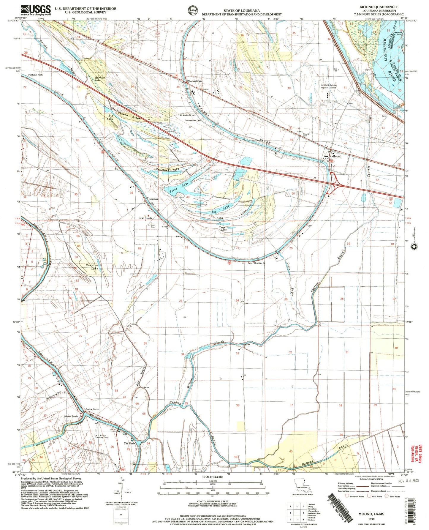
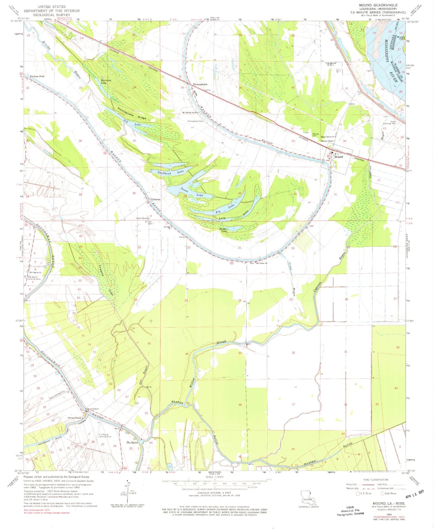
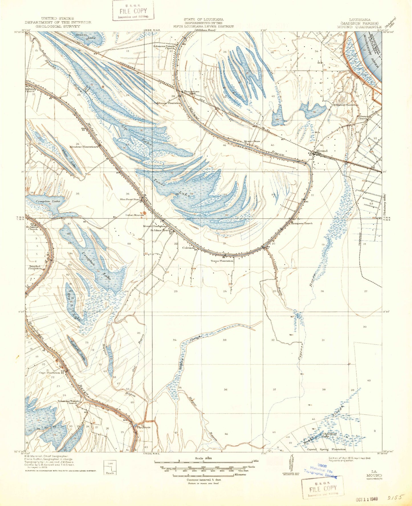
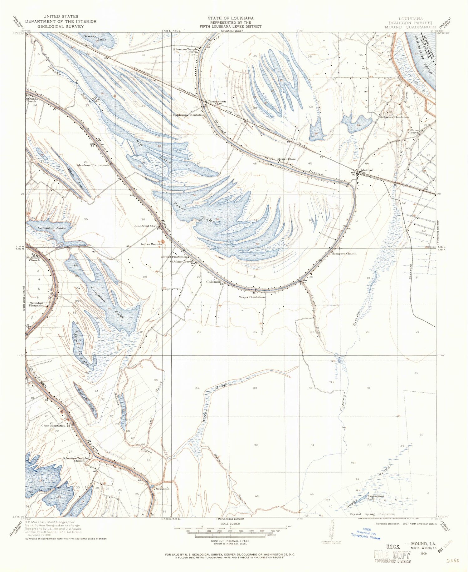
Classic USGS Mound Louisiana 7.5'x7.5' Topo Map
Couldn't load pickup availability
Historical USGS topographic quad map of Mound in the states of Louisiana, Mississippi. Map scale may vary for some years, but is generally around 1:24,000. Print size is approximately 24" x 27"
This quadrangle is in the following counties: Madison, Warren.
The map contains contour lines, roads, rivers, towns, and lakes. Printed on high-quality waterproof paper with UV fade-resistant inks, and shipped rolled.
Contains the following named places: Alcadone Plantation, Big Lake, California Plantation, Cape Plantation, Catfish Lake, Christmas Lake, Coleman, Compton Lake, Cross Bayou, Crystal Springs Plantation, Cypress Bayou, Dry Lake, Gar Bayou, Harper Bayou, Harrison Lake, K C Ranch Landing Strip, Killarney Church, Killarney Planatation, Long Lake, Mexico Store, Mound, Mound Cemetery, Mound Fire District 1, Mound Plantation, Mount Abbey Church, Mount Moriah Church Number 1, Mount Moriah Church Number 2, Mount Pilgrim Church, Mount Zilla Church, Nebraska Bar, Nebraska Landing, Rattlesnake Ridge, Red Beard Dusting Service Airport, Roundaway-Bayou Vidal Cutoff, Saint James Church, Saint John Cemetery, Saint John Church, Sandbank Lake, Shady Grove Church, Sip Lake, Solomon Temple, Solomons Temple Church, Texas Lake, Texas Plantation, The Basin, Thomas Chapel, Thomastown, Thomastown Cemetery, Thomastown School, Thompson Church, Trinidad Plantation, Vicksburg Tallulah Regional Airport, Village of Mound, Walnut Bayou, Ward One, Willow Slough, Yerger Lake, Yerger Landing Strip, Youngs Landing