MyTopo
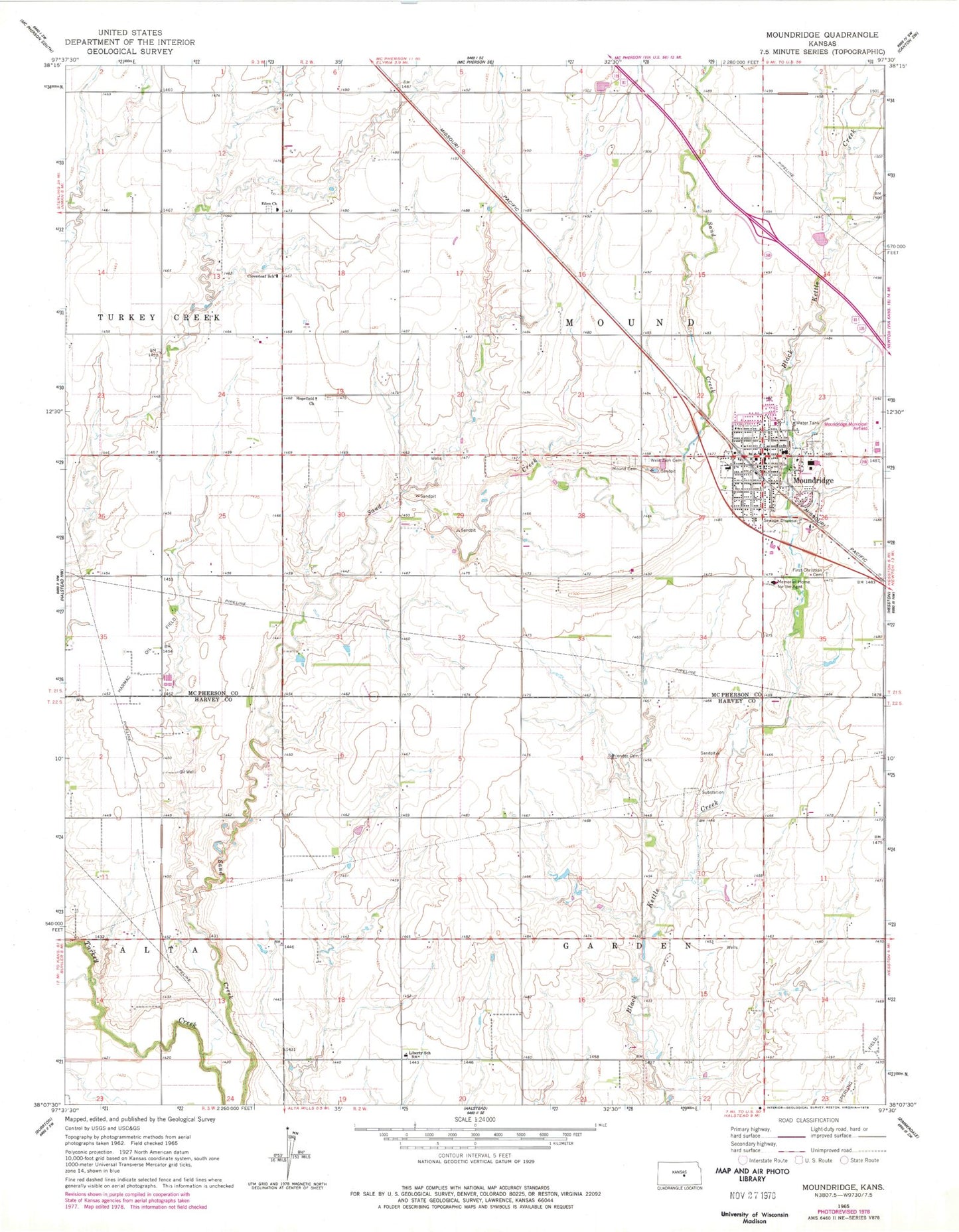
Classic USGS Moundridge Kansas 7.5'x7.5' Topo Map
Couldn't load pickup availability
Historical USGS topographic quad map of Moundridge in the state of Kansas. Map scale may vary for some years, but is generally around 1:24,000. Print size is approximately 24" x 27"
This quadrangle is in the following counties: Harvey, McPherson.
The map contains contour lines, roads, rivers, towns, and lakes. Printed on high-quality waterproof paper with UV fade-resistant inks, and shipped rolled.
Contains the following named places: City of Moundridge, Cloverleaf School, Eden Mennonite Church, First Mennonite Cemetery, First Mennonite Church, Gospel Mennonite Church, Harmac Oil Field, Hopefield Mennonite Church, Lake View, Liberty School, McPherson County Rural Fire District 7 Moundridge, Memorial Home, Mercy Hospital, Mound Cemetery, Moundridge, Moundridge City Hall, Moundridge Elementary School, Moundridge Emergency Medical Services, Moundridge Evangelical Free Church, Moundridge High School, Moundridge Middle School, Moundridge Municipal Airport, Moundridge Police Department, Moundridge Post Office, Moundridge Public Library, Moundridge Senior Citizens Center, Moundridge Sewer Treatment Plant, Moundridge United Methodist Church, Saint John's Lutheran Church, Schlender Cemetery, Sperling Oil Field, Team Marketing Alliance Grain Elevator Number 1, Township of Garden, Township of Mound, West Zion Cemetery, West Zion Mennonite Church, ZIP Code: 67107