MyTopo
USGS Classic Mount Adams East Washington 7.5'x7.5' Topo Map
Couldn't load pickup availability
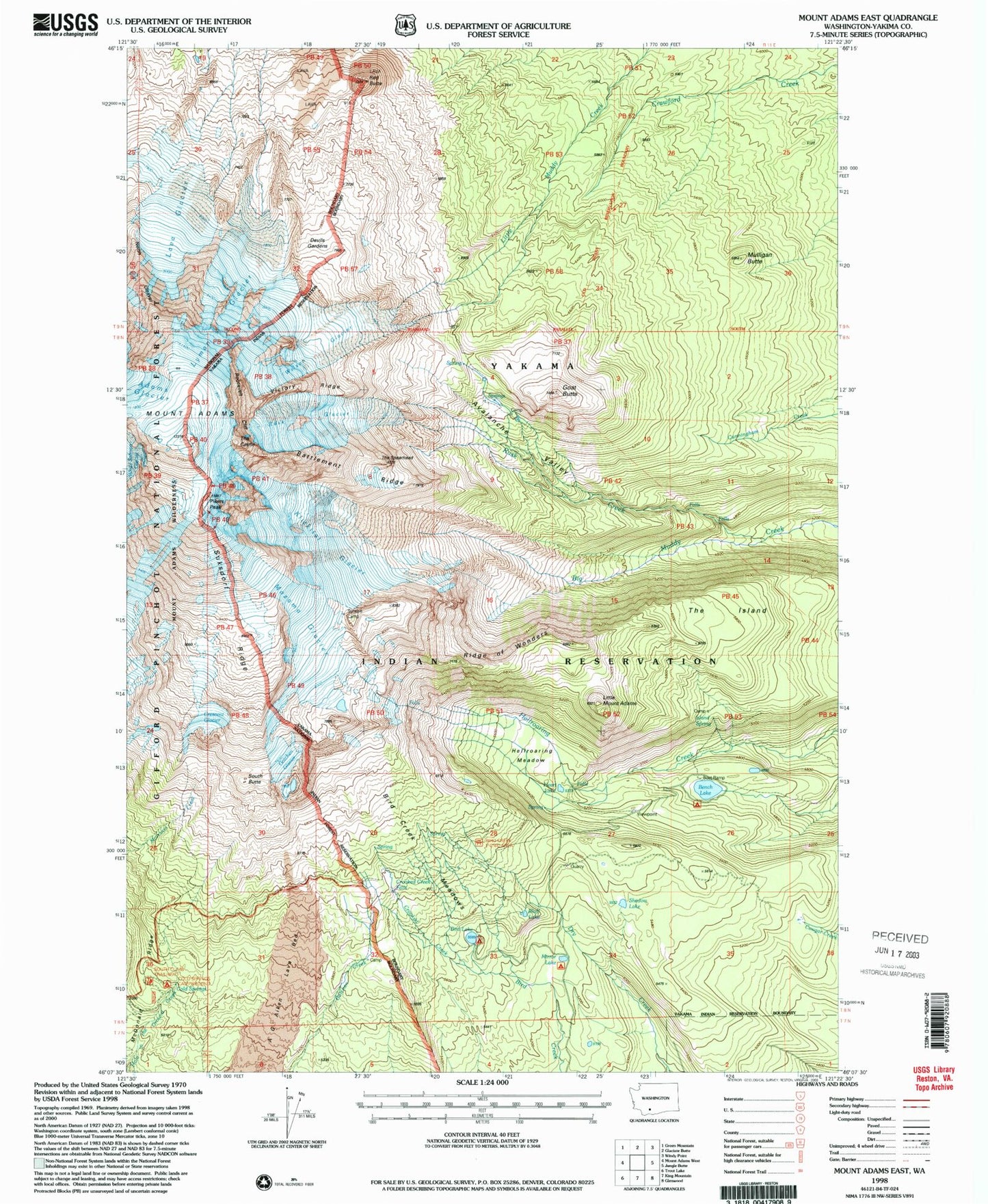
Historical USGS topographic quad map of Mount Adams East in the state of Washington. Scale: 1:24000. Print size: 24" x 27"
This quadrangle is in the following counties: Yakima.
The map contains contour lines, roads, rivers, towns, lakes, and grids including latitude / longitude and UTM / MGRS. Printed on high-quality waterproof paper with UV fade-resistant inks.
Contains the following named places: Mount Adams, Avalanche Valley, Battlement Ridge, Bench Lake, Bird Creek Meadows, Bird Creek Meadows Picnic Area, Bird Lake, Bluff Lake, Cold Springs, Crescent Glacier, Crooked Creek, Crooked Creek Falls, Devils Gardens, Goat Butte, Gotchen Glacier, Heart Lake, Hellroaring Meadow, Island Spring, Klickitat Glacier, Lava Glacier, Little Mount Adams, Lyman Glacier, Mazama Glacier, McDonald Ridge, Mirror Lake, Mulligan Butte, North Cleaver, Red Butte, Ridge of Wonders, Roosevelt Cliff, Rusk Creek, Rusk Glacier, Shadow Lake, South Butte, Suksdorf Ridge, The Castle, The Spearhead, Timberline Campground, Victory Ridge, Wilson Glacier, Pikers Peak, Cold Springs Campground, Southwest Yakima Division (historical)