
MyTopo
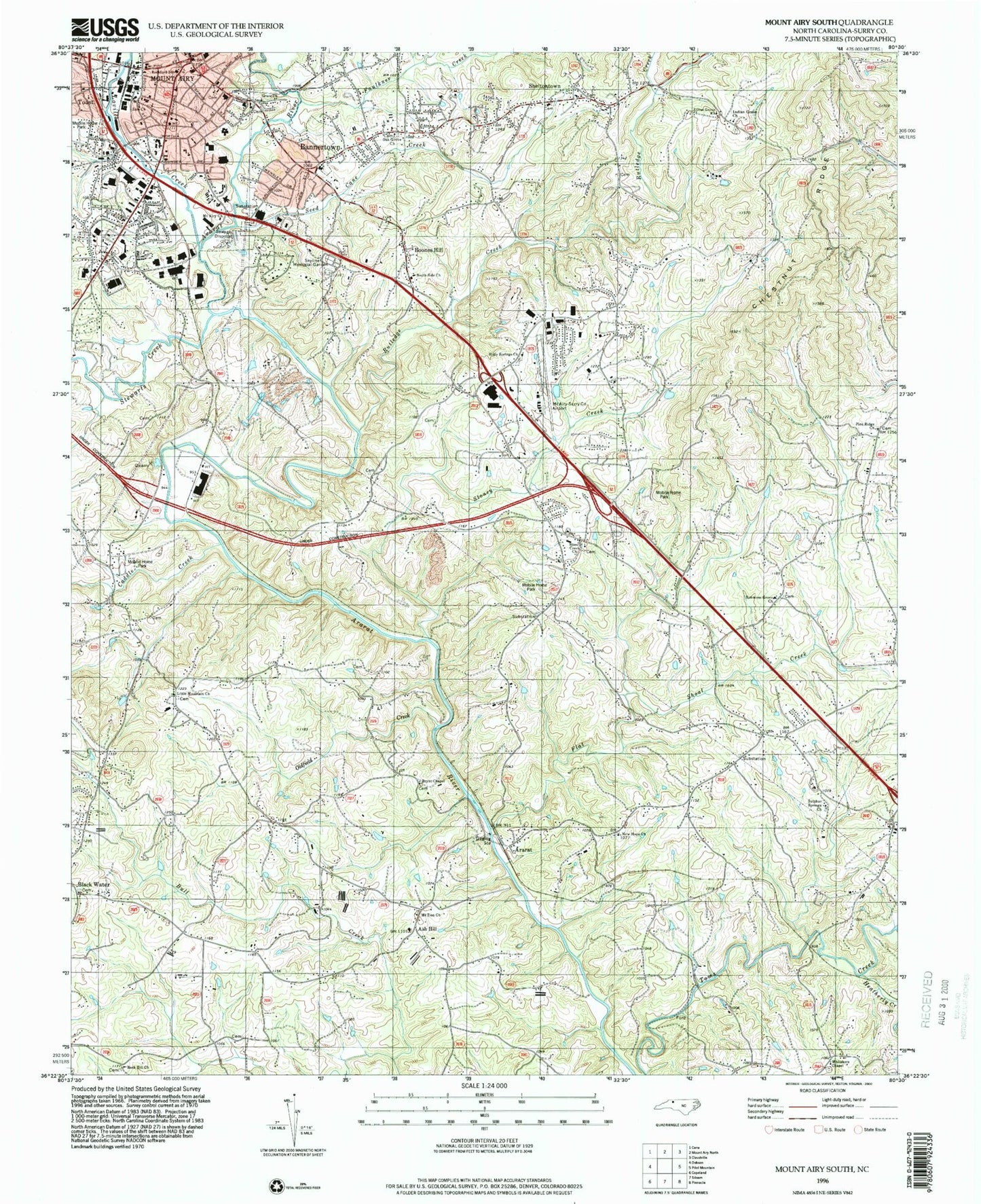
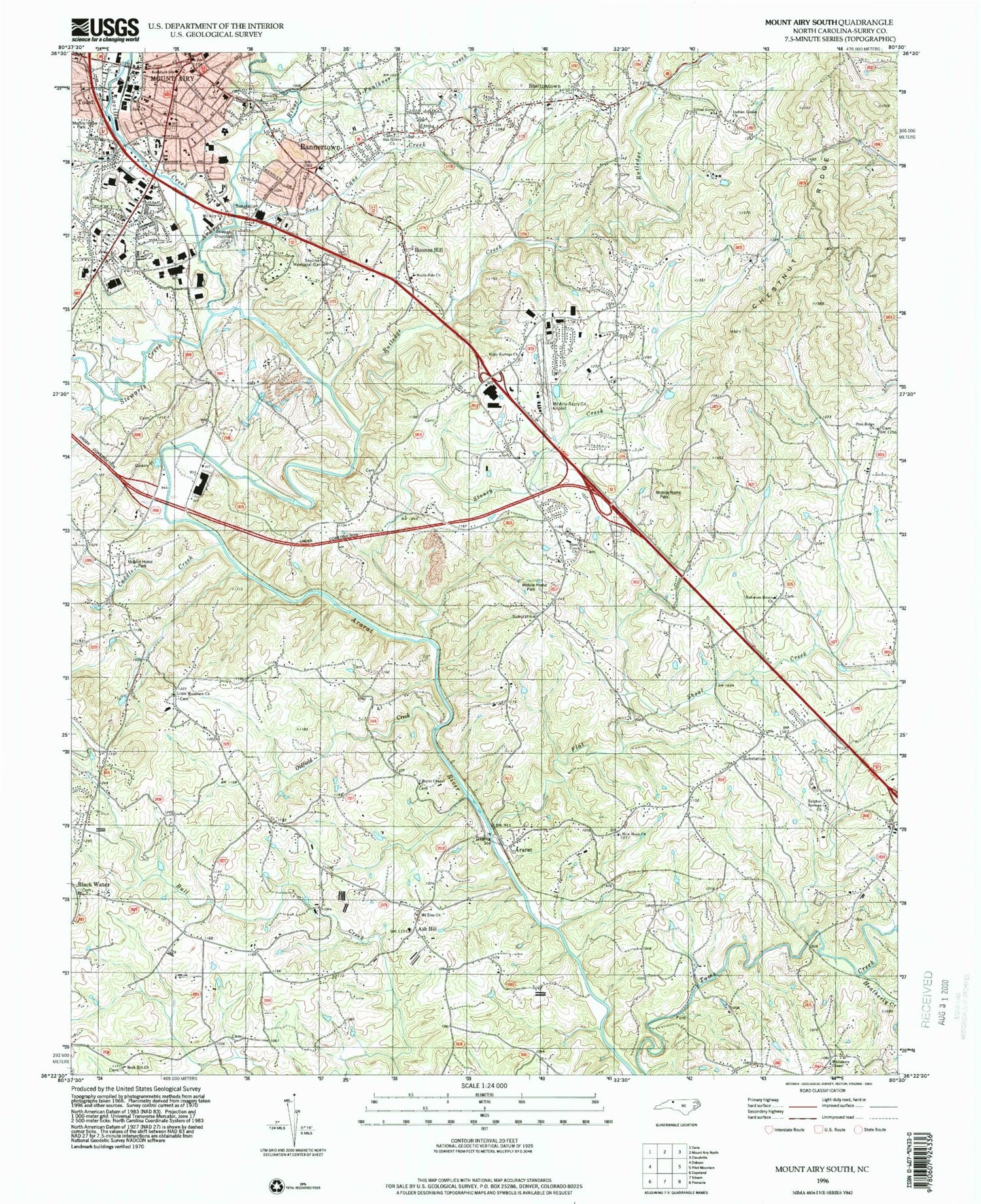
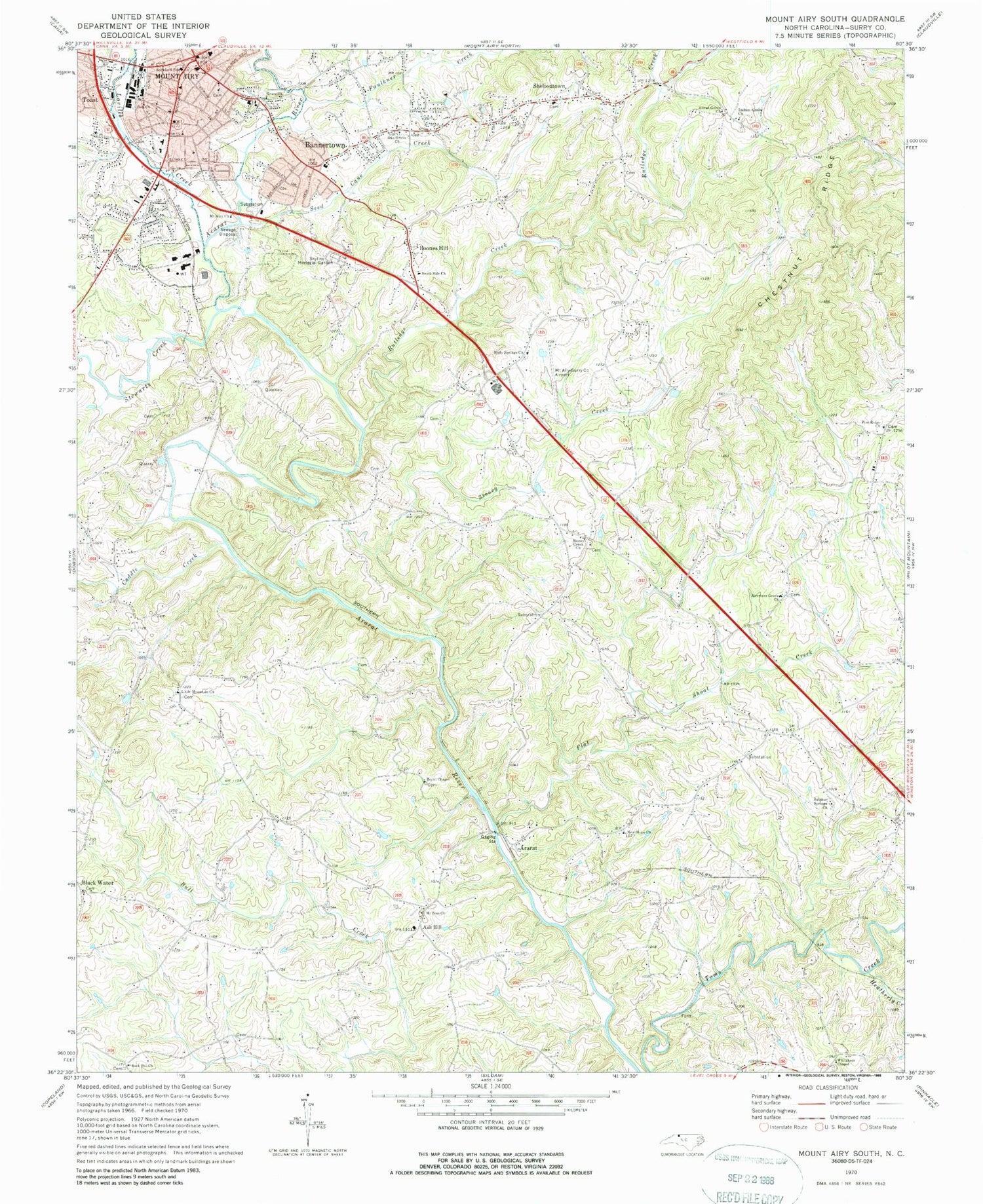
Classic USGS Mount Airy South North Carolina 7.5'x7.5' Topo Map
Couldn't load pickup availability
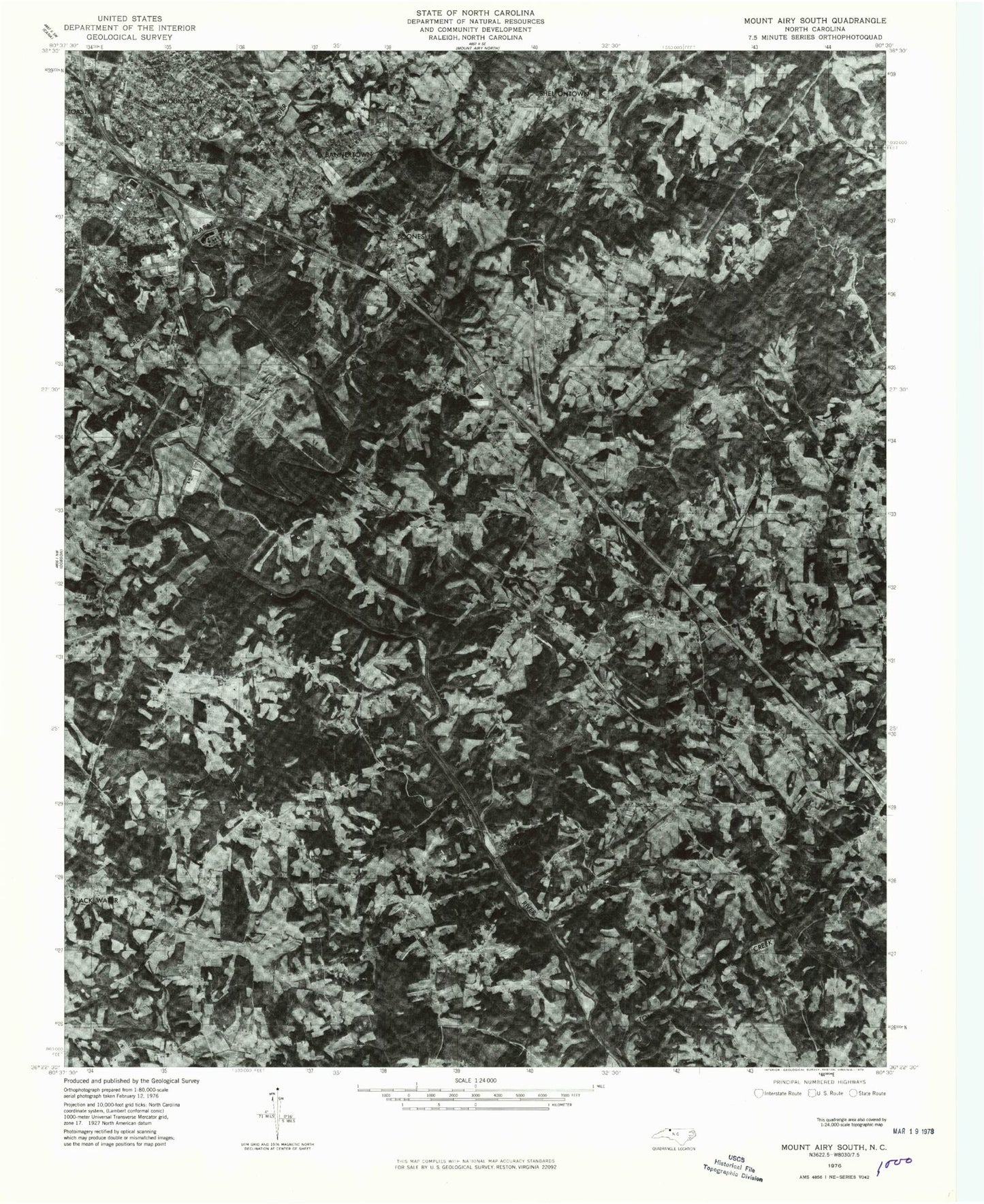
Historical USGS topographic quad map of Mount Airy South in the state of North Carolina. Map scale may vary for some years, but is generally around 1:24,000. Print size is approximately 24" x 27"
This quadrangle is in the following counties: Surry.
The map contains contour lines, roads, rivers, towns, and lakes. Printed on high-quality waterproof paper with UV fade-resistant inks, and shipped rolled.
Contains the following named places: Ararat, Ararat Missionary Baptist Church, Ararat Post Office, Ararat Volunteer Fire Department, Ash Hill, Ash Hill General Store, Ash Hill Post Office, Bannertown, Bannertown Baptist Church, Bannertown Elementary School, Bannertown Volunteer Fire Department Holly Springs Station, Bannertown Volunteer Fire Department Reeves Mill Station, Black Water, Blue Ridge Academy, Boones Hill, Bryans Baptist Church, Bryans Ironworks, Bryant Chapel, Caddle Creek, Chestnut Ridge School, Earle Theatre, Eldora School, Faulkner Creek, Flat Shoal Creek, Flat Shoals, Fulks Bloomery Forge, Grace Church, Haymore Memorial Baptist Church, Haynes Forge, Heatherly Creek, Holly Springs, Holly Springs Baptist Church, Indian Grove, Indian Grove Church, Indian Grove Post Office, Indian Grove School, Kincannon Forge, Little Mountain Church, Long Hill, Long Hill School, Loves Grove Primitive Baptist Church, Lovills Creek, Mount Airy, Mount Airy Church, Mount Airy Fire Department, Mount Airy Historic District, Mount Airy Police Department, Mount Airy Post Office, Mount Airy/Surry County Airport, Mount Zion Baptist Church, Mount Zion Church, New Hope Baptist Church, New Hope Methodist Church, Northern Hospital of Surry County, Oak Grove, Oak Grove Methodist Church, Old Cadel Ford, Oldfield Creek, Pine Ridge Baptist Church, Ridge View School, Rockford School, Rutledge Creek, Seed Cane Creek, Shelton Church of the Brethren, Sheltontown, Sheltontown School, Simmons Grove Missionary Baptist Church, Simmons School, Skyline Memorial Garden, South Side Church, Stewarts Creek, Stoney Creek, Stoney Creek Primitive Baptist Church, Sulphur Springs Baptist Church, Surry County Emergency Services Station 2, Tharrington Elementary School, The Church of Jesus Christ of Latter Day Saints, Township of Eldora, Township of Long Hill, Township of South Westfield, Whitakers Chapel Cemetery, Whitakers Chapel Methodist Church, Whittier Creek, Zion Church, ZIP Code: 27007