
MyTopo
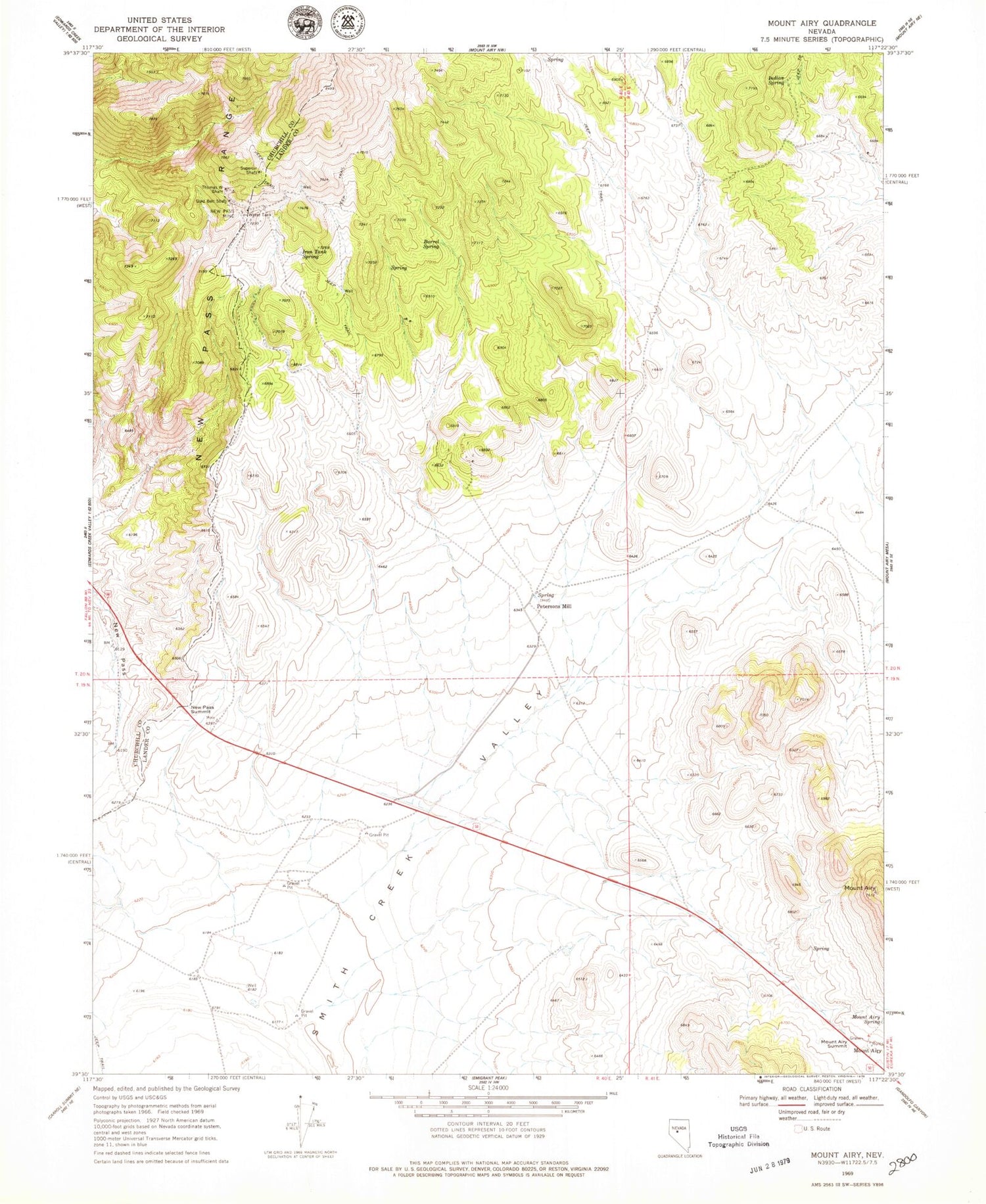
Classic USGS Mount Airy Nevada 7.5'x7.5' Topo Map
Couldn't load pickup availability
Historical USGS topographic quad map of Mount Airy in the state of Nevada. Map scale may vary for some years, but is generally around 1:24,000. Print size is approximately 24" x 27"
This quadrangle is in the following counties: Churchill, Lander.
The map contains contour lines, roads, rivers, towns, and lakes. Printed on high-quality waterproof paper with UV fade-resistant inks, and shipped rolled.
Contains the following named places: Barrel Spring, Gold Belt Shaft, Happy Days Mine, Indian Spring, Iron Tank Spring, Last Chance Mine, Little Jumbo Mine, Mount Airy, Mount Airy Mesa, Mount Airy Spring, Mount Airy Summit, Nevada Austin Mine, New Pass Mine, New Pass Summit, Newpass, Newpass Post Office, Newpass Ranch, Petersons Mill, Petersons Mill Hot Spring, Rabbit Foot Mine, Sheridan Mine, Superoir Shaft, Thomas W Shaft, Yellow Bull Mine


