MyTopo
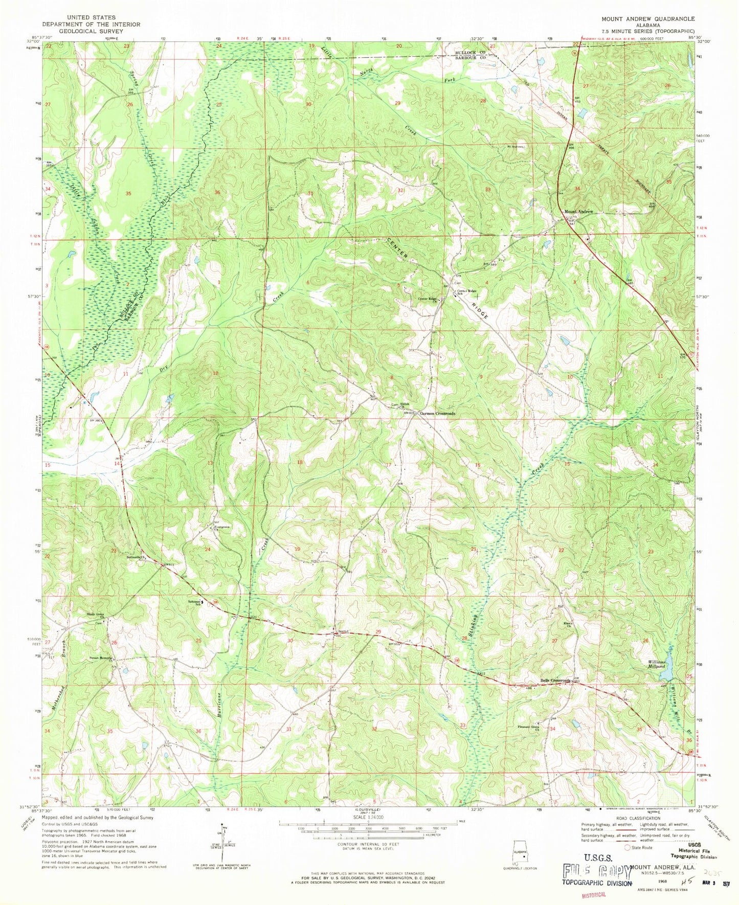
Classic USGS Mount Andrew Alabama 7.5'x7.5' Topo Map
Couldn't load pickup availability
Historical USGS topographic quad map of Mount Andrew in the state of Alabama. Map scale may vary for some years, but is generally around 1:24,000. Print size is approximately 24" x 27"
This quadrangle is in the following counties: Barbour, Bullock.
The map contains contour lines, roads, rivers, towns, and lakes. Printed on high-quality waterproof paper with UV fade-resistant inks, and shipped rolled.
Contains the following named places: Anglins Bridge, Barkers School, Bells Crossroads, Bethsaida Church, Bickleys Mill, Center Ridge, Center Ridge Cemetery, Center Ridge Church, Center Ridge School, Cooks Ford Bridge, Dickle Mill, Elam Church, Evergreen Baptist Church, Garmon Crossroads, Greens Crossroad Volunteer Fire Department, Greens Crossroads, Laurel Grove, Little Indian Creek, McClains School, Mount Andrew, Mount Andrew Cemetery, Mount Andrew Volunteer Fire Department, North Fork Little Creek, Pleasant Grove Baptist Church, Pleasant Grove Baptist Church Cemetery, Polecat Branch, Robinson School, Sanders Store, Shady Grove Church, Shady Grove Elementary School, Shiloh African Methodist Episcopal Church, Shiloh Cemetery, Spires Store, Spring Creek, Street Memorial United Methodist Church, Williams Millpond, Willis Store