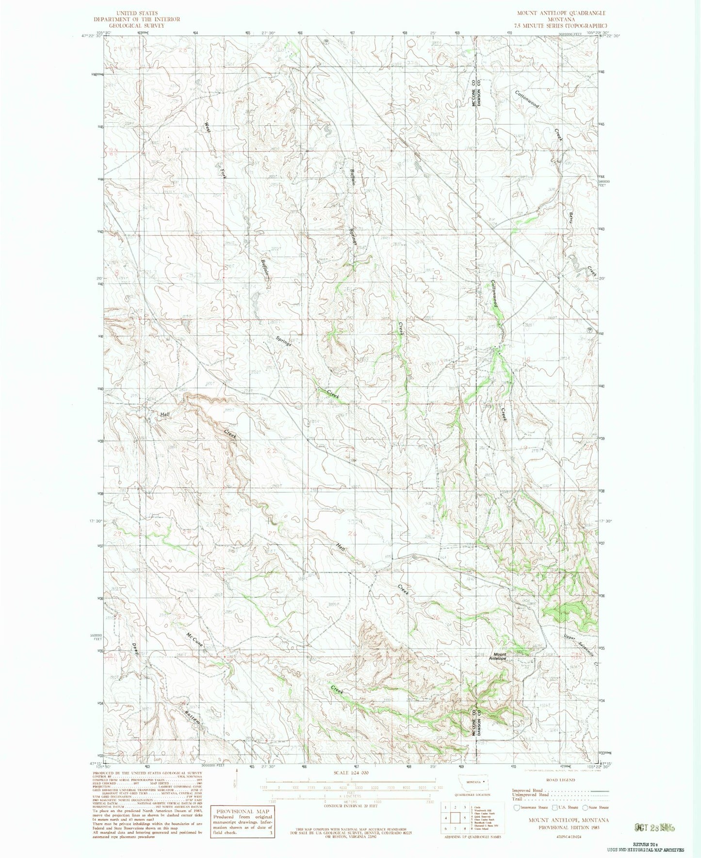
MyTopo
Classic USGS Mount Antelope Montana 7.5'x7.5' Topo Map
Regular price
$16.95
Regular price
Sale price
$16.95
Unit price
per
Couldn't load pickup availability
Historical USGS topographic quad map of Mount Antelope in the state of Montana. Map scale may vary for some years, but is generally around 1:24,000. Print size is approximately 24" x 27"
This quadrangle is in the following counties: Dawson, McCone.
The map contains contour lines, roads, rivers, towns, and lakes. Printed on high-quality waterproof paper with UV fade-resistant inks, and shipped rolled.
Contains the following named places: 18N49E09CCBC01 Well, 18N49E15ACBB01 Well, 18N49E28DADC01 Well, 19N49E27DDBD01 Well, 19N49E33ACAA01 Well, 19N49E34AABD01 Well, Berry Creek, Floyd Quick Number 2 Dam, Mount Antelope, Quick Reservoir, Valgate