MyTopo
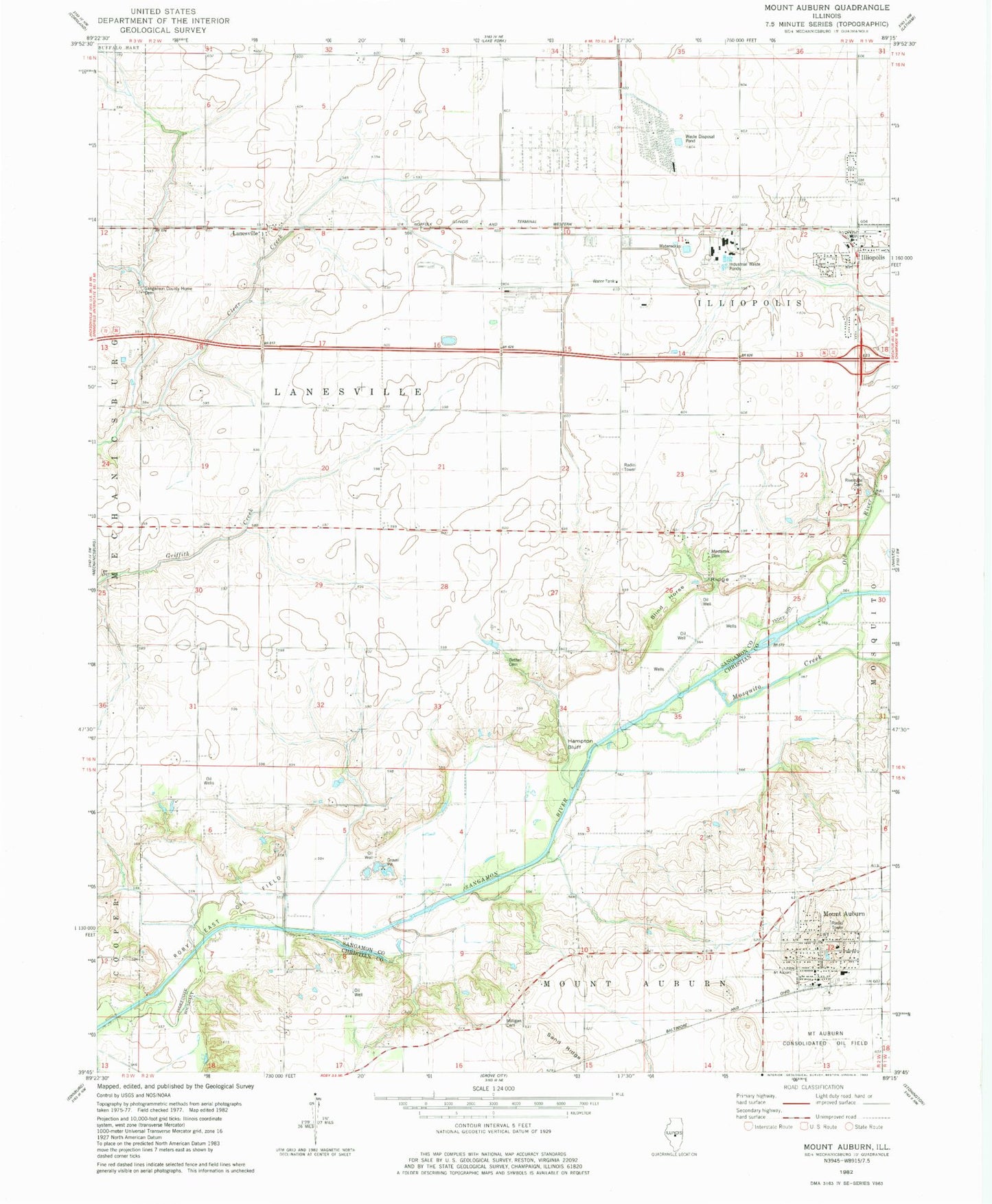
Classic USGS Mount Auburn Illinois 7.5'x7.5' Topo Map
Couldn't load pickup availability
Historical USGS topographic quad map of Mount Auburn in the state of Illinois. Map scale may vary for some years, but is generally around 1:24,000. Print size is approximately 24" x 27"
This quadrangle is in the following counties: Christian, Sangamon.
The map contains contour lines, roads, rivers, towns, and lakes. Printed on high-quality waterproof paper with UV fade-resistant inks, and shipped rolled.
Contains the following named places: Bethel Cemetery, Blind Horse Ridge, De Kalb Heliport, Hampton Bluff, Haynes, Lanesville, Milligan Cemetery, Mosquito Creek, Mostetter Cemetery, Mount Auburn, Mount Auburn Cemetery, Mount Auburn Elementary School, Mount Auburn Fire Protection District, Mount Auburn Post Office, Old River, Riverside Cemetery, Sand Ridge, Sangamon County Home Cemetery, Sangamon Ordnance Plant, Saunders, Township of Illiopolis, Township of Lanesville, Village of Illiopolis, Village of Mount Auburn, Yellow Hammer Knob, ZIP Code: 62539