MyTopo
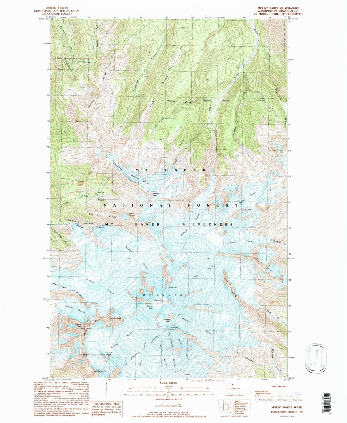
USGS Classic Mount Baker Washington 7.5'x7.5' Topo Map
Couldn't load pickup availability
Historical USGS topographic quad map of Mount Baker in the state of Washington. Scale: 1:24000. Print size: 24" x 27"
This quadrangle is in the following counties: Whatcom.
The map contains contour lines, roads, rivers, towns, lakes, and grids including latitude / longitude and UTM / MGRS. Printed on high-quality waterproof paper with UV fade-resistant inks.
Contains the following named places: Mount Baker, Bar Creek, Bastile Glacier, Bastile Ridge, Black Buttes, Boulder Glacier, Chowder Ridge, Chromatic Moraine, Cockscomb, Coleman Glacier, Colfax Peak, Cougar Divide, Crater Moraine, Deming Glacier, Dobbs Creek, Dorr Fumarole Field, Easton Glacier, Grant Peak, Hadley Glacier, Hadley Peak, Heliotrope Ridge, Kulshan Cabin, Lahar Lookout, Lasiocarpa Ridge, Lava Divide, Lee Promontory, Lincoln Peak, Mazama Glacier, Park Cliffs, Park Glacier, Portrait Rock, Rainbow Glacier, Roman Wall, Roosevelt Glacier, Seward Peak, Sherman Crater, Sherman Peak, Sholes Creek, Sholes Glacier, Skyline Divide, Smith Basin, Squak Glacier, Summit Crater, Talum Glaciers, The Portals, Thunder Glacier, Whatcom County, Dobbs Cleaver, No Name Glacier