MyTopo
USGS Classic Mount Bannon Wyoming 7.5'x7.5' Topo Map
Regular price
$16.95
Regular price
Sale price
$16.95
Unit price
per
Couldn't load pickup availability
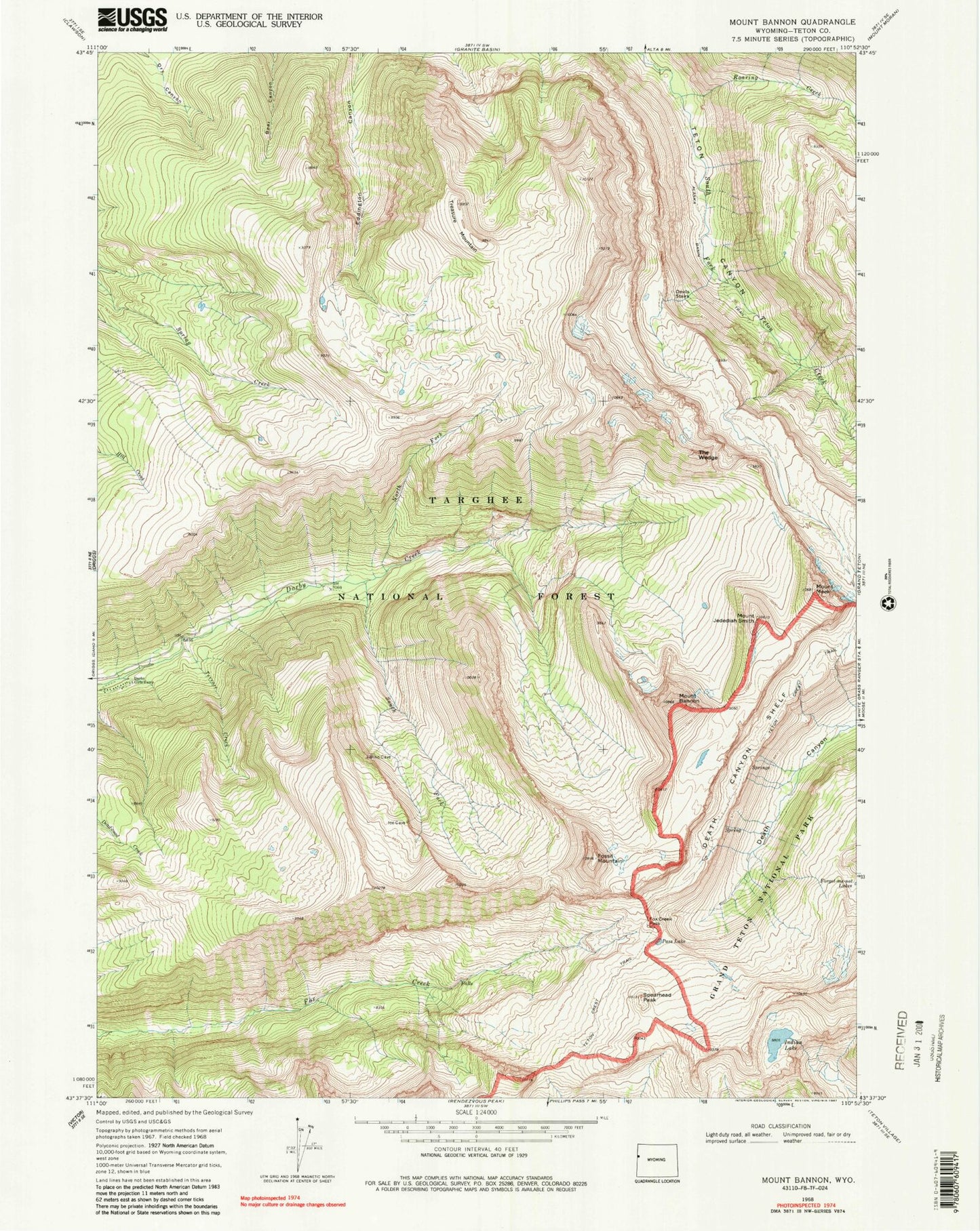
Historical USGS topographic quad map of Mount Bannon in the state of Wyoming. Scale: 1:24000. Print size: 24" x 27"
This quadrangle is in the following counties: Teton.
The map contains contour lines, roads, rivers, towns, lakes, and grids including latitude / longitude and UTM / MGRS. Printed on high-quality waterproof paper with UV fade-resistant inks.
Contains the following named places: Spearhead Peak, Mount Bannon, The Wedge, The Wedge, Alaska Basin Trail, Darby Girls Camp, Death Canyon Shelf, Devils Stairs, Fossil Mountain, Fox Creek Pass, Indian Lake, Mount Jedediah Smith, Mount Meek, North Fork Darby Creek, Pass Lake, Roaring Creek, Terrace Creek, Treasure Mountain, South Fork Darby Creek