MyTopo
Classic USGS Mount Belknap Utah 7.5'x7.5' Topo Map
Couldn't load pickup availability
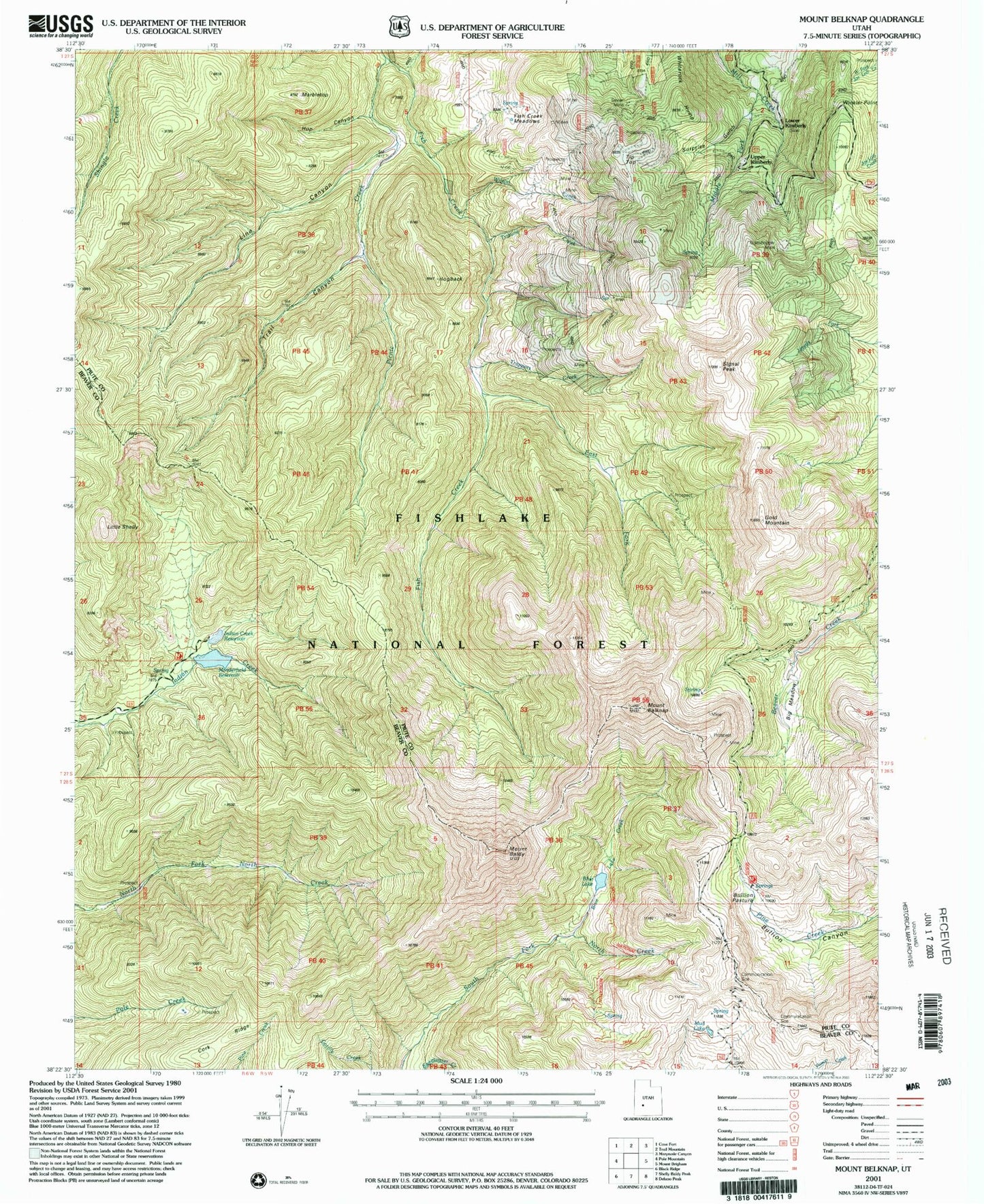
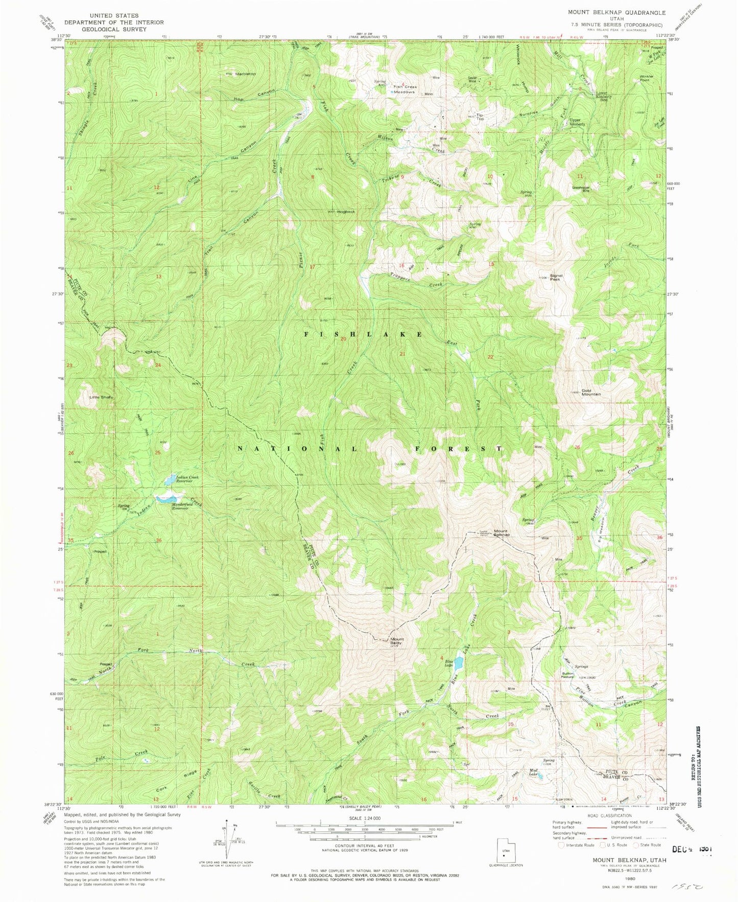
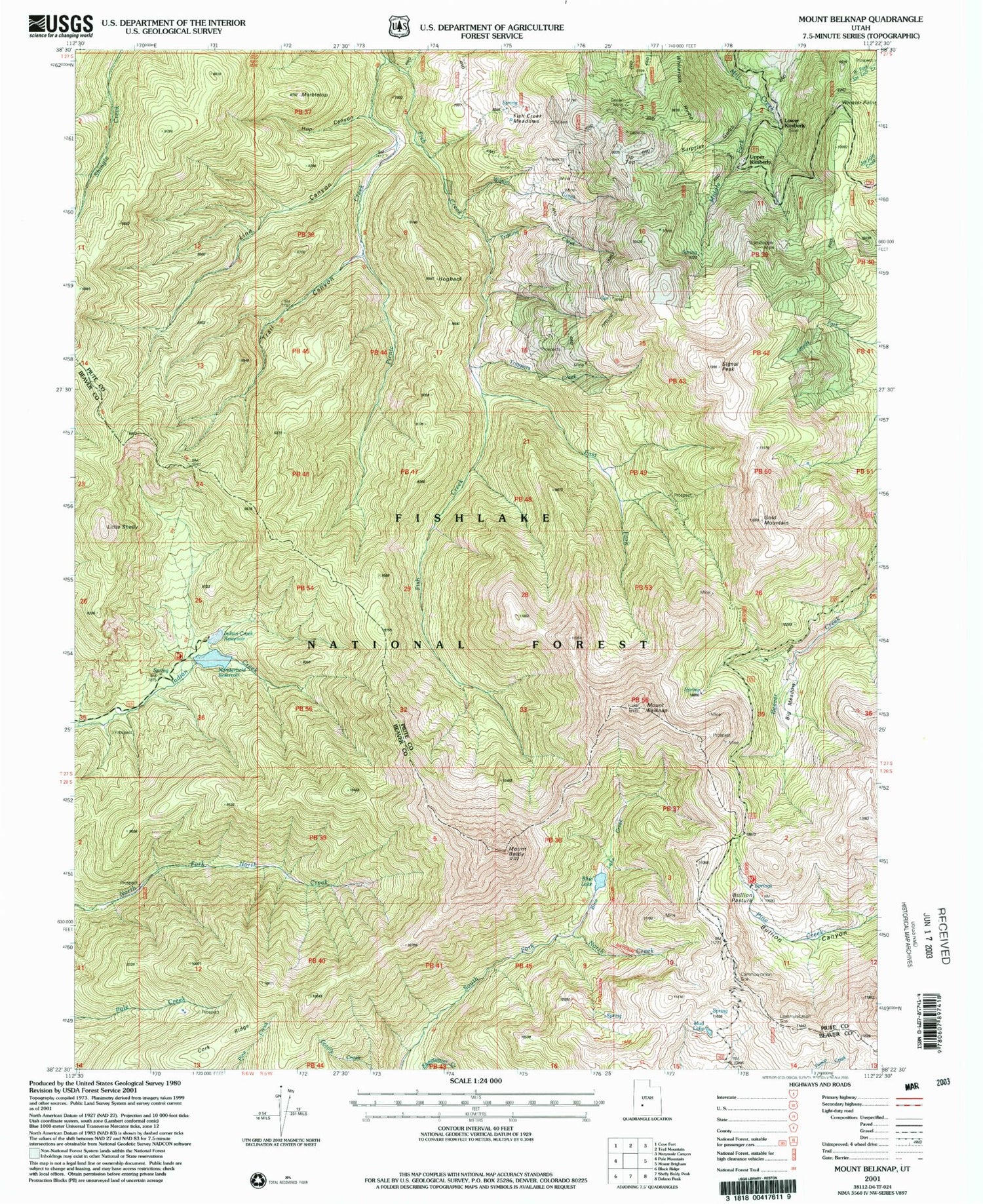
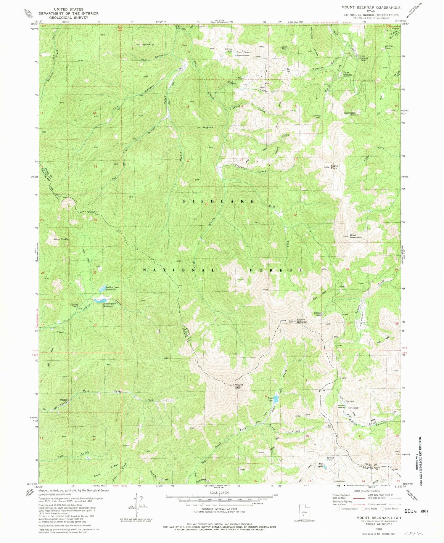
Historical USGS topographic quad map of Mount Belknap in the state of Utah. Typical map scale is 1:24,000, but may vary for certain years, if available. Print size: 24" x 27"
This quadrangle is in the following counties: Beaver, Piute.
The map contains contour lines, roads, rivers, towns, and lakes. Printed on high-quality waterproof paper with UV fade-resistant inks, and shipped rolled.
Contains the following named places: Mount Baldy, Mount Belknap, Big Meadow, Blue Lake Creek, Bullion Pasture, Cork Ridge, East Fork Fish Creek, Fish Creek Meadows, Gold Mountain, Hogback, Hop Canyon, Line Canyon, Little Shelly, Lower Kimberly, Marbletop, Middle Fork Mill Creek, Mud Lake, Picnic Creek, Pipeline Trail, Sevier Mine, Signal Peak, Suprise Gulch, Tip Top, Trail Canyon, Trappers Creek, Tribune Creek, Upper Kimberly, Whiterock Hump, Wilson Creek, Blue Lake, Blue Lake Dam, Manderfield Reservoir, Manderfield Dam, Indian Creek Reservoir, Indian Creek Dam, Fishlake National Forest, Tushar Trail, Lower Kimberly Mine, Upper Kimbaberly Mine, Grasshopper Mine, Winkler Point