MyTopo
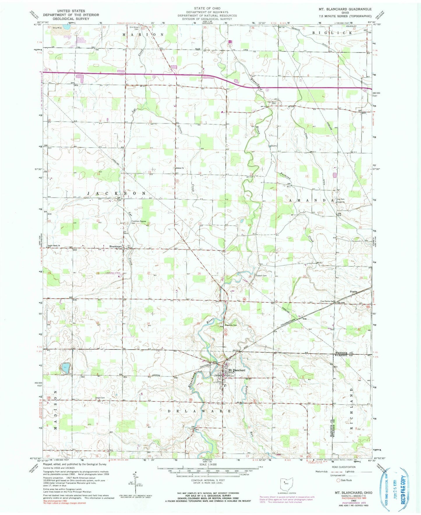
Classic USGS Mount Blanchard Ohio 7.5'x7.5' Topo Map
Couldn't load pickup availability
Historical USGS topographic quad map of Mount Blanchard in the state of Ohio. Map scale may vary for some years, but is generally around 1:24,000. Print size is approximately 24" x 27"
This quadrangle is in the following counties: Hancock, Wyandot.
The map contains contour lines, roads, rivers, towns, and lakes. Printed on high-quality waterproof paper with UV fade-resistant inks, and shipped rolled.
Contains the following named places: Brights Ditch, Buckrun Creek, Castor Cemetery, Delaware Township Fire Department, Eagle Creek Church, Elm Grove Cemetery, Five Points Cemetery, Folk School, Frontiers Repose Cemetery, Hagerty Airport, Houcktown, Houcktown Post Office, Island Park, Krout Cemetery, Lackery School, Lee Cemetery, Lutz Airport, Miller School, Mount Blanchard, Mount Blanchard Branch Library, Mount Blanchard Cemetery, Mount Blanchard Elementary School, Mount Blanchard Nazarene Church, Mount Blanchard Post Office, Mount Blanchard United Methodist Church, Potato Run, Pratts, Riverdale High School, Riverview Cemetery, Salem Cemetery, Siddall Cemetery, Silver Creek, Stahl Ditch, Township of Amanda, Township of Jackson, Treece School, Union Church, Van Horn Cemetery, Village of Mount Blanchard, WKXA-FM (Findlay), ZIP Code: 45867