MyTopo
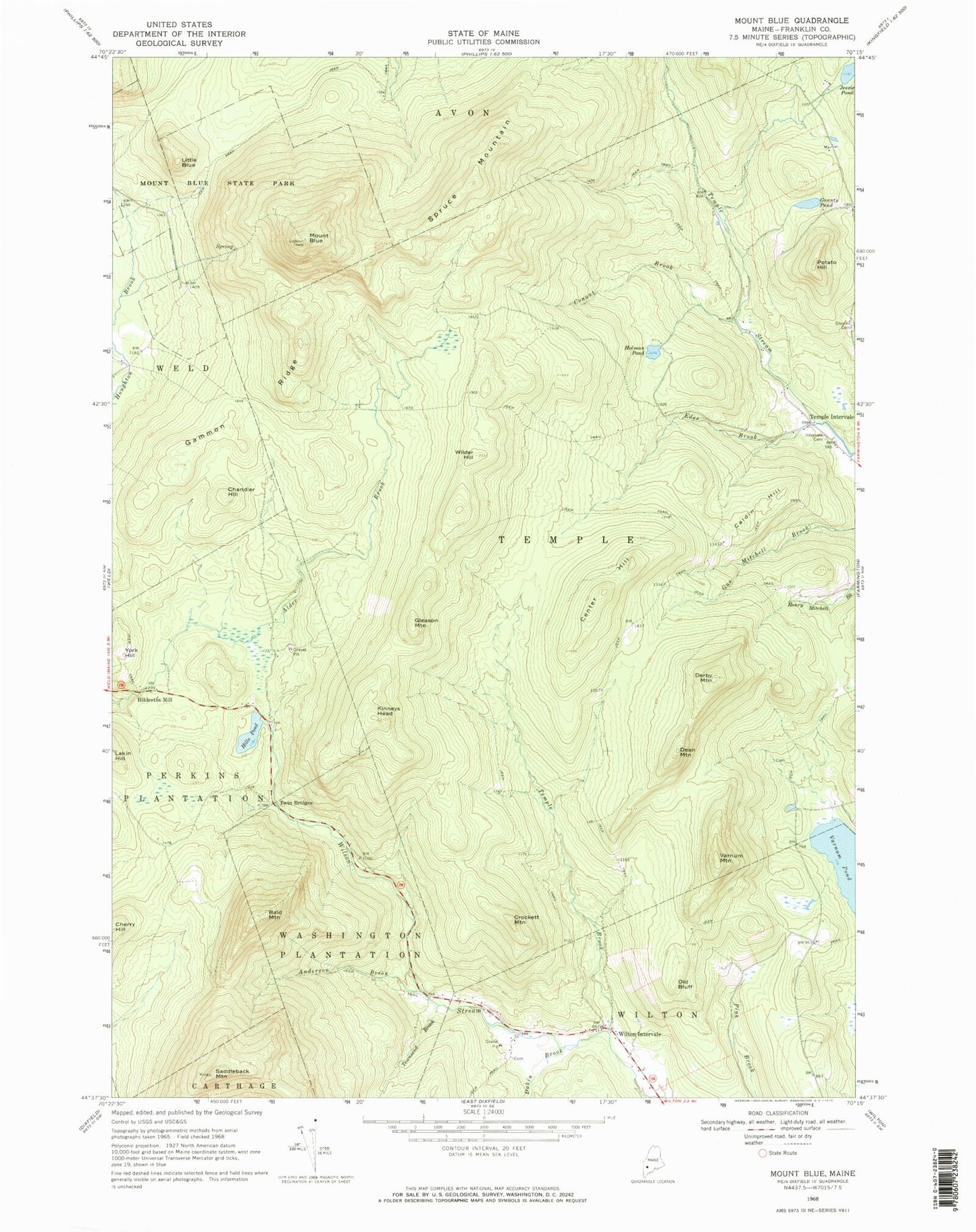
Classic USGS Mount Blue Maine 7.5'x7.5' Topo Map
Couldn't load pickup availability
Historical USGS topographic quad map of Mount Blue in the state of Maine. Typical map scale is 1:24,000, but may vary for certain years, if available. Print size: 24" x 27"
This quadrangle is in the following counties: Franklin.
The map contains contour lines, roads, rivers, towns, and lakes. Printed on high-quality waterproof paper with UV fade-resistant inks, and shipped rolled.
Contains the following named places: Alder Brook, Anderson Brook, Bald Mountain, Mount Blue, Caldin Hill, Center Hill, Chandler Hill, Conant Brook, Crockett Mountain, Dakin Brook, Dean Mountain, Derby Mountain, Edes Brook, Gammon Ridge, Gleason Mountain, Grants Pond, Hills Pond, Holman Pond, Temple Intervale Cemetery, Jessie Pond, Kinneys Head, Little Blue, Old Bluff, Potato Hill, Saddleback Mountain, Spruce Mountain, Temple Brook, Townsend Brook, Twin Bridges, Varnum Mountain, Wilder Hill, Wilton Intervale, Hildreths Mill, Temple Intervale, Unorganized Territory of South Franklin, Town of Temple, Adams Richardson Cemetery, Deane Cemetery, Perkins Township, Washington Township