
MyTopo
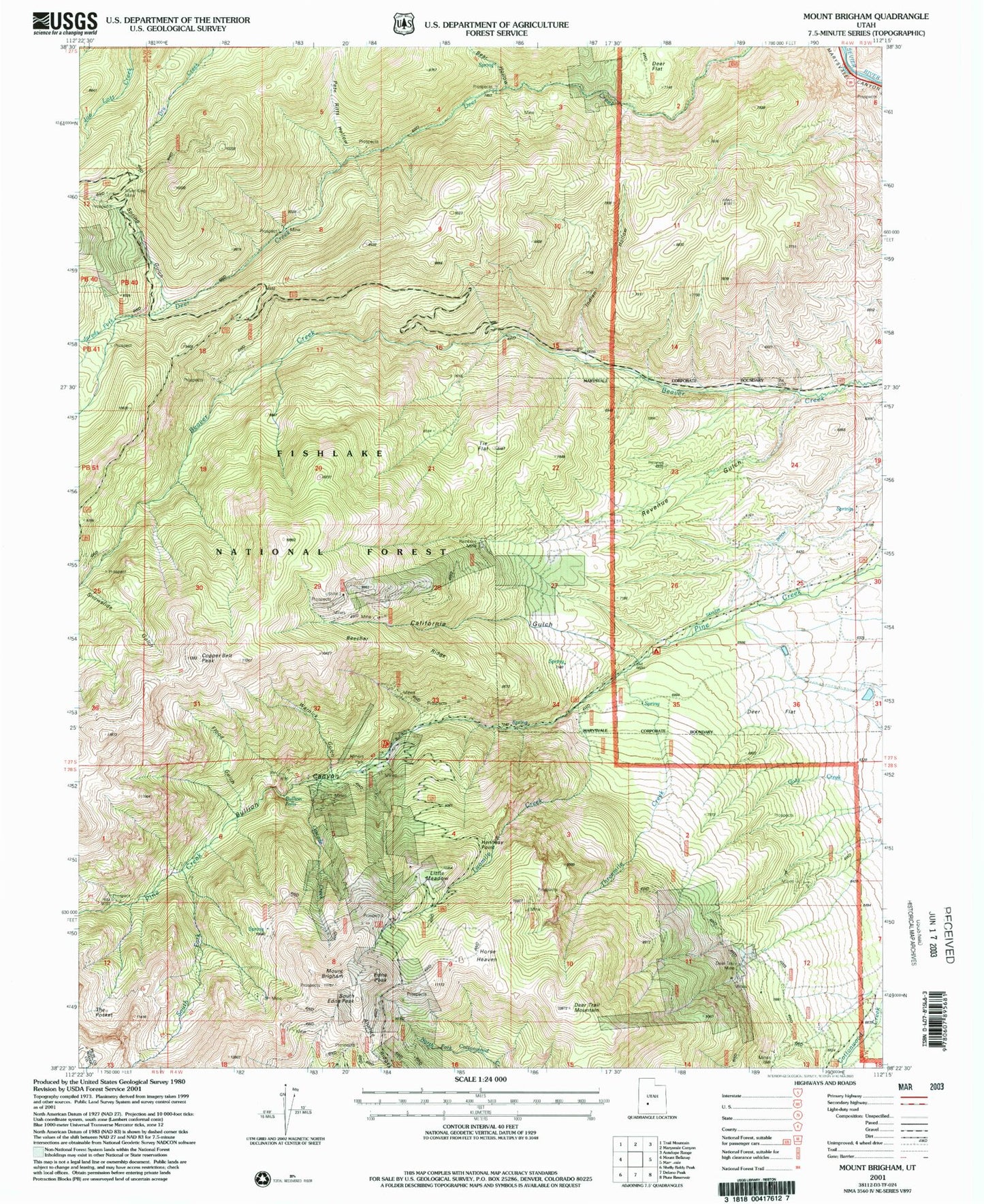
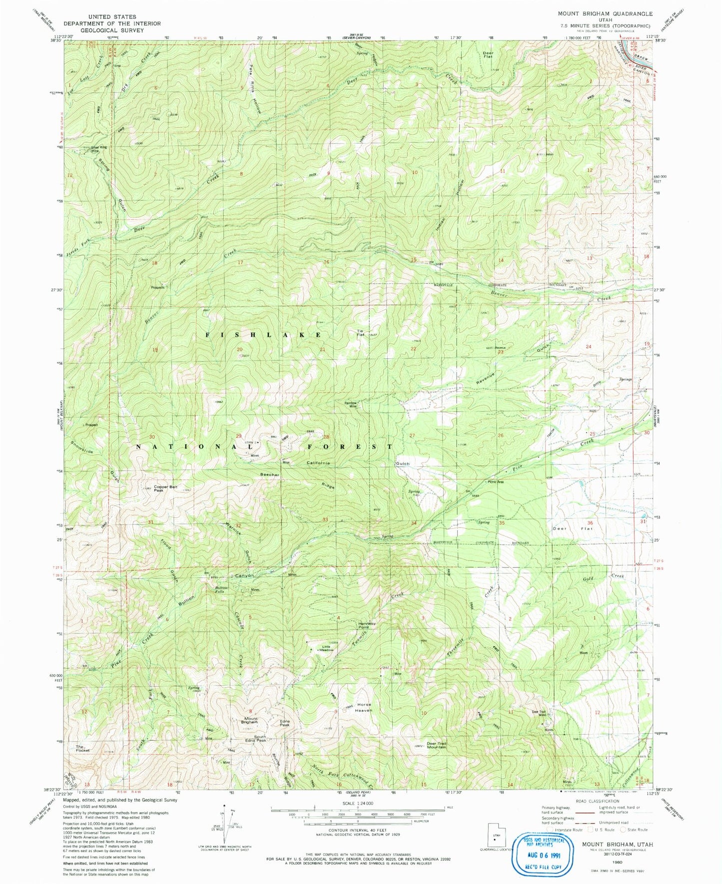
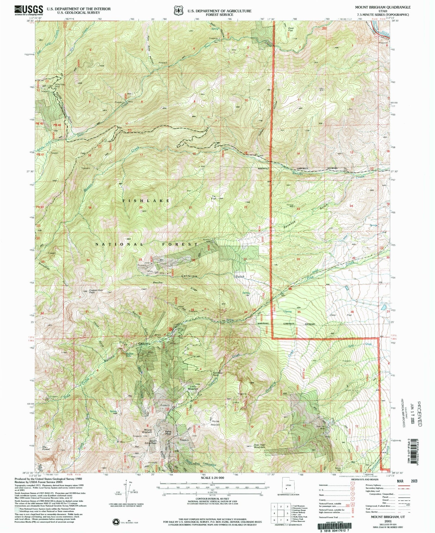
Classic USGS Mount Brigham Utah 7.5'x7.5' Topo Map
Couldn't load pickup availability
Historical USGS topographic quad map of Mount Brigham in the state of Utah. Map scale may vary for some years, but is generally around 1:24,000. Print size is approximately 24" x 27"
This quadrangle is in the following counties: Beaver, Piute.
The map contains contour lines, roads, rivers, towns, and lakes. Printed on high-quality waterproof paper with UV fade-resistant inks, and shipped rolled.
Contains the following named places: Alunite Ridge, Bear Hollow, Beaver Creek Recreation Site, Beecher Ridge, Bullion Canyon, Bullion Falls, Bullion Trail, Butler Beck Cabin, California Gulch, Cascade Creek, Copper Belt Peak, Copper Belt Trail, Deer Creek Guard Station, Deer Creek Trail, Deer Flat, Deer Trail Mine, Deer Trail Mountain, Edna Peak, Flood Gulch, Gray Hills, Hennessy Point, Horse Heaven, Indian Hollow, Jareds Fork, Little Meadow, Mount Brigham, Pete Ritts Hollow, Rainbow Mine, Revenue Gulch, Silver King Mine, Snowslide Gulch, South Edna Peak, South Fork Pine Creek, Spring Gulch, Staley Pasture, Taylor Ditch, The Pocket, Threemile Creek, Tie Flat, Town of Marysvale, Twomile Creek, Warnick Gulch