MyTopo
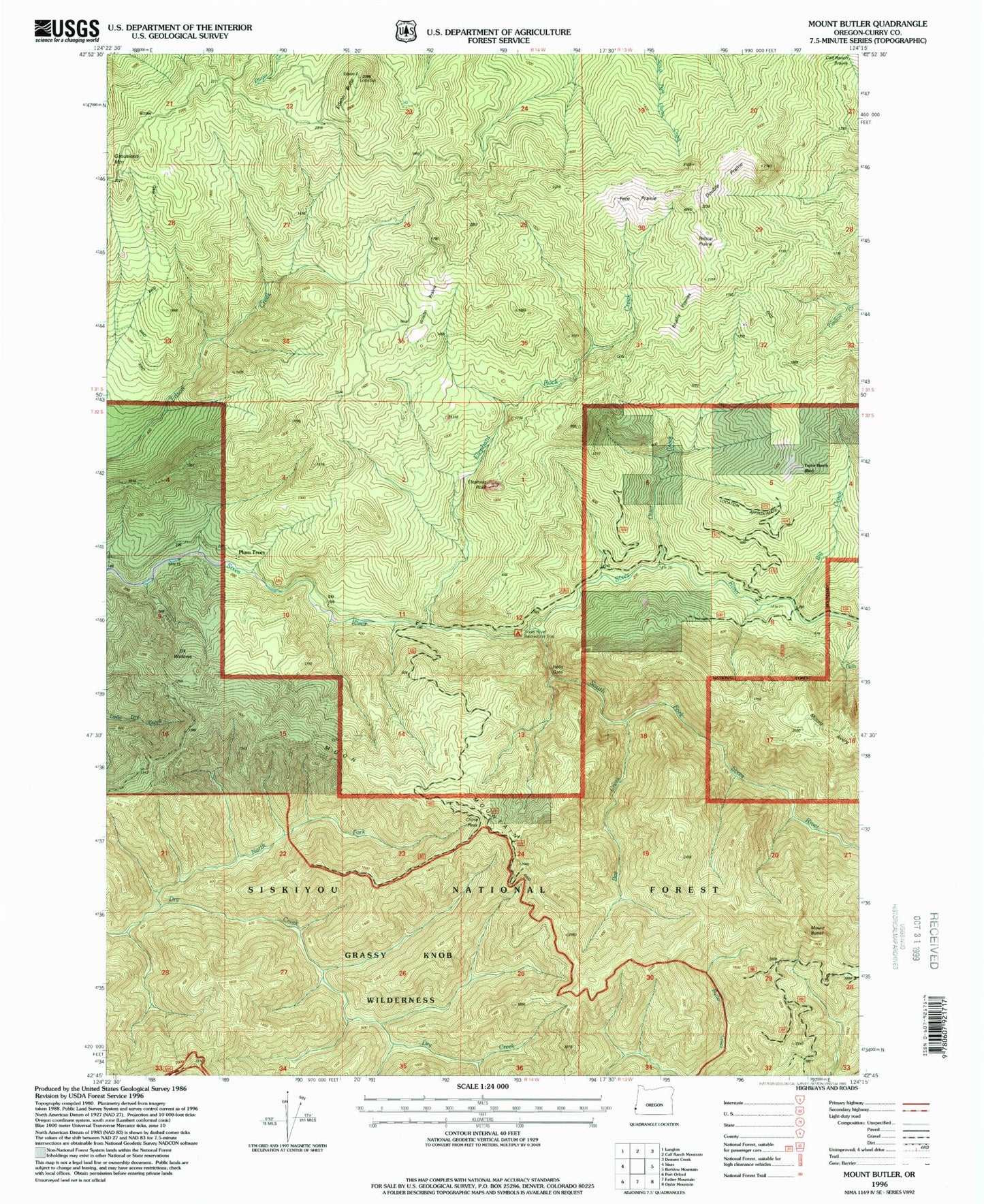
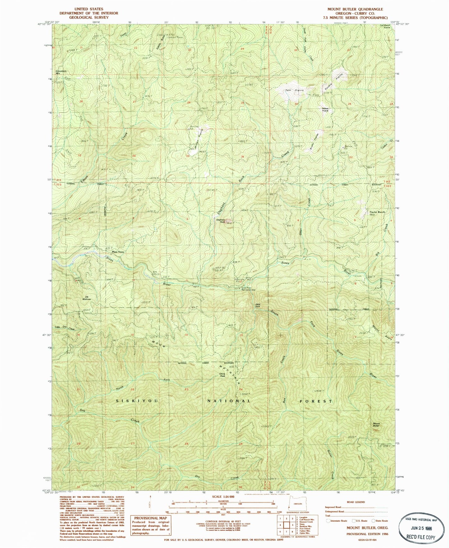
Classic USGS Mount Butler Oregon 7.5'x7.5' Topo Map
Couldn't load pickup availability
Historical USGS topographic quad map of Mount Butler in the state of Oregon. Map scale may vary for some years, but is generally around 1:24,000. Print size is approximately 24" x 27"
This quadrangle is in the following counties: Curry.
The map contains contour lines, roads, rivers, towns, and lakes. Printed on high-quality waterproof paper with UV fade-resistant inks, and shipped rolled.
Contains the following named places: Bea Creek, Bee Creek, Big Creek, Brushy Prairies, China Peak, Double Prairie, Edson Butte, Elephant Rock, Elephant Rock Creek, Elk Wallows, Grassy Creek, Hells Gate, Hilltop Prairie, Inman Mine, Lily B Creek, Moon Mountain, Mount Avery, Mount Butler, North Fork Dry Creek, Otter Creek, Plum Trees, Sixes River Recreation Site, South Fork Sixes River, Taylor Ranch, Tent Prairie, Wilson Prairie, ZIP Code: 97465