MyTopo
Classic USGS Mount Cannon Montana 7.5'x7.5' Topo Map
Couldn't load pickup availability
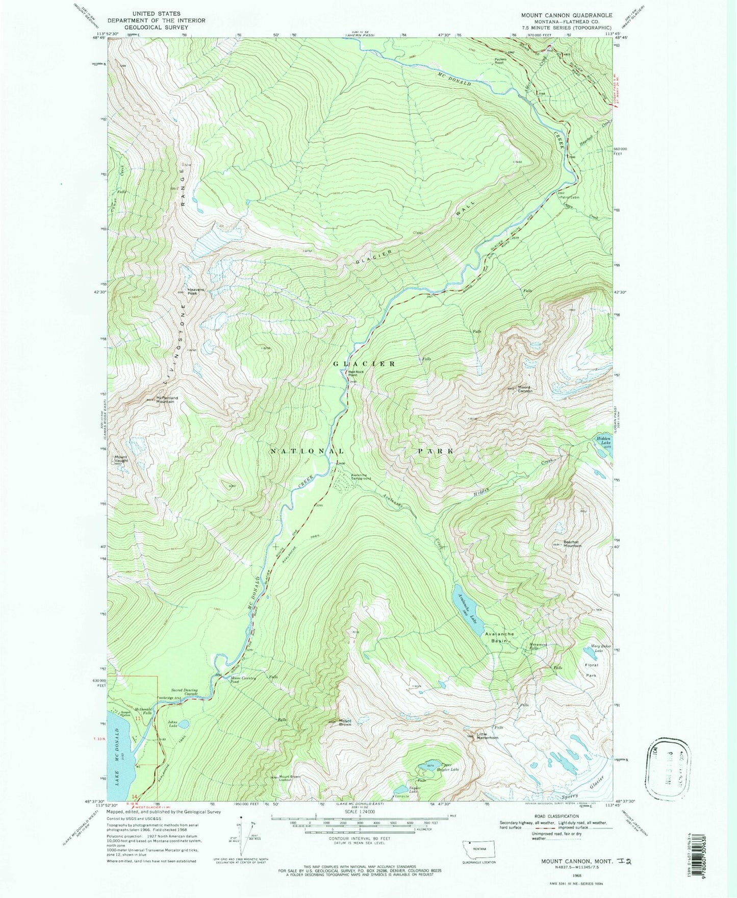
Historical USGS topographic quad map of Mount Cannon in the state of Montana. Typical map scale is 1:24,000, but may vary for certain years, if available. Print size: 24" x 27"
This quadrangle is in the following counties: Flathead.
The map contains contour lines, roads, rivers, towns, and lakes. Printed on high-quality waterproof paper with UV fade-resistant inks, and shipped rolled.
Contains the following named places: Alder Creek, Avalanche Basin, Avalanche Campground, Avalanche Creek, Avalanche Lake, Avalanche Trail, Mount Brown, Mount Cannon, Floral Park, Glacier Wall, Haystack Creek, Heavens Peak, Hidden Creek, Johns Lake, Little Matterhorn, Logan Creek, Mary Baker Lake, McDonald Falls, McPartland Mountain, Monument Falls, Moose Country Pond, Mount Brown Lookout, Packers Roost, Red Rock Point, Sacred Dancing Cascade, Snyder Lake, Upper Snyder Lake, Mount Vaught, Bearhat Mountain, Waterton-Glacier International Peace Park, Geduhn (historical), Glacier National Park