MyTopo
Classic USGS Mount Carroll Illinois 7.5'x7.5' Topo Map
Couldn't load pickup availability
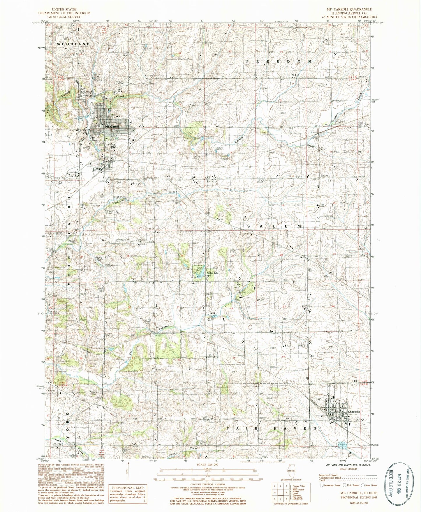
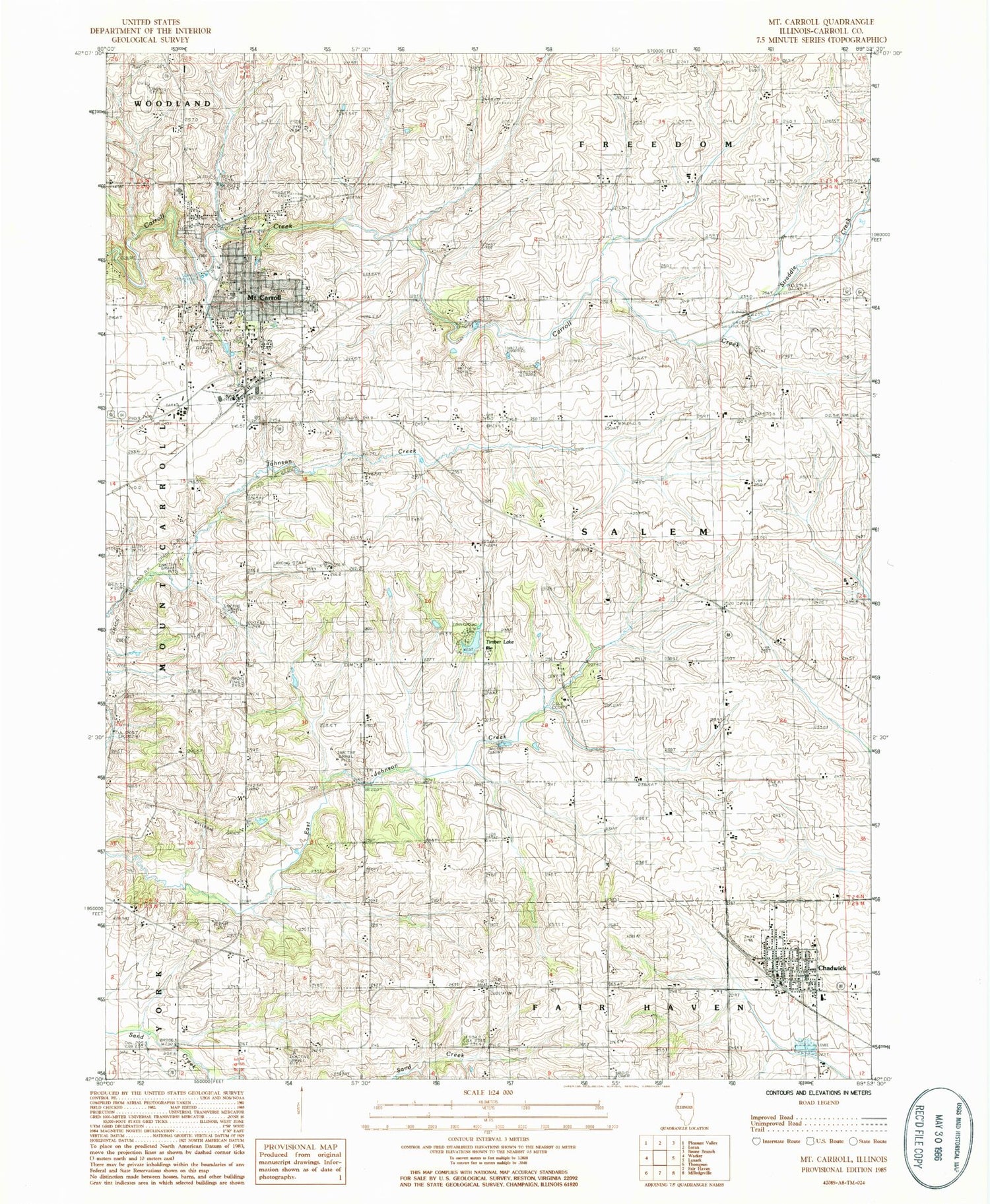
Historical USGS topographic quad map of Mount Carroll in the state of Illinois. Map scale may vary for some years, but is generally around 1:24,000. Print size is approximately 24" x 27"
This quadrangle is in the following counties: Carroll.
The map contains contour lines, roads, rivers, towns, and lakes. Printed on high-quality waterproof paper with UV fade-resistant inks, and shipped rolled.
Contains the following named places: Adams - Daggert Cemetery, Ashdale Junction, Black Oak Cemetery, Black Oak Church, Carroll County, Carroll County Farm, Carroll County Sheriff's Office, Chadwick, Chadwick Fire Protection District, Chadwick Junior High School, Chadwick Police Department, Chadwick Post Office, City of Mount Carroll, Daggett, Daggett School, Emerson School, Fairground School, Fairview School, Ferrin School, First Baptist Church, First Lutheran Church, Hope Brethren Cemetery, Hope United Methodist Church, Kingery School, Mission Ridge School, Mount Carroll, Mount Carroll Ambulance, Mount Carroll Fire Protection District, Mount Carroll High School, Mount Carroll Historic District, Mount Carroll Police Department, Mount Carroll Post Office, Mount Carroll United Methodist Church, Oak Hill Cemetery, Oakville Cemetery, Oakville School, Pleasant Hill School, Straddle Creek, Tautz Airport, Timber Lake, Timber Lake Dam, Township of Salem, Trinity Evangelical Lutheran Cemetery, Trinity Lutheran Church, Village of Chadwick, Vinegar Hill School, Williard Nycum RLA Airport, ZIP Code: 61053