MyTopo
Classic USGS Mount Catherine Utah 7.5'x7.5' Topo Map
Couldn't load pickup availability
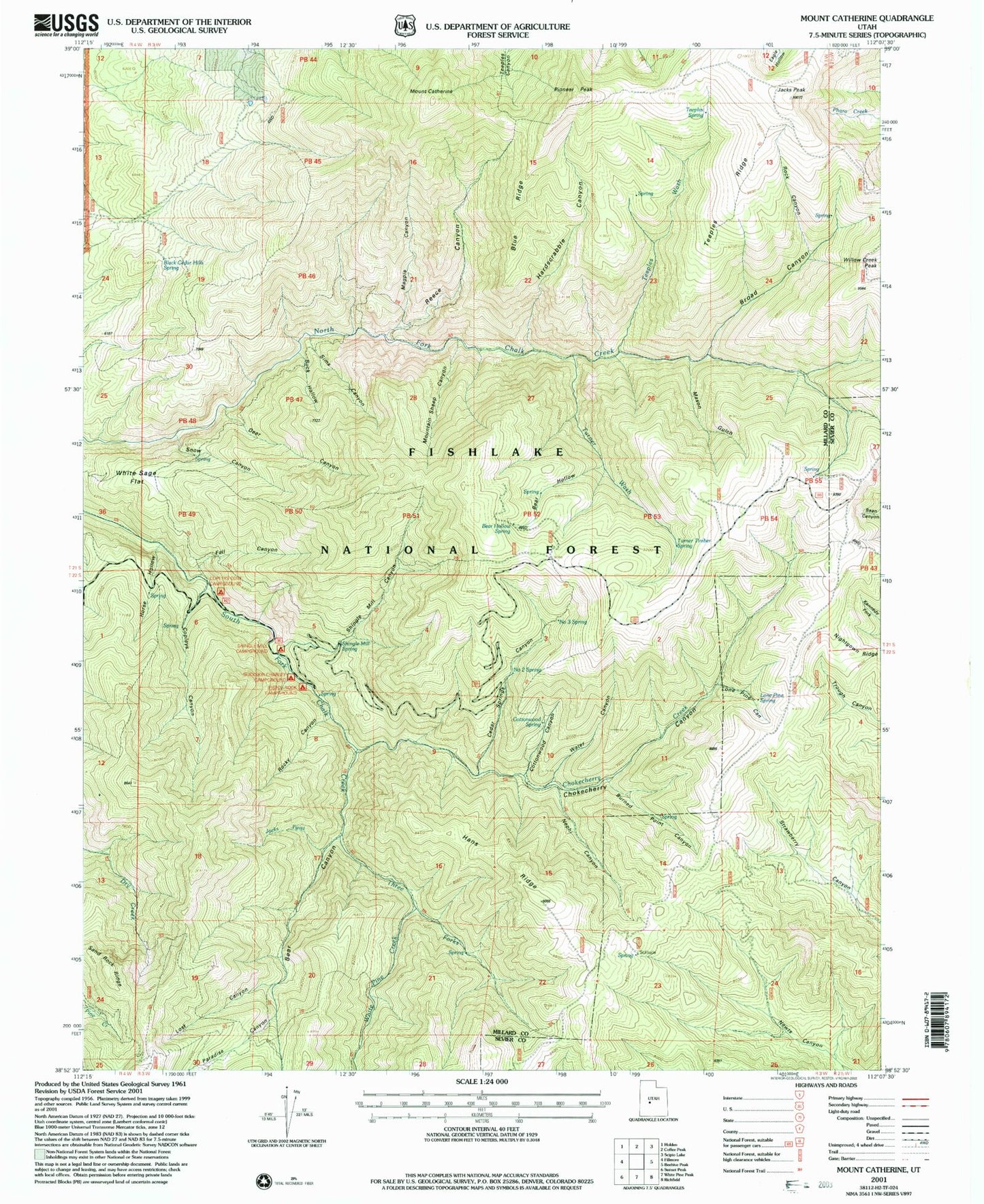
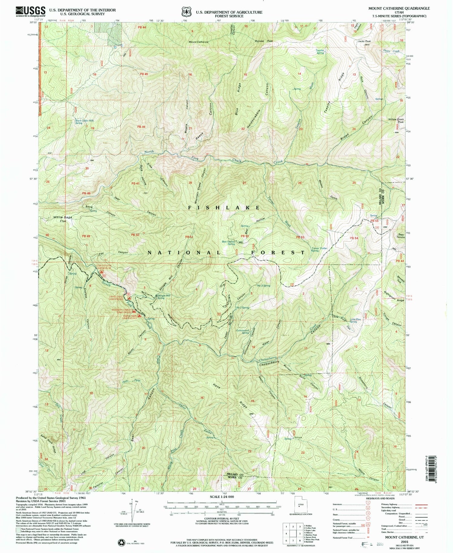
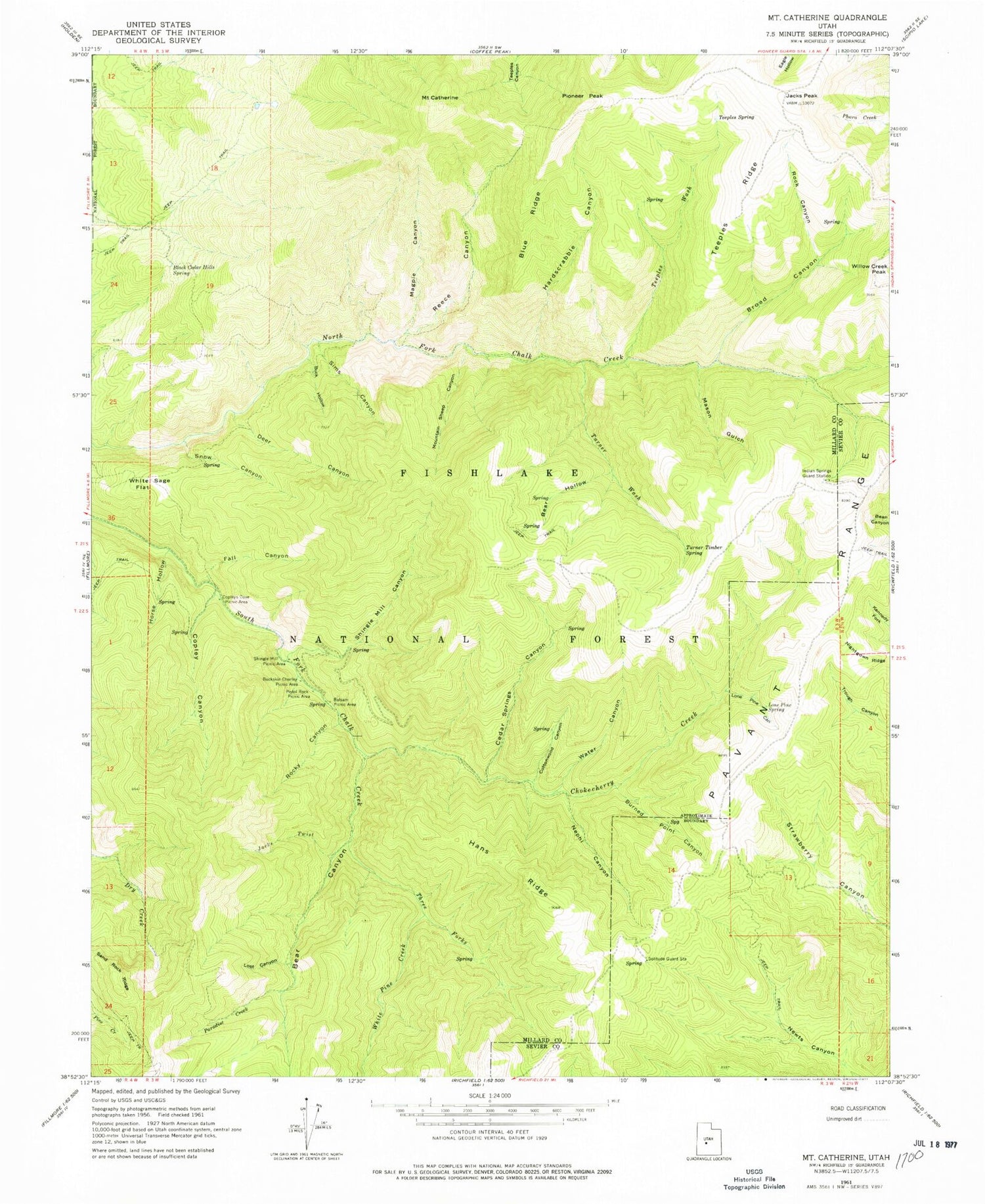
Historical USGS topographic quad map of Mount Catherine in the state of Utah. Typical map scale is 1:24,000, but may vary for certain years, if available. Print size: 24" x 27"
This quadrangle is in the following counties: Millard, Sevier.
The map contains contour lines, roads, rivers, towns, and lakes. Printed on high-quality waterproof paper with UV fade-resistant inks, and shipped rolled.
Contains the following named places: Balsam Picnic Area, Bear Canyon, Bear Hollow, Black Cedar Hills Spring, Blue Ridge, Broad Canyon, Buck Hollow, Buckskin Charley Picnic Area, Burned Point Canyon, Mount Catherine, Cedar Springs Canyon, Chokecherry Creek, Copley Canyon, Copleys Cove Picnic Area, Cottonwood Canyon, Deer Canyon, Fall Canyon, Hans Ridge, Hardscrabble Canyon, Horse Hollow, Indian Springs Guard Station, Jacks Peak, Jacks Twist, Lone Pine Canyon, Lone Pine Spring, Lost Canyon, Magpie Canyon, Mason Gulch, Mountain Sheep Canyon, Nephi Canyon, Nightgown Ridge, Paradise Creek, Pioneer Peak, Pistol Rock Picnic Area, Reece Canyon, Rock Canyon, Rocky Canyon, Sand Rock Ridge, Shingle Mill Canyon, Shingle Mill Picnic Area, Sims Canyon, Snow Canyon, Solitude Guard Station, Teeples Ridge, Teeples Spring, Teeples Wash, Three Forks, Turner Timber Spring, Turner Wash, Water Canyon, White Pine Creek, White Sage Flat, Willow Creek Peak, Sugarloaf Mountain, Bear Hollow Spring, Number Three Spring, Number Two Spring, Cottonwood Spring, Shingle Mill Spring, Copley Creek, Flat Canyon, The Lakes, Paradise Canyon, Indian Springs, Balsam Spring