MyTopo
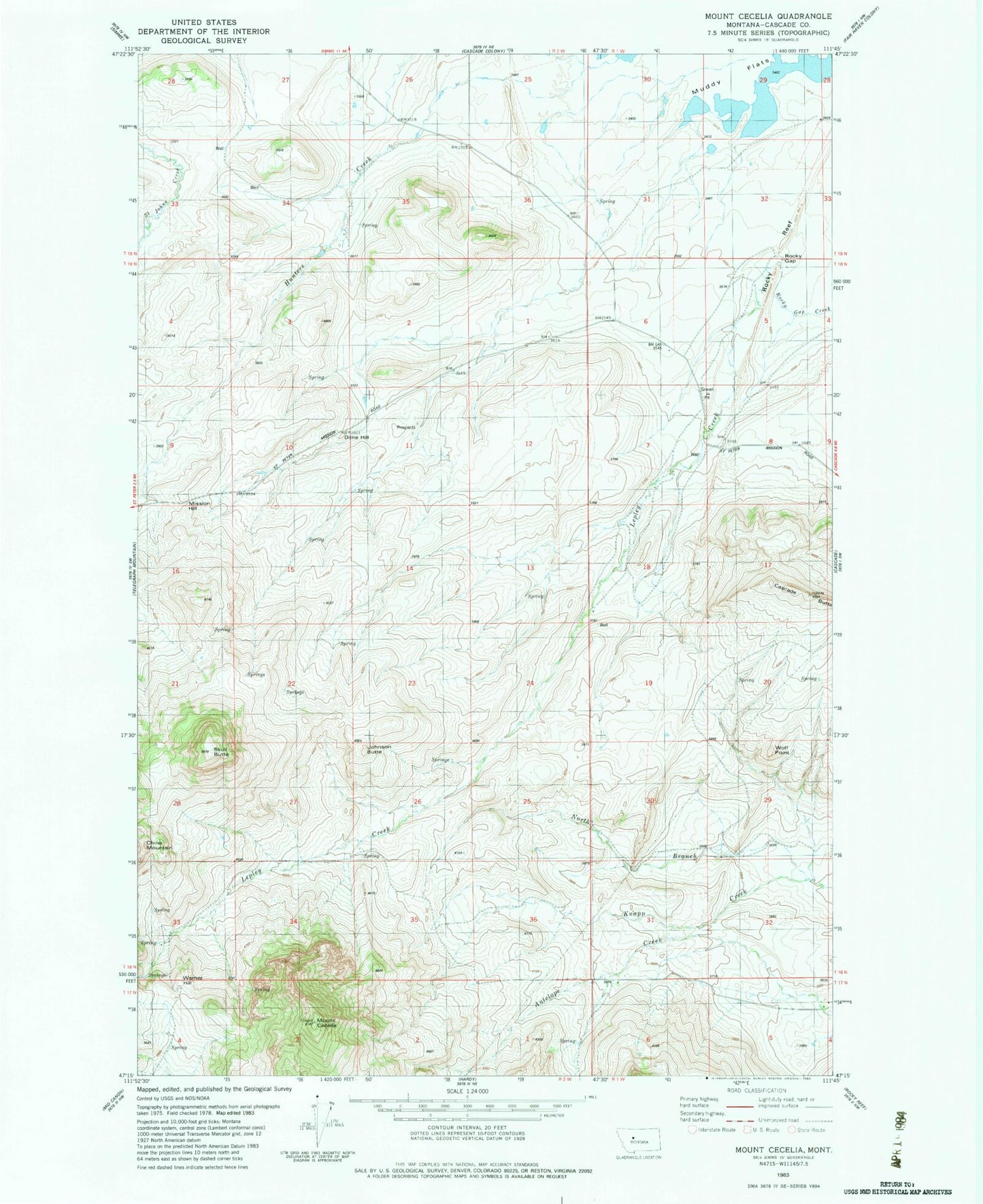
Classic USGS Mount Cecelia Montana 7.5'x7.5' Topo Map
Couldn't load pickup availability
Historical USGS topographic quad map of Mount Cecelia in the state of Montana. Map scale may vary for some years, but is generally around 1:24,000. Print size is approximately 24" x 27"
This quadrangle is in the following counties: Cascade.
The map contains contour lines, roads, rivers, towns, and lakes. Printed on high-quality waterproof paper with UV fade-resistant inks, and shipped rolled.
Contains the following named places: 17N01W05A___01 Well, 17N01W06B___01 Spring, 18N01W07C___01 Well, 18N01W07D___01 Well, 18N01W18C___01 Well, 18N01W29C___01 Spring, 18N01W31A___01 Well, 18N01W31A___02 Well, 18N01W32A___01 Well, Cascade Butte, China Mountain, Dime Hill, Hunters Creek, Johnson Butte, Lepley Creek, Mission Hill, Mount Cecelia, North Branch Knapp Creek, Rocky Gap, Rocky Reef Reservoir, Skull Butte, Spun Dam, Taylor School, Warner Hill, Wolf Point, Yaklich School