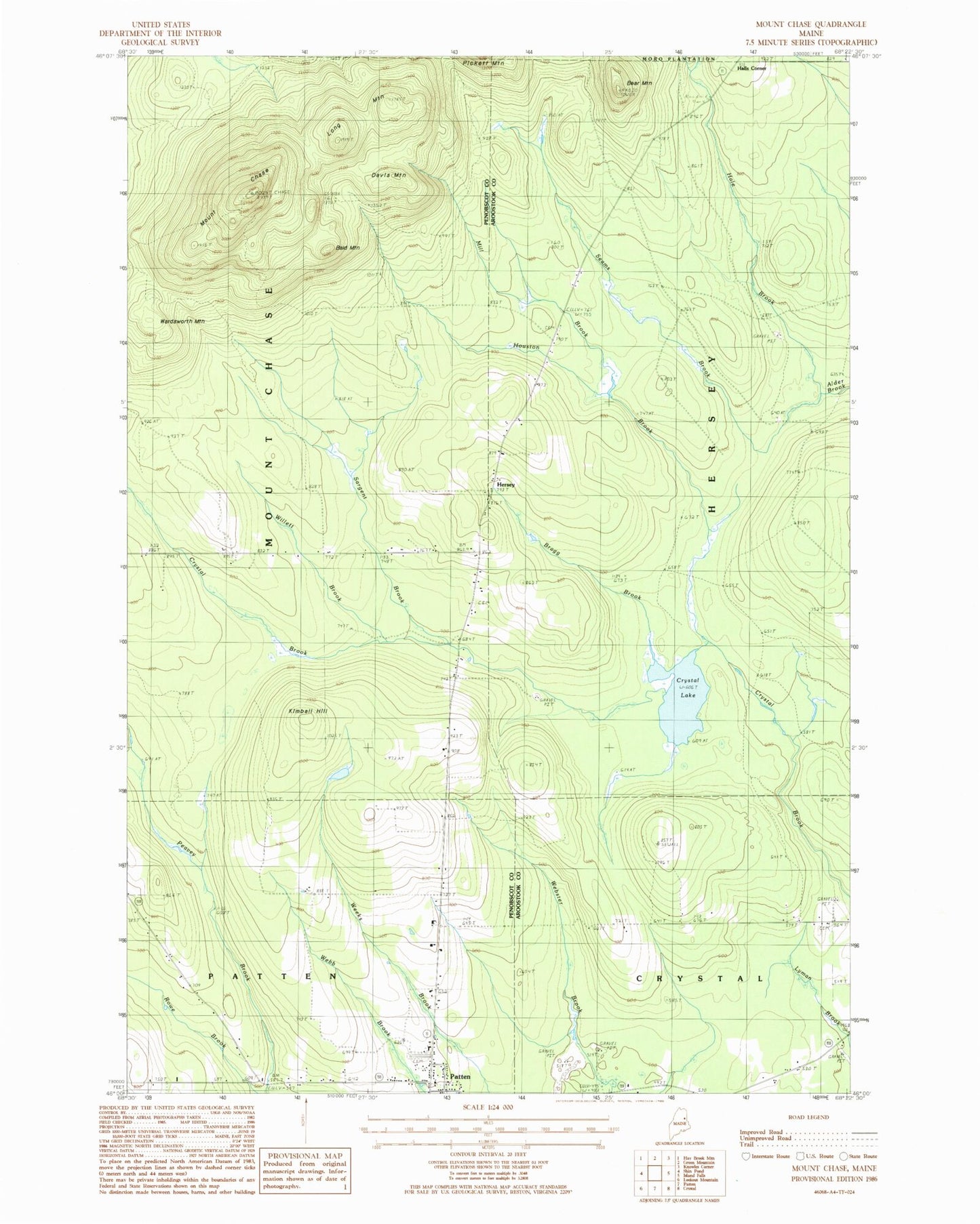
MyTopo
Classic USGS Mount Chase Maine 7.5'x7.5' Topo Map
Couldn't load pickup availability
Historical USGS topographic quad map of Mount Chase in the state of Maine. Typical map scale is 1:24,000, but may vary for certain years, if available. Print size: 24" x 27"
This quadrangle is in the following counties: Aroostook, Penobscot.
The map contains contour lines, roads, rivers, towns, and lakes. Printed on high-quality waterproof paper with UV fade-resistant inks, and shipped rolled.
Contains the following named places: Allsbury School, Bald Mountain, Bear Mountain, Bragg Brook, Crystal Lake, Davis Mountain, Davis School, Hale Brook, Houston Brook, Kimball Hill, Long Mountain, Mill Brook, Mount Chase, Myrick School, Patten Academy, Rowe Brook, Sargent Brook, Seams Brook, Wardsworth Mountain, Willett Brook, Halls Corner, Hersey, Peasley Brook Dam, Peasley Brook, Patten Lumbermans Museum, Hersey Cemetery, Crystal Cemetery, Patten Cemetery, Patten Census Designated Place