MyTopo
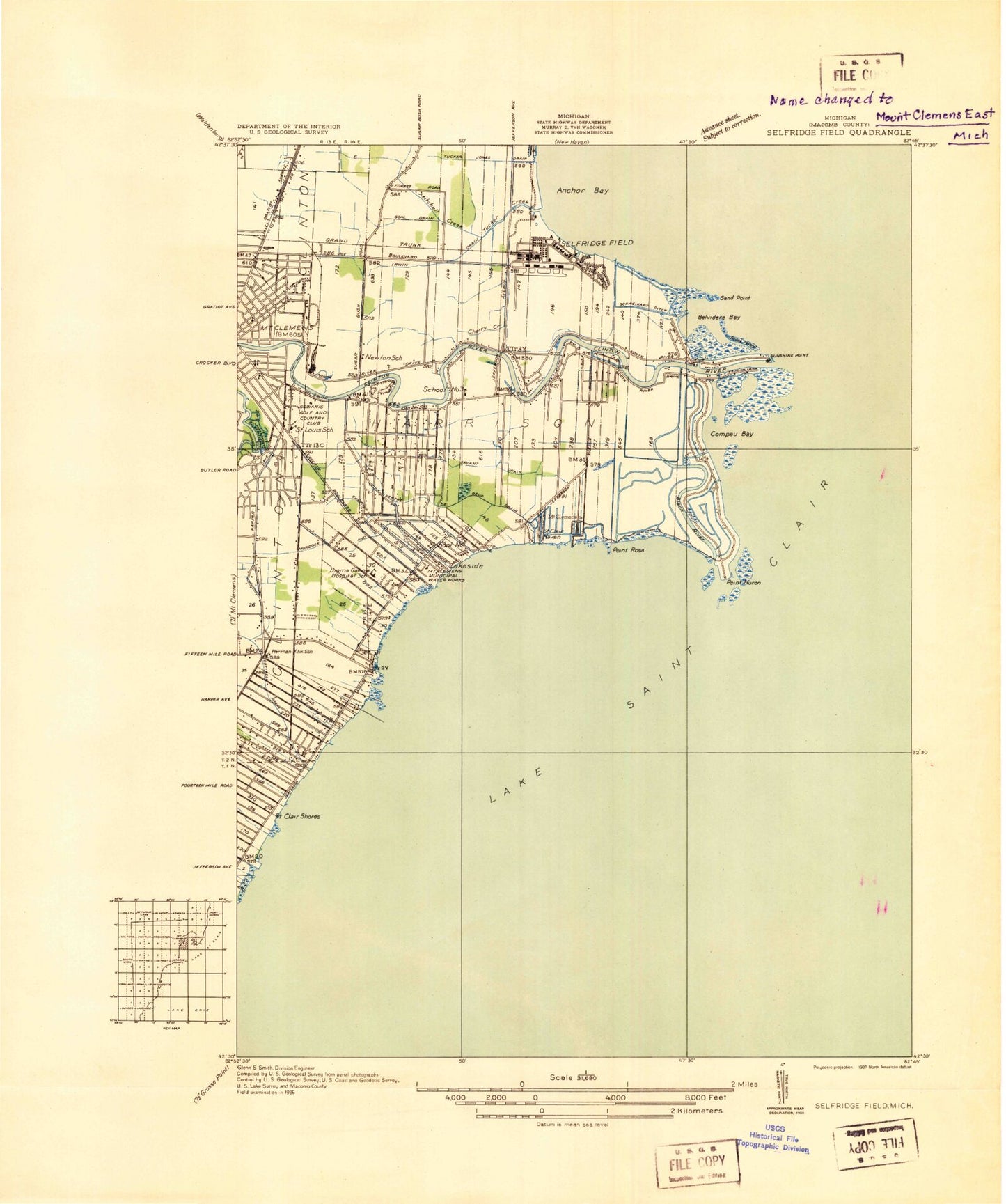
Classic USGS Mount Clemens East Michigan 7.5'x7.5' Topo Map
Couldn't load pickup availability
Historical USGS topographic quad map of Mount Clemens East in the state of Michigan. Map scale may vary for some years, but is generally around 1:24,000. Print size is approximately 24" x 27"
This quadrangle is in the following counties: Macomb.
The map contains contour lines, roads, rivers, towns, and lakes. Printed on high-quality waterproof paper with UV fade-resistant inks, and shipped rolled.
Contains the following named places: Aloysius Trombley Park, Belvidere Bay, Black Creek, Cairns Field, Campau Bay, Charter Township of Harrison, Christian Clemens School, Clinton River, Clinton River Mobile Home Park, Clinton River Spillway, Cottrell Drain, Donald J Yacks Elementary School, Edison School, Emma V Lobbestael Elementary School, Ensign Access Point, Gibraltar Trade Center North Shopping Center, Gowanie Country Club, Graham School, Grass Island, Harrison Census Designated Place, Harrison Township Fire Department Station 1, Harrison Township Fire Department Station 2, Ingleside Center Shopping Center, Jefferson School, King Academy, Klix School, LaHood Retail Shopping Center, Lakeshore Post Office, Lakeside, Lakeside Community Church, L'Anse Creuse Adult Education School, L'anse Creuse Bay, L'Anse Creuse Child Care Center, L'Anse Creuse High School, L'Anse Creuse Middle School Central, L'Anse Creuse Middle School South, Lawndale Park, MacArthur Park, Mariner's Pointe Shopping Center, Medstar Ambulance, Metropolitan Beach, Mount Clemens Fire Department, Neil Reid Park, North Broadway Church of Christ, Peltier Drain, Point Huron, Point Rosa, Professional Development Center, Reid School, Saint Clair Haven, Saint Huberts Church, Saint John North Shores Hospital, Saint Louis School, Sand Point, Selfridge Air National Guard Base, Selfridge Air National Guard Base Fire Department, Selfridge Air National Guard Base Post Office, Selfridge Army Garrison, Selfridge School, South River School, Sunshine Point, Tebo Drain, Trinity School, Tucker Family Cemetery, Waterfront Park, William Tucker County Park, Willow Point Mobile Home Park, Zion Temple Church in Jesus, ZIP Code: 48045