MyTopo
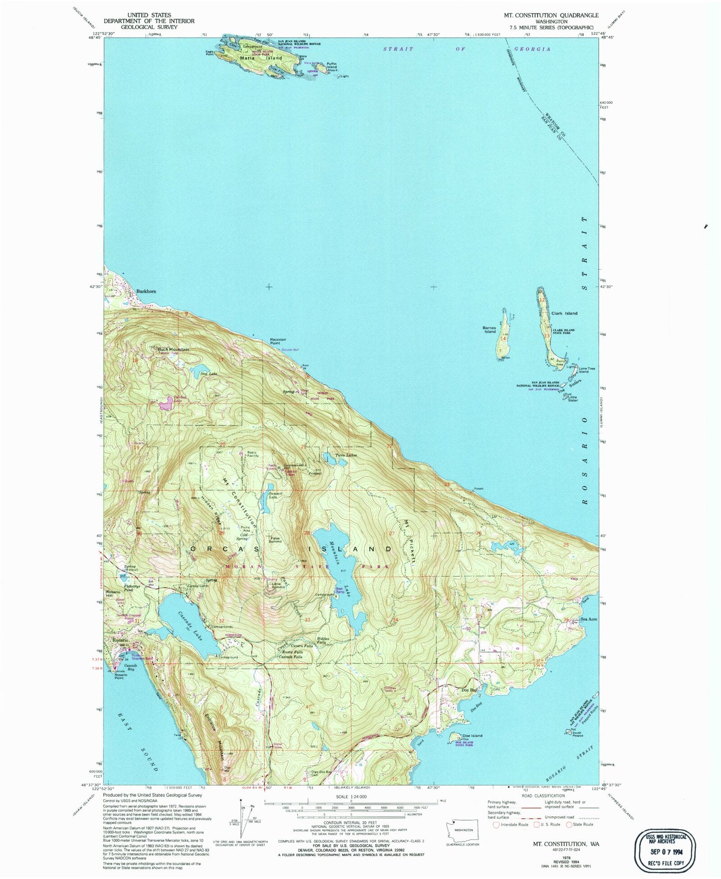
Classic USGS Mount Constitution Washington 7.5'x7.5' Topo Map
Couldn't load pickup availability
Historical USGS topographic quad map of Mount Constitution in the state of Washington. Typical map scale is 1:24,000, but may vary for certain years, if available. Print size: 24" x 27"
This quadrangle is in the following counties: San Juan, Whatcom.
The map contains contour lines, roads, rivers, towns, and lakes. Printed on high-quality waterproof paper with UV fade-resistant inks, and shipped rolled.
Contains the following named places: Barnes Island, Buck Mountain, Cascade Bay, Cascade Falls, Cavern Falls, Clark Island, Cold Spring, Day Lake, Doe Bay, Doe Island, Eagle Point, Entrance Mountain, Flahertys Pond, Hidden Falls, Hidden Ridge, Little Sister, Lone Tree Island, Matia Island, Matia Island State Park, Olga - Doe Bay Cemetery, Paul Creek, Peapod Rocks, Puffin Island, Rolfe Cape, Rosario Point, Rustic Falls, South Peapod, Moran State Park, Summit Lake, The Sisters, Twin Lakes, Rolfe Cove, Buckhorn, Doe Bay, False Summit, Little Summit, Mount Pickett, Raccoon Point, Cold Creek, Mountain Lake, Cascade Lake, Clark Island State Park, Doe Island Marine State Park, Mount Constitution, Chin-Chin-Tse-Tung, Kangaroo Point, San Juan Islands Wilderness, Sea Acre, Utter Dam, Mountain Lake Dam, Cascade Lake Dam, Boyd Middle Reservoir Dam, Boyd Middle Reservoir, Boyd Lower Reservoir Dam, Boyd Lower Reservoir, Moran Creek, Rosario Seaplane Base, KAFE-FM (Bellingham), KISM-FM (Bellingham), KLYN-FM (Lynden), KBCB-TV (Bellingham), KVOS-TV (Bellingham), Rosario Resort Marina, San Juan County Fire District 2 / Orcas Island Fire and Rescue Station 23 Rosario, San Juan County Fire District 2 / Orcas Island Fire and Rescue Station 27 - Doe Bay, San Juan Islands National Wildlife Refuge


