
MyTopo
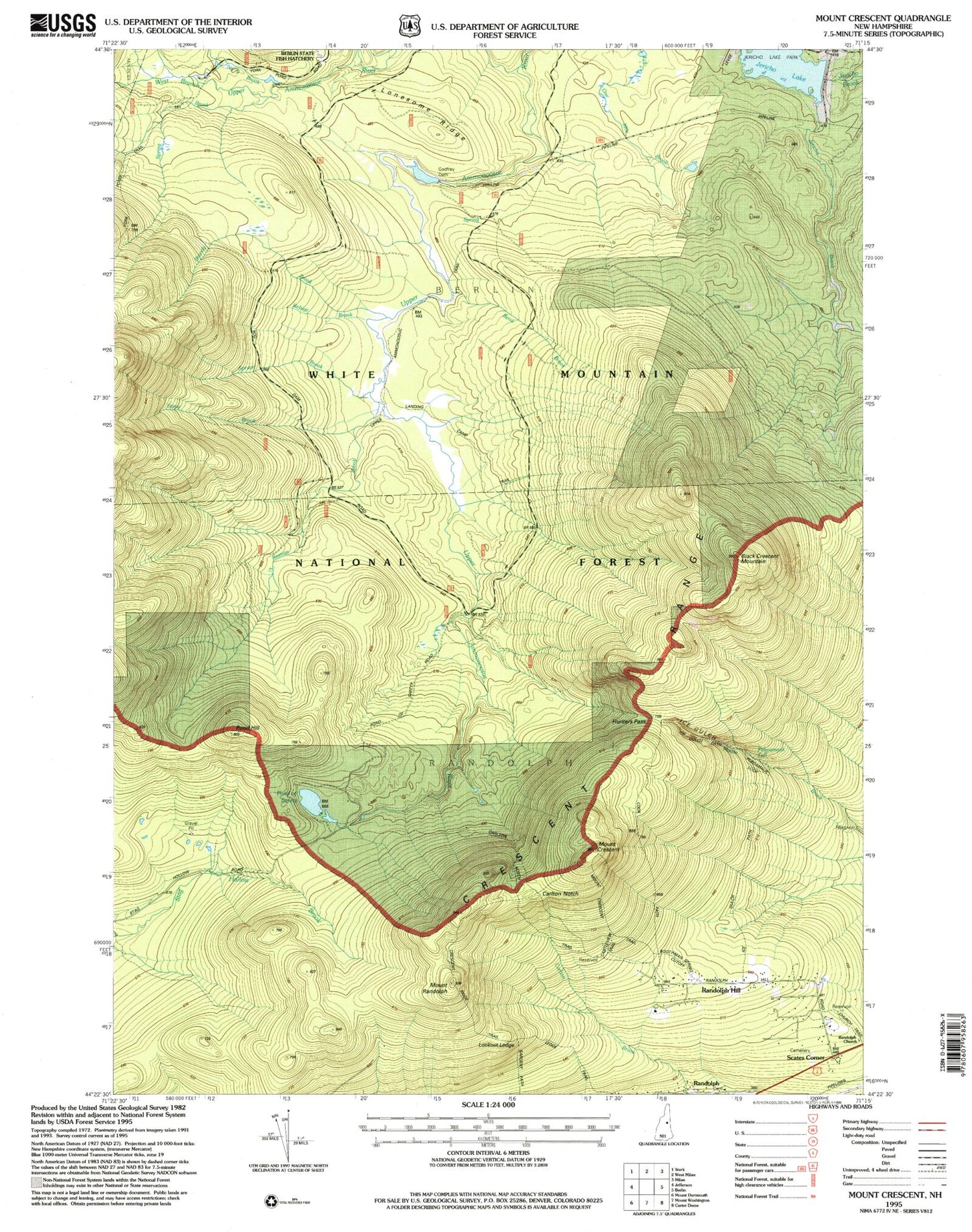
Classic USGS Mount Crescent New Hampshire 7.5'x7.5' Topo Map
Couldn't load pickup availability
Historical USGS topographic quad map of Mount Crescent in the state of New Hampshire. Map scale may vary for some years, but is generally around 1:24,000. Print size is approximately 24" x 27"
This quadrangle is in the following counties: Coos.
The map contains contour lines, roads, rivers, towns, and lakes. Printed on high-quality waterproof paper with UV fade-resistant inks, and shipped rolled.
Contains the following named places: Bend Brook, Black Crescent Mountain, Bog Dam, Bog Dam Trail, Brandy Brook, Camp 18, Camp 19, Carlton Notch, City of Berlin, Cook Path, Crescent Range, Godfrey Dam, Godfrey Pond, Hunters Pass, Ice Gulch, Ice Gulch Path, Jericho Lake, Jericho Lake Park, Jericho Trail, Keenan Brook, Lonesome Ridge, Lookout Ledge, Mount Crescent, Mount Randolph, Number Nine Brook, Peboamauk Fall, Pond Hill, Pond of Safety, Pond of Safety Trail, Randolph, Randolph Emergency Medical Services, Randolph Hill, Randolph Police Department, Ravine House, Refuge Brook, Scates Corner, Site Number 1 Dead River Dam, Spring Brook, Spruce Brook, Stony Brook, Town of Randolph, Upper Ammonoosuc Trail, West Branch Upper Ammonoosuc River


