MyTopo
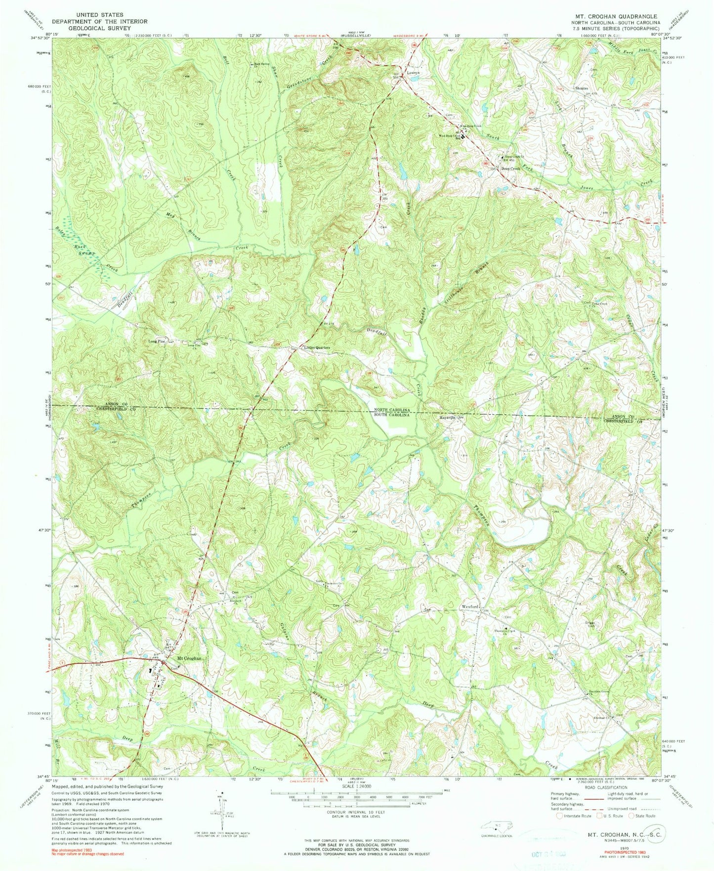
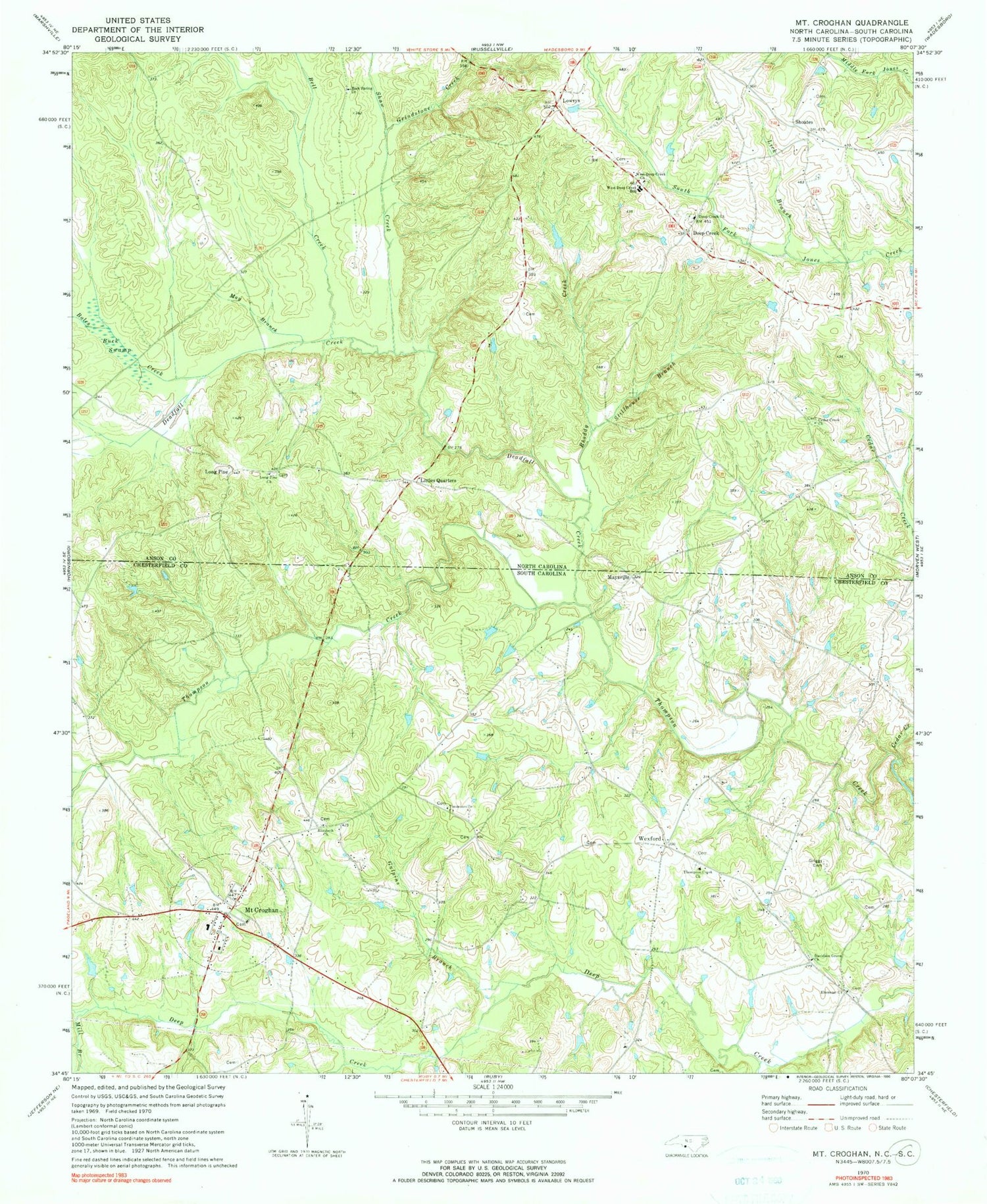
Classic USGS Mount Croghan South Carolina 7.5'x7.5' Topo Map
Couldn't load pickup availability
Historical USGS topographic quad map of Mount Croghan in the states of South Carolina, North Carolina. Map scale may vary for some years, but is generally around 1:24,000. Print size is approximately 24" x 27"
This quadrangle is in the following counties: Anson, Chesterfield.
The map contains contour lines, roads, rivers, towns, and lakes. Printed on high-quality waterproof paper with UV fade-resistant inks, and shipped rolled.
Contains the following named places: Bell Creek, Boles Creek, Buck Swamp, Cedar Creek, Cedar Creek Church, Concordia Farms Lake, Concordia Farms Lake Dam, Crews Branch, Davidson Grove Baptist Church, Davidson Grove Church Cemetery, Davidson Grove School, Deadfall Creek, Deep Creek, Deep Creek Church, Deep Creek Church Cemetery, Ebenezer Cemetery, Ebenezer Church, Elizabeth Baptist Church, Elizabeth Cemetery, Gaddy - Sellers Cemetery, Griggs Cemetery, Grindstone Creek, Gulledge Family Cemetery, Gulledge Fire Department, Gulpins Branch, Jenning Branch, Lick Branch, Littles Quarters, Long Pine, Long Pine Church, Long Pine Church Cemetery, Lowrys, May Branch, Maysville, Mill Branch, Mill Creek, Mount Croghan, Mount Croghan Baptist Church, Mount Croghan Memorial Park, Mount Croghan Station, Mount Croghan United Methodist Church Cemetery, Muddy Branch, Old Thompson Creek Cemetery, Rhoddy Creek, Ruby - Mount Croghan Fire Department Station 2, Shaw Creek, Shoates, Stillhouse Branch, Talton Branch, Thompson Creek Baptist Church, Thompsons Creek Cemetery, Timmonsville Baptist Church, Timmonsville Baptist Church Cemetery, Timmonsville School, Town of Mount Croghan, Township of White Store, Wamble Hill Church, West Deep Creek Church, West Deep Creek Church Cemetery, West Deep Creek School, Wexford, Wexford School