MyTopo
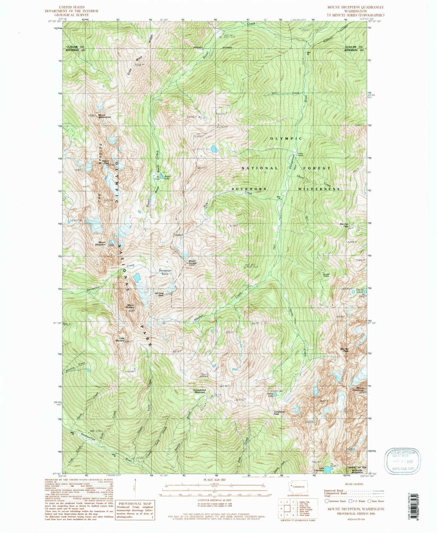
Classic USGS Mount Deception Washington 7.5'x7.5' Topo Map
Couldn't load pickup availability
Historical USGS topographic quad map of Mount Deception in the state of Washington. Typical map scale is 1:24,000, but may vary for certain years, if available. Print size: 24" x 27"
This quadrangle is in the following counties: Clallam, Jefferson.
The map contains contour lines, roads, rivers, towns, and lakes. Printed on high-quality waterproof paper with UV fade-resistant inks, and shipped rolled.
Contains the following named places: Boulder Shelter, Camp Handy, Charlia Lakes, Mount Clark, Constance Pass, Lake Constance, Mount Constance, Crag Creek, Deception Basin, Mount Deception, Mount Fricaba, Ghoul Creek, Hal Foss Peak, Hawk Creek, Heather Creek, Home Creek, Home Lake, Little Mystery, Lower Twin Creek, Marmot Pass, Milk Creek, Mount Mystery, Royal Basin, Royal Creek, Royal Creek Cabin, Royal Creek Trail, Royal Lake, Slide Creek, Still Creek, Sunnybrook Meadows, The Needles, Upper Twin Creek, Mount Walkinshaw, Warrior Peak, Buckhorn Wilderness, Buckhorn Pass, West Branch Home Creek, Mount Valerianos (not official)