MyTopo
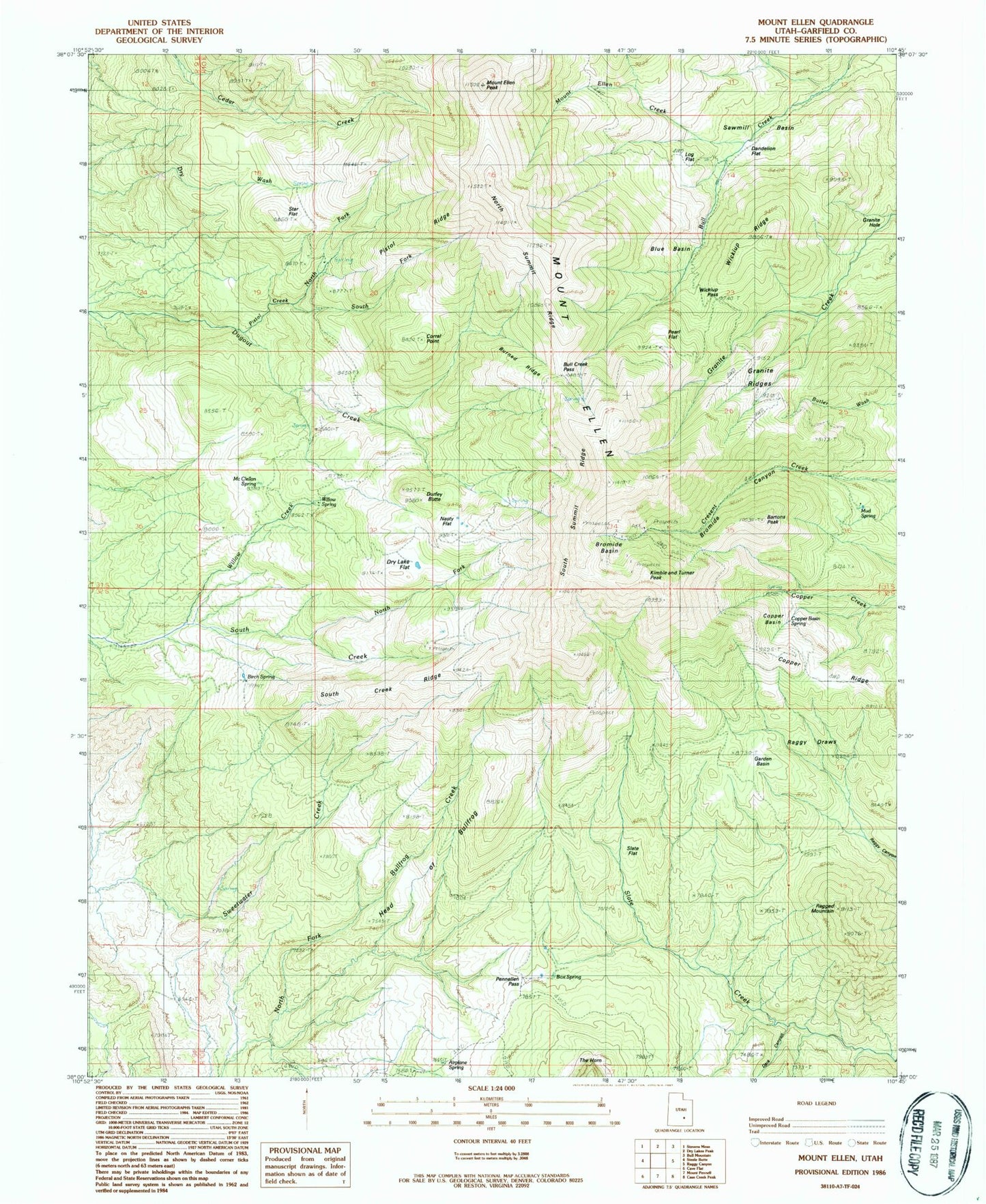
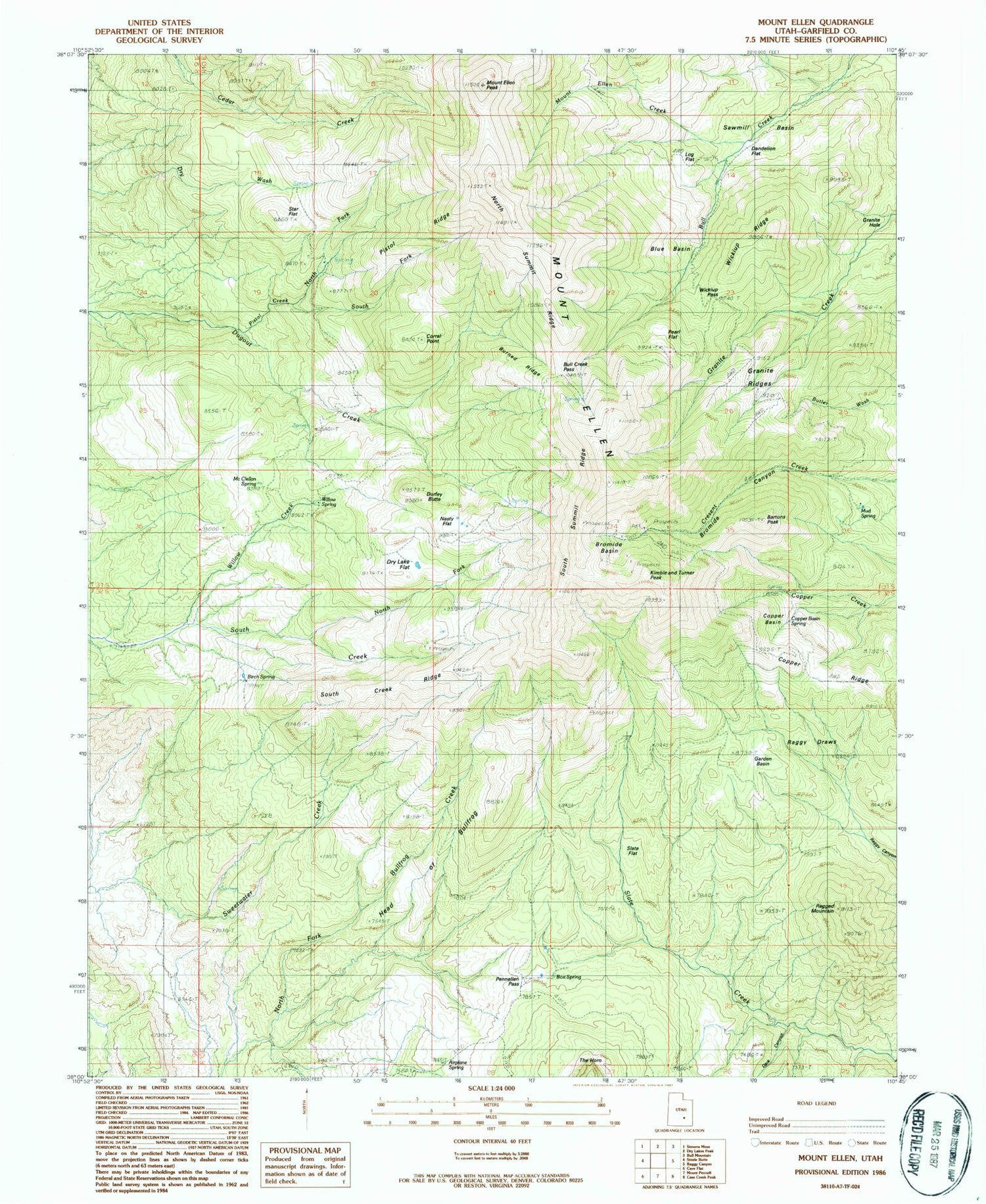
Classic USGS Mount Ellen Utah 7.5'x7.5' Topo Map
Couldn't load pickup availability
Historical USGS topographic quad map of Mount Ellen in the state of Utah. Typical map scale is 1:24,000, but may vary for certain years, if available. Print size: 24" x 27"
This quadrangle is in the following counties: Garfield.
The map contains contour lines, roads, rivers, towns, and lakes. Printed on high-quality waterproof paper with UV fade-resistant inks, and shipped rolled.
Contains the following named places: Dark Canyon, Airplane Spring, Bartons Peak, Birch Spring, Blue Basin, Box Spring, Bromide Basin, Bromide Canyon, Bromide Mine, Bull Creek Pass, Burned Ridge, Copper Basin, Copper Basin Spring, Copper Ridge, Corral Point, Dandelion Flat, Dry Lake Flat, Durfey Butte, Mount Ellen Peak, Mount Ellen, Garden Basin, Granite Hole, Granite Ridges, Head of Bullfrog, Kimble and Turner Peak, Log Flat, McClellan Spring, Mount Ellen Creek, Nasty Flat, North Fork Pistol Creek, North Fork South Creek, North Summit Ridge, Pearl Flat, Pennellen Pass, Pistol Creek, Pistol Ridge, Ragged Mountain, Raggy Draws, Sawmill Basin, Slate Flat, South Creek Ridge, South Fork Pistol Creek, South Summit Ridge, Star Flat, Wickiup Pass, Wickiup Ridge, Willow Creek, Willow Spring, Desert Overlook, McMillan Springs Campground, Lonesome Beaver Campground