MyTopo
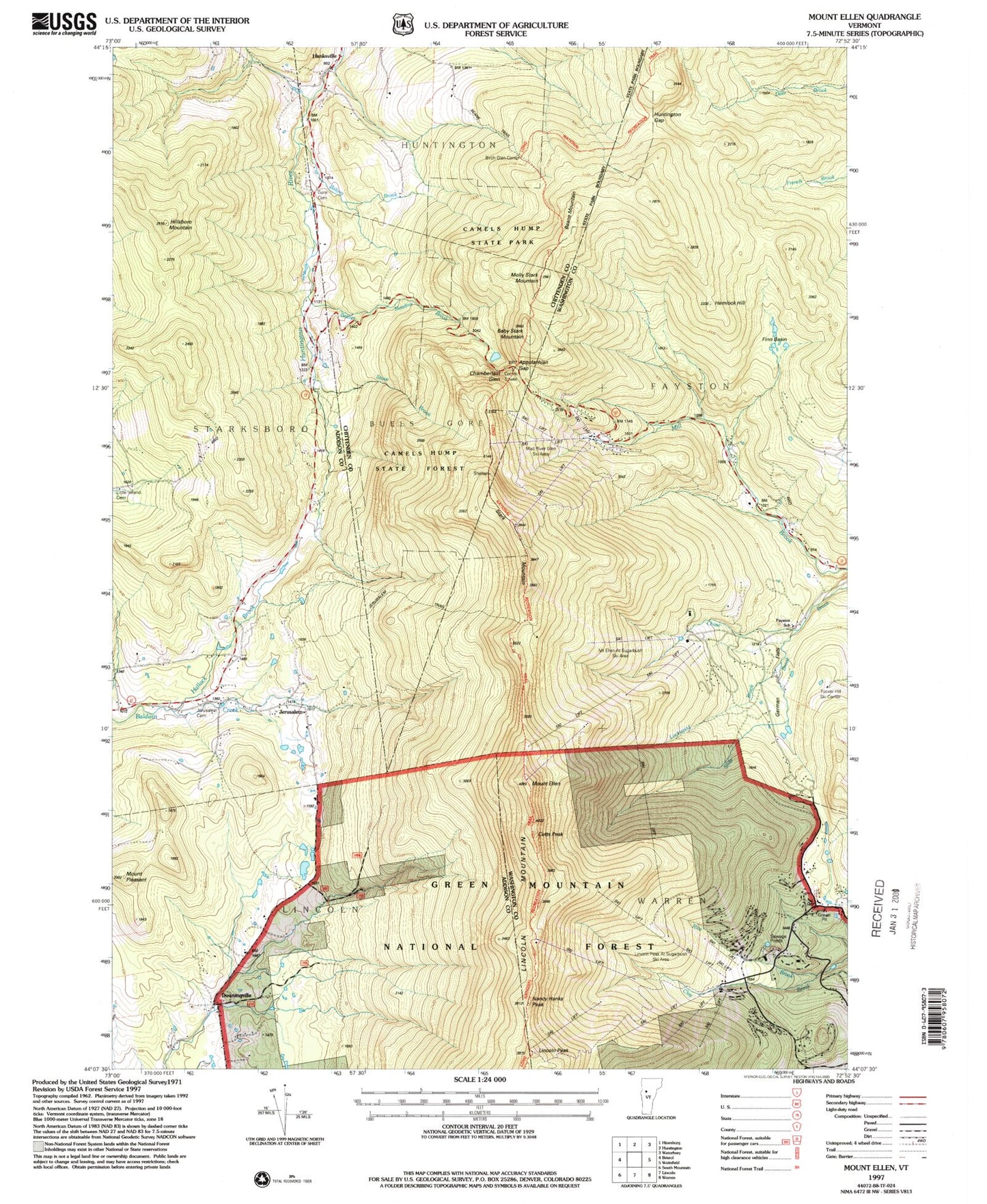
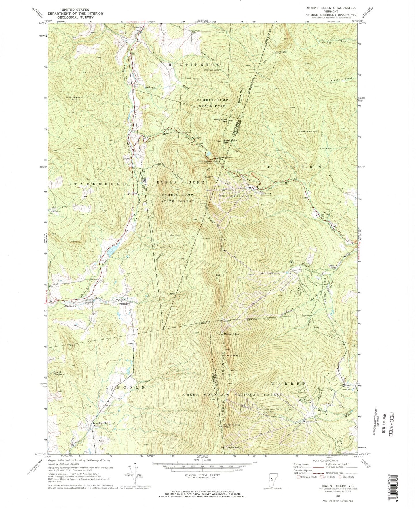
Classic USGS Mount Ellen Vermont 7.5'x7.5' Topo Map
Couldn't load pickup availability
Historical USGS topographic quad map of Mount Ellen in the state of Vermont. Typical map scale is 1:24,000, but may vary for certain years, if available. Print size: 24" x 27"
This quadrangle is in the following counties: Addison, Chittenden, Washington.
The map contains contour lines, roads, rivers, towns, and lakes. Printed on high-quality waterproof paper with UV fade-resistant inks, and shipped rolled.
Contains the following named places: Appalachian Gap, Baby Stark Mountain, Bakers Brook, Beane Mountain, Beane Trail, Beaver Meadow Brook, Birch Glen Camp, Camels Hump State Park, Chamberlain Glen, Cutts Peak, Downingville, Mount Ellen, Fayston Elementary School, Finn Basin, German Flats, Gore Cemetery, Hallock Brook, Hanksville, Hemlock Hill, Hillsboro Mountain, Huntington Gap, Jerusalem, Jerusalem Cemetery, Jerusalem Trail, Lincoln Mountain, Lincoln Peak, Little Ireland Cemetery, Lockwood Brook, Molly Stark Mountain, Nancy Hanks Peak, Mount Pleasant, Rice Brook, Slide Brook, Stark Mountain, Stave Brook, Glen Ellen Ski Area, Mad River Glen Ski Area, Sugarbush Valley Ski Area, WDOT-FM (Warren), Buels Gore, Strattonwald Dam, Bristol Municipal Forest, Huntington Gap Wildlife Manangement Area, Theron Dean Shelter, Catamount Cross Country Trail, Mad River Glen Nordic Ski Center, Sugarbush Ski Center, Sugarbush Village, Starksboro Volunteer Fire Department Station 2, Warren Volunteer Fire Department Sugarbush Substation