MyTopo
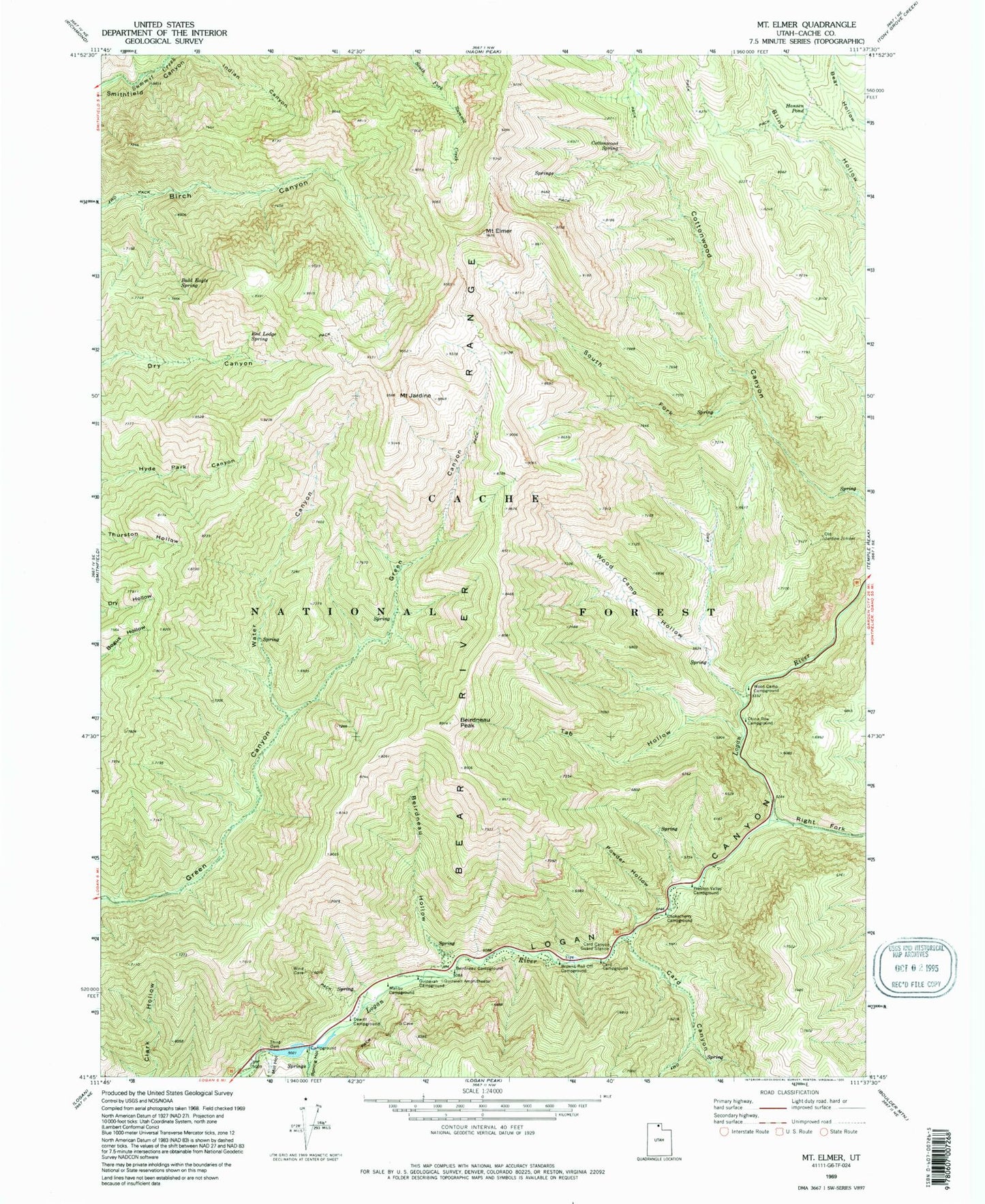
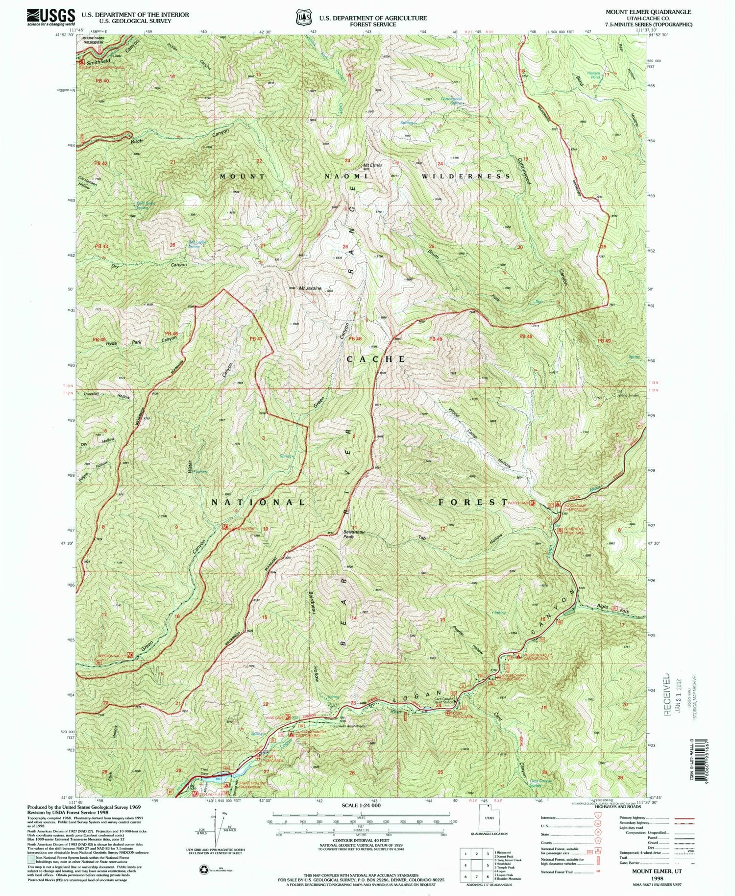
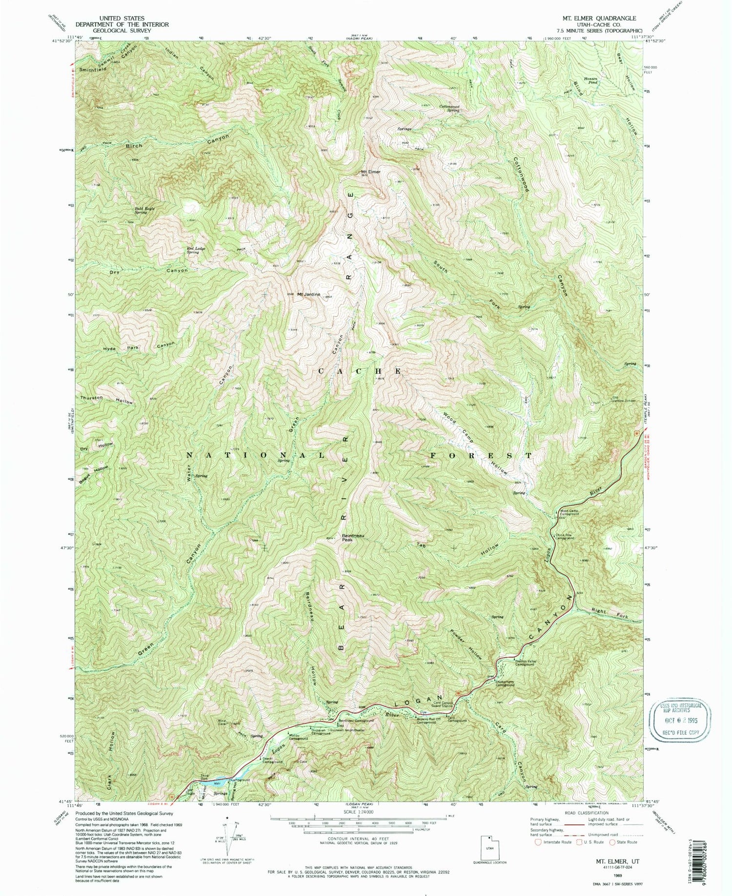
Classic USGS Mount Elmer Utah 7.5'x7.5' Topo Map
Couldn't load pickup availability
Historical USGS topographic quad map of Mount Elmer in the state of Utah. Typical map scale is 1:24,000, but may vary for certain years, if available. Print size: 24" x 27"
This quadrangle is in the following counties: Cache.
The map contains contour lines, roads, rivers, towns, and lakes. Printed on high-quality waterproof paper with UV fade-resistant inks, and shipped rolled.
Contains the following named places: Bald Eagle Spring, Beirdneau Campground, Beirdneau Hollow, Beirdneau Peak, Browns Roll Off Campground, Card Campground, Card Canyon, Card Canyon Guard Station, China Row Campground, Chokecherry Campground, Cottonwood Spring, Dewitt Campground, Mount Elmer, Guinavah Amphitheater, Guinavah Campground, Hansen Pond, Mount Jardine, Malibu Campground, Mill Hollow, Old Jardine Juniper, Powder Hollow, Preston Valley Campground, Red Ledge Spring, Right Fork Logan Canyon, South Fork Cottonwood Canyon, Spring Hollow, Tab Hollow, Third Dam, Water Canyon, Wood Camp Campground, Wood Camp Hollow, Brachiopod Rock, Right Fork Logan River, Card Canyon Spring, Beindneau Summer Home Area, Middle Spring Hollow Picnic Area, Smoky Rock Campground, Chokecherry Summer Home Area, Pine Bluffs Summer Home Area, Nook Campground, Spring Hollow Campground