MyTopo
Classic USGS Mount Enterprise Texas 7.5'x7.5' Topo Map
Couldn't load pickup availability
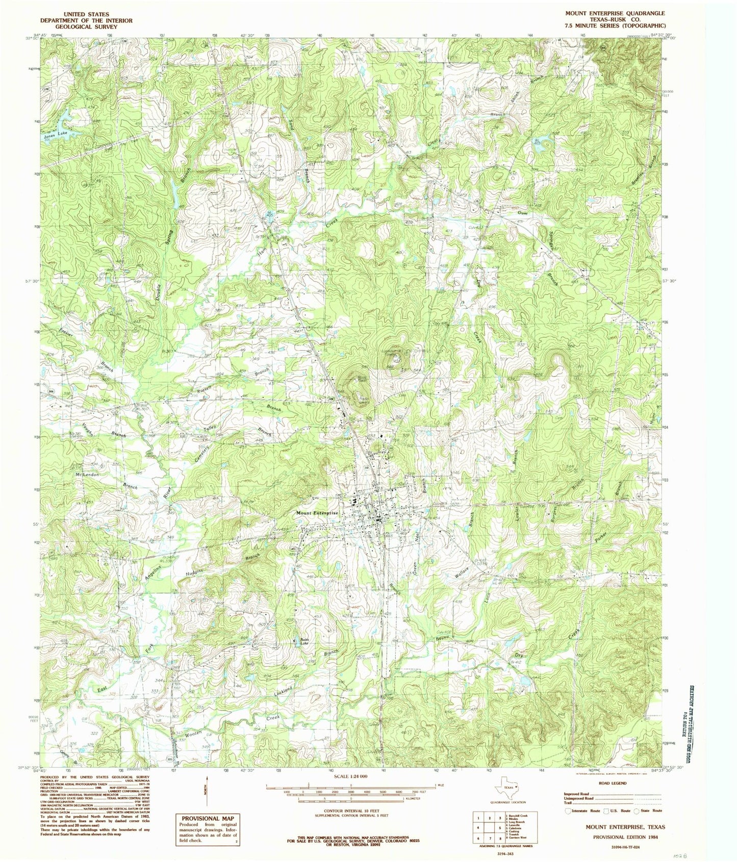
Historical USGS topographic quad map of Mount Enterprise in the state of Texas. Map scale may vary for some years, but is generally around 1:24,000. Print size is approximately 24" x 27"
This quadrangle is in the following counties: Rusk.
The map contains contour lines, roads, rivers, towns, and lakes. Printed on high-quality waterproof paper with UV fade-resistant inks, and shipped rolled.
Contains the following named places: Bane Cemetery, Barker Family Cemetery, Bayou Loco, Boles Lake, Burgess Branch, Campground Cemetery, Cemetery Branch, City of Mount Enterprise, Clear Branch, Double Spring Branch, Dry Creek, Edmonson Cemetery, Frasier Branch, Gatlin Branch, Gentry Branch, Green Neal Branch, Griffin Branch, Griffin Lake Dam, Gum Springs Branch, Ham Creek, Hudgins Branch, Jones Lake, King Cemetery, Lawler Branch, Lockland Branch, Lone Star Church, Longview Public Library, McLendon Branch, Minden Elementary and High School, Mount Enterprise, Mount Enterprise City Hall, Mount Enterprise Police Department, Mount Enterprise Post Office, Mount Enterprise Volunteer Fire Department, Parker Branch, Ross Cemetery, Russell Branch, Sand Branch, Schoolhouse Branch, Shiloh Branch, Shiloh Church, Stockman Spring, Talley Branch, Talley Cemetery, Vaughn Branch, Wallace Branch, Wooten Creek, ZIP Code: 75681