
MyTopo
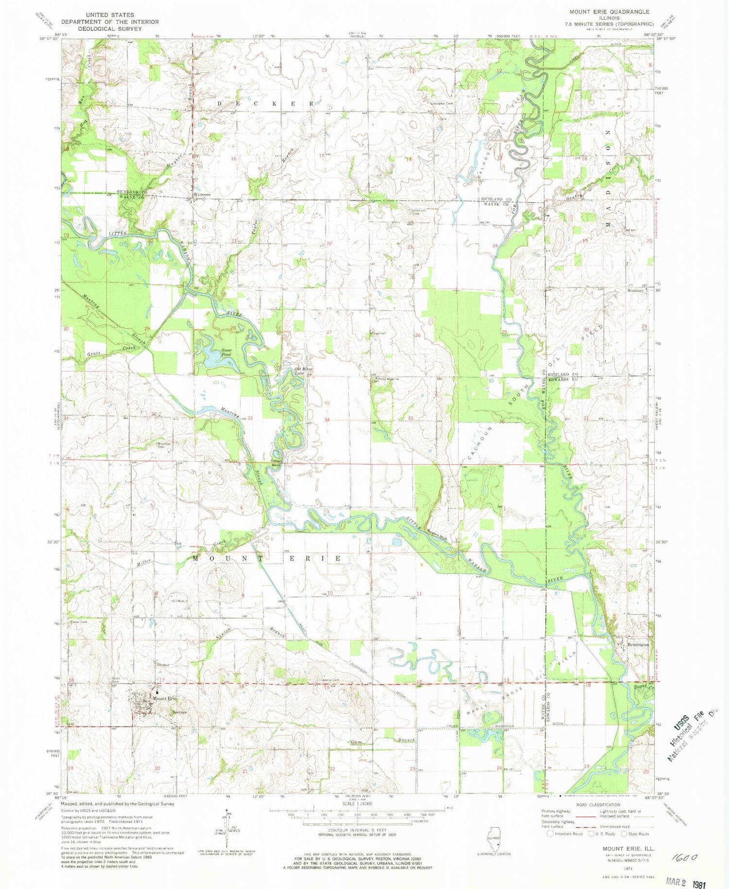
Classic USGS Mount Erie Illinois 7.5'x7.5' Topo Map
Couldn't load pickup availability
Historical USGS topographic quad map of Mount Erie in the state of Illinois. Map scale may vary for some years, but is generally around 1:24,000. Print size is approximately 24" x 27"
This quadrangle is in the following counties: Clay, Edwards, Richland, Wayne.
The map contains contour lines, roads, rivers, towns, and lakes. Printed on high-quality waterproof paper with UV fade-resistant inks, and shipped rolled.
Contains the following named places: Barton School, Bennington, Blood School, C B and Q Railroad Reservoir, C B and Q Railroad Reservoir Dam, Calhoun Oil Field, Calhoun South Oil Field, Carson Cemetery, Crews Cemetery, Cross Diversion Ditch, Dorsey Bridge, Farmer School, Forest Ridge Church, Fox River, Gallagher Cemetery, Gentry Creek, Goose Pond, Grove Creek, Gum Branch, Hedrick School, Hughes Branch, Johnson Cemetery, Maple Grove Oil Field, Miller Creek, Miller Creek School, Moultrie School, Mount Erie, Mount Erie Elementary School, Mount Erie Post Office, Mount Erie Townhall, Moutray Cemetery, Moutray Slough, Newton Branch, North Ridge School, Old River Lake, Providence Church, Rutgers Bluff, Scott Cemetery, Seminary, Seminary School, Seminary Tabernacle, Shannon Bridge, South Ridge School, Sugar Creek, Taylor Branch, Totten Bend, Township of Mount Erie, Travers Cemetery, Village of Mount Erie, Wynoose, ZIP Code: 62446


