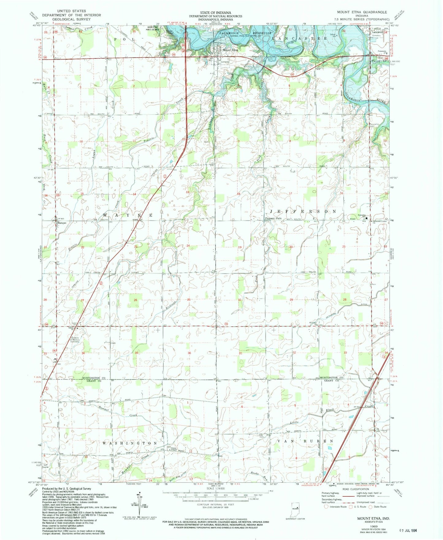
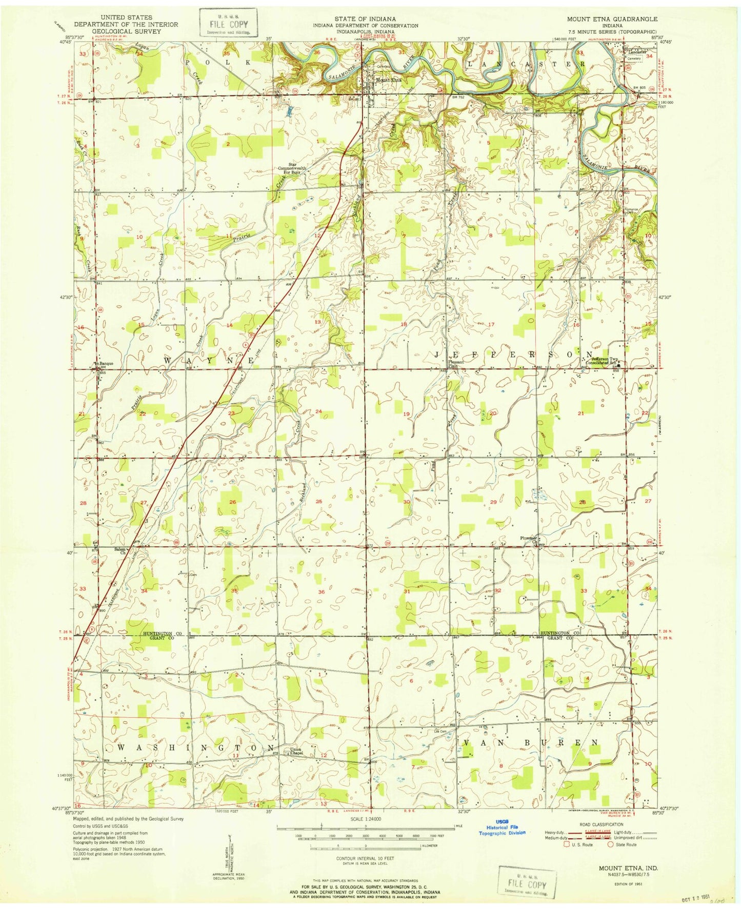
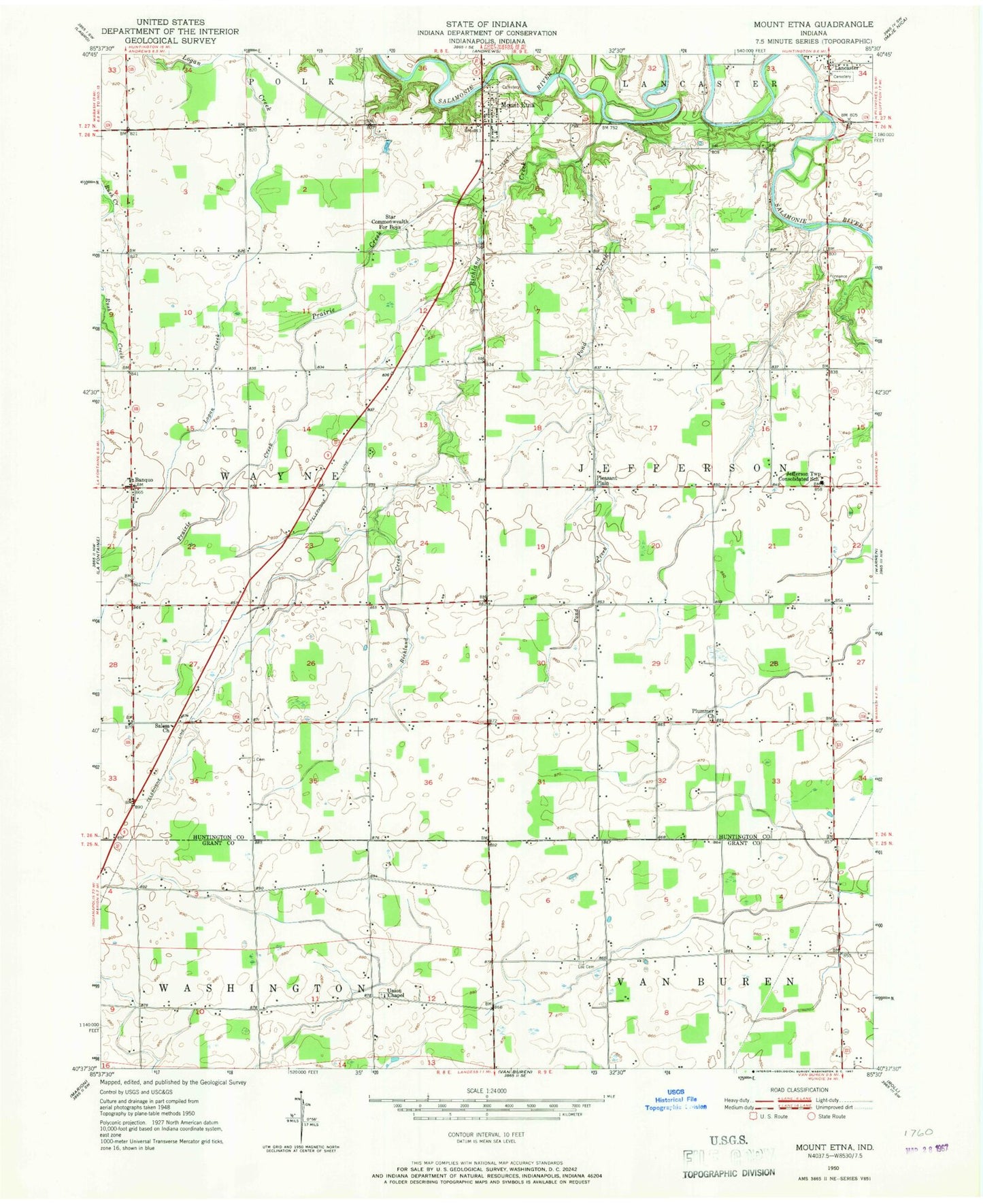
MyTopo
Classic USGS Mount Etna Indiana 7.5'x7.5' Topo Map
Couldn't load pickup availability
Historical USGS topographic quad map of Mount Etna in the state of Indiana. Map scale may vary for some years, but is generally around 1:24,000. Print size is approximately 24" x 27"
This quadrangle is in the following counties: Grant, Huntington.
The map contains contour lines, roads, rivers, towns, and lakes. Printed on high-quality waterproof paper with UV fade-resistant inks, and shipped rolled.
Contains the following named places: Banquo, Brook Creek, Gardens of Memory Cemetery, Jefferson Center Church, Lancaster, Lee Cemetery, Mount Etna, Mount Etna Volunteer Fire Department Station 1, Mount Etna Volunteer Fire Department Station 2, Pleasant Plain, Plummer Church, Pond Creek, Prairie Creek, Purviance Cemetery, Richland Creek, Salamonie Church, Salem Church, Town of Mount Etna, Township of Jefferson, Township of Wayne, Union Chapel, ZIP Code: 46991