
MyTopo
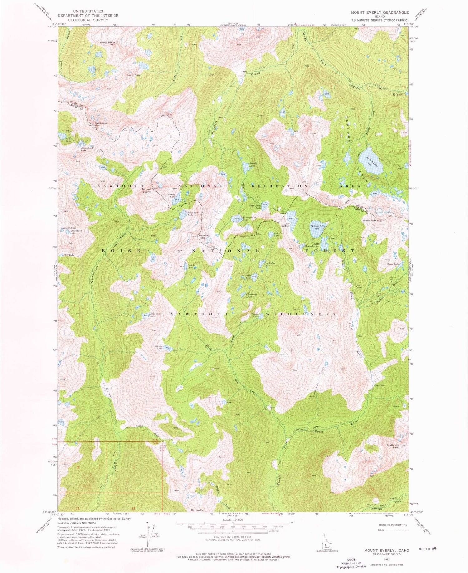
Classic USGS Mount Everly Idaho 7.5'x7.5' Topo Map
Couldn't load pickup availability
Historical USGS topographic quad map of Mount Everly in the state of Idaho. Typical map scale is 1:24,000, but may vary for certain years, if available. Print size: 24" x 27"
This quadrangle is in the following counties: Boise, Elmore.
The map contains contour lines, roads, rivers, towns, and lakes. Printed on high-quality waterproof paper with UV fade-resistant inks, and shipped rolled.
Contains the following named places: Ardeth Lake, Arrowhead Lake, Benedict Creek, Benedict Lake, Billy Creek, Blacknose Mountain, Blue Jay Lake, Camp Lake, Chickadee Lake, Cliff Lake, Confusion Lake, Dandy Lake, Everly Lake, Mount Everly, Flytrip Creek, Glens Peak, Lake Ingeborg, Island Lake, Little Spangle Lake, Low Pass Lake, Mattingly Peak, Nanny Creek, North Raker, Pancho Lake, Pats Lake, Plummer Lake, Plummer Peak, Rock Creek, Rock Slide Lake, Snowbank Lake, Spangle Lake, Surprise Lake, Tenlake Basin, Tenlake Creek, Three Island Lake, Timpa Creek, Timpa Lake, The Rakers, Spangle Lakes, South Raker, Tenlake Basin


