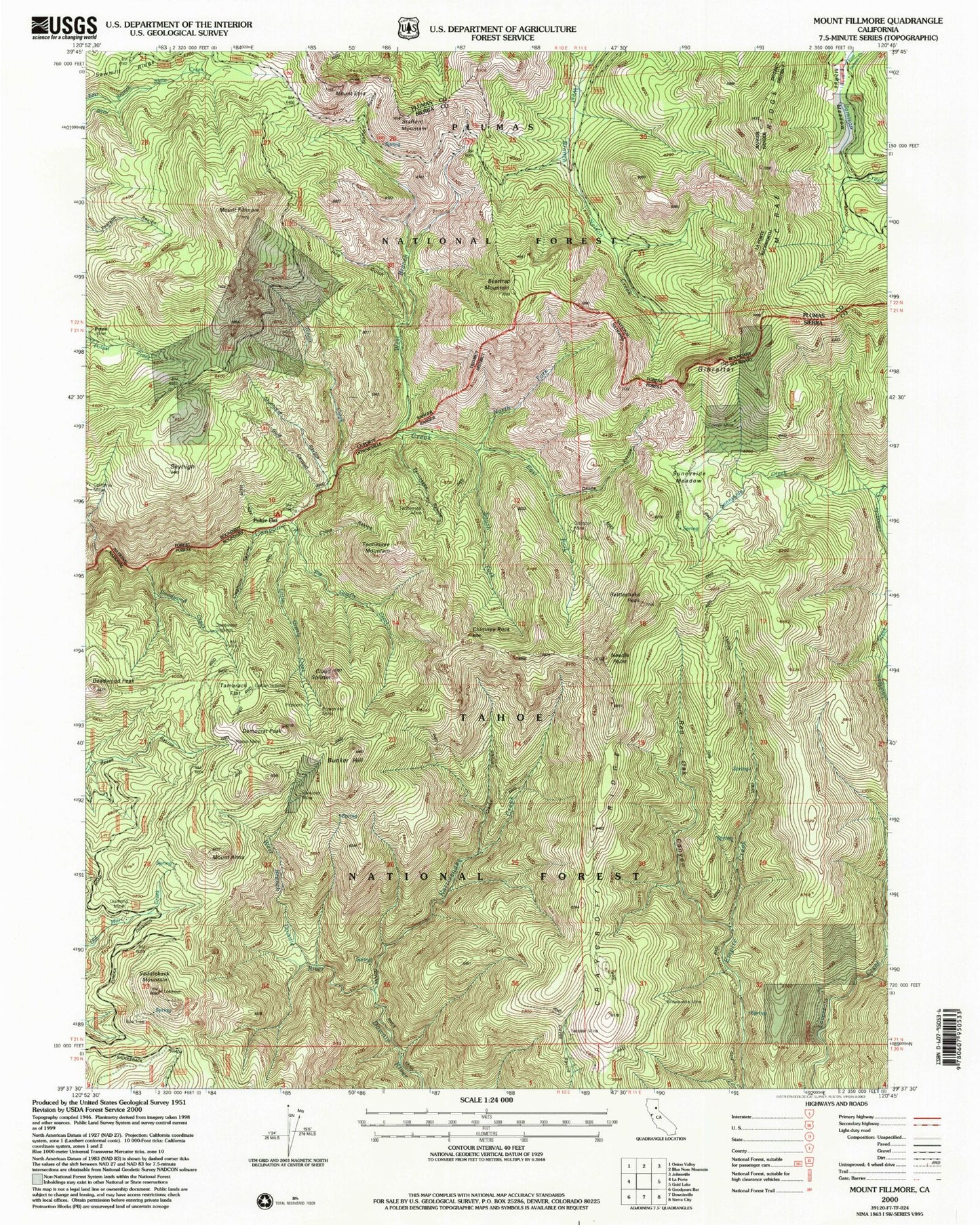
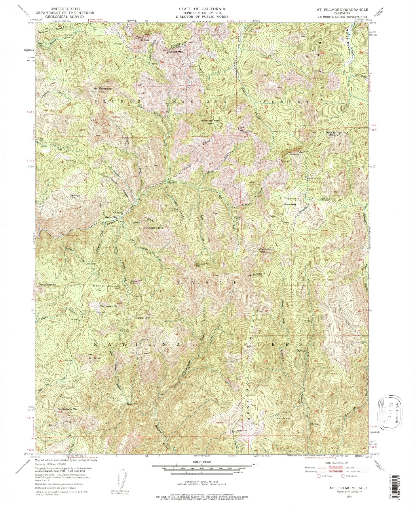
MyTopo
Classic USGS Mount Fillmore California 7.5'x7.5' Topo Map
Couldn't load pickup availability
Historical USGS topographic quad map of Mount Fillmore in the state of California. Map scale may vary for some years, but is generally around 1:24,000. Print size is approximately 24" x 27"
This quadrangle is in the following counties: Plumas, Sierra.
The map contains contour lines, roads, rivers, towns, and lakes. Printed on high-quality waterproof paper with UV fade-resistant inks, and shipped rolled.
Contains the following named places: Beartrap Mountain, Bee Tree, Big Grizzly Creek, Bunker Hill, Bunker Hill Mine, Chimney Rock, China Ravine, Clarks Canyon, Cleghorn Ravine, Cloud Splitter, Cowell Mine, Craycroft Ridge, Deadwood, Deadwood Creek, Deadwood Diggings, Deadwood Peak, Deans Ravine, Democrat Peak, Diamond Mine, East Fork Canyon Creek, Empire Creek Trail, Gibraltar, Gibraltar Mine, Gold Canyon, Golden Scepter Mine, Hays Ravine, Herkimer Mine, Hog Gulch, Illinois Creek, Little Grizzly Creek, McRae Ridge, Mount Alma, Mount Etna, Mount Fillmore, Needle Point, Nessler Mine, North Fork Canyon Creek, Poker Flat, Poker Flat Cemetery, Rattlesnake Creek, Rattlesnake Peak, Red Oak Canyon, Reese Mine, Saddleback Mountain, Skyhigh, South Fork Canyon Creek, Stafford Mountain, Stafford Ravine, Studhorse Ravine, Sunnyside Creek, Sunnyside Meadow, Tamarack Flat, Tennessee Mine, Tennessee Mountain, Tennessee Ravine, West Branch Canyon Creek, West Branch Downie River, Wideawake Mine