
MyTopo
Classic USGS Mount Grace Massachusetts 7.5'x7.5' Topo Map
Couldn't load pickup availability
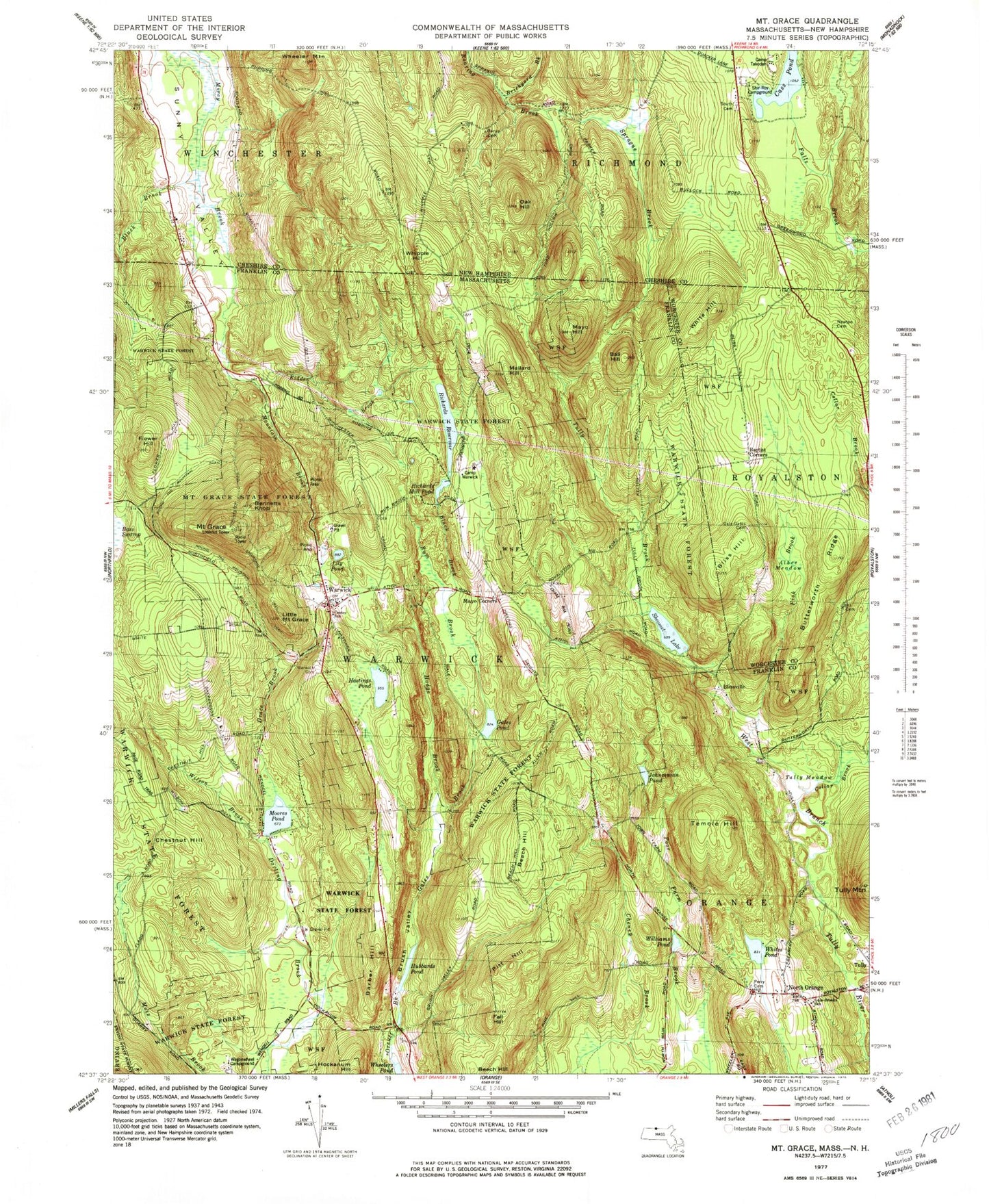
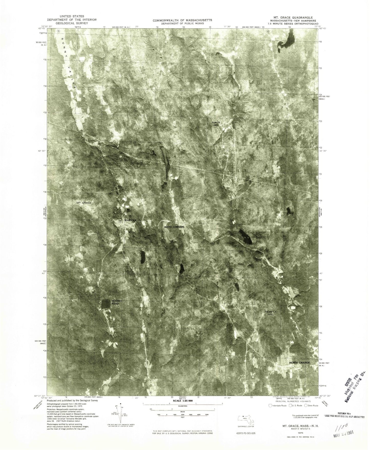
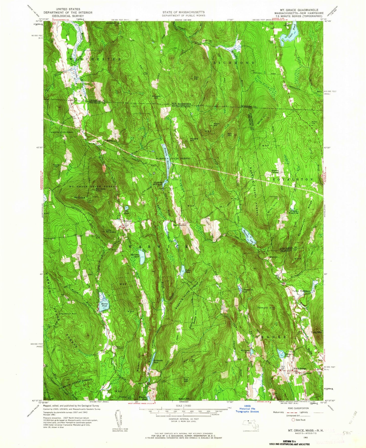
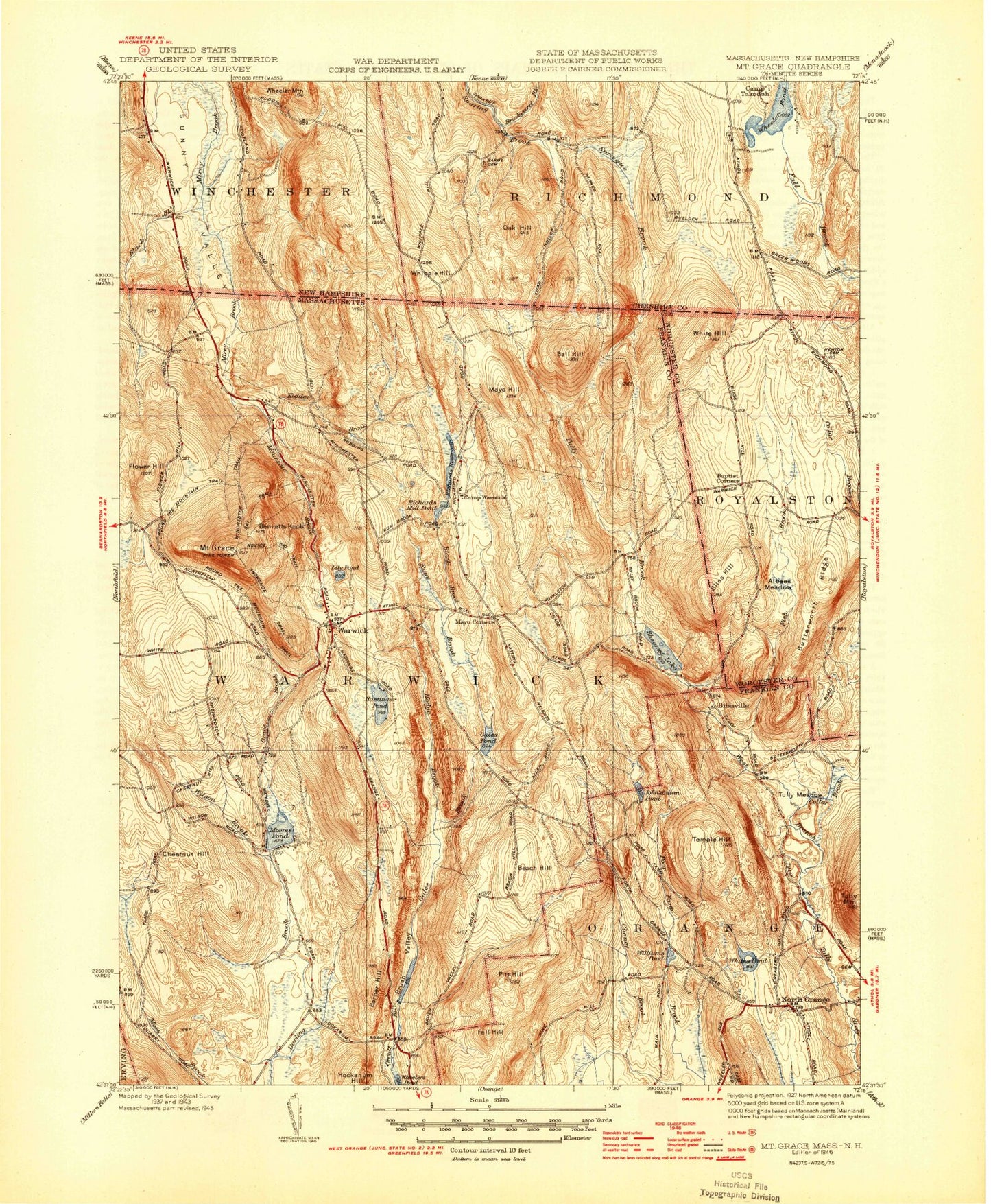
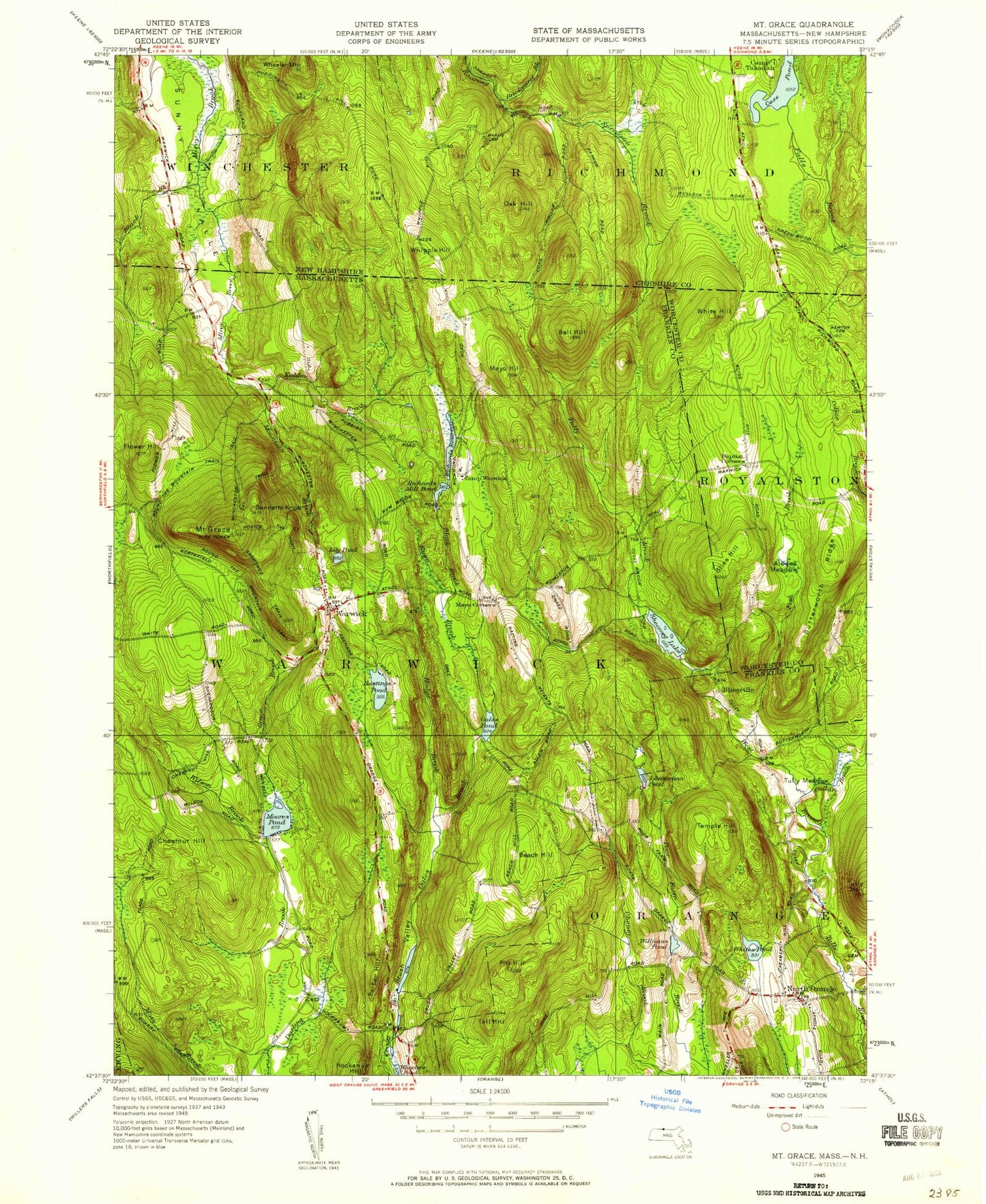
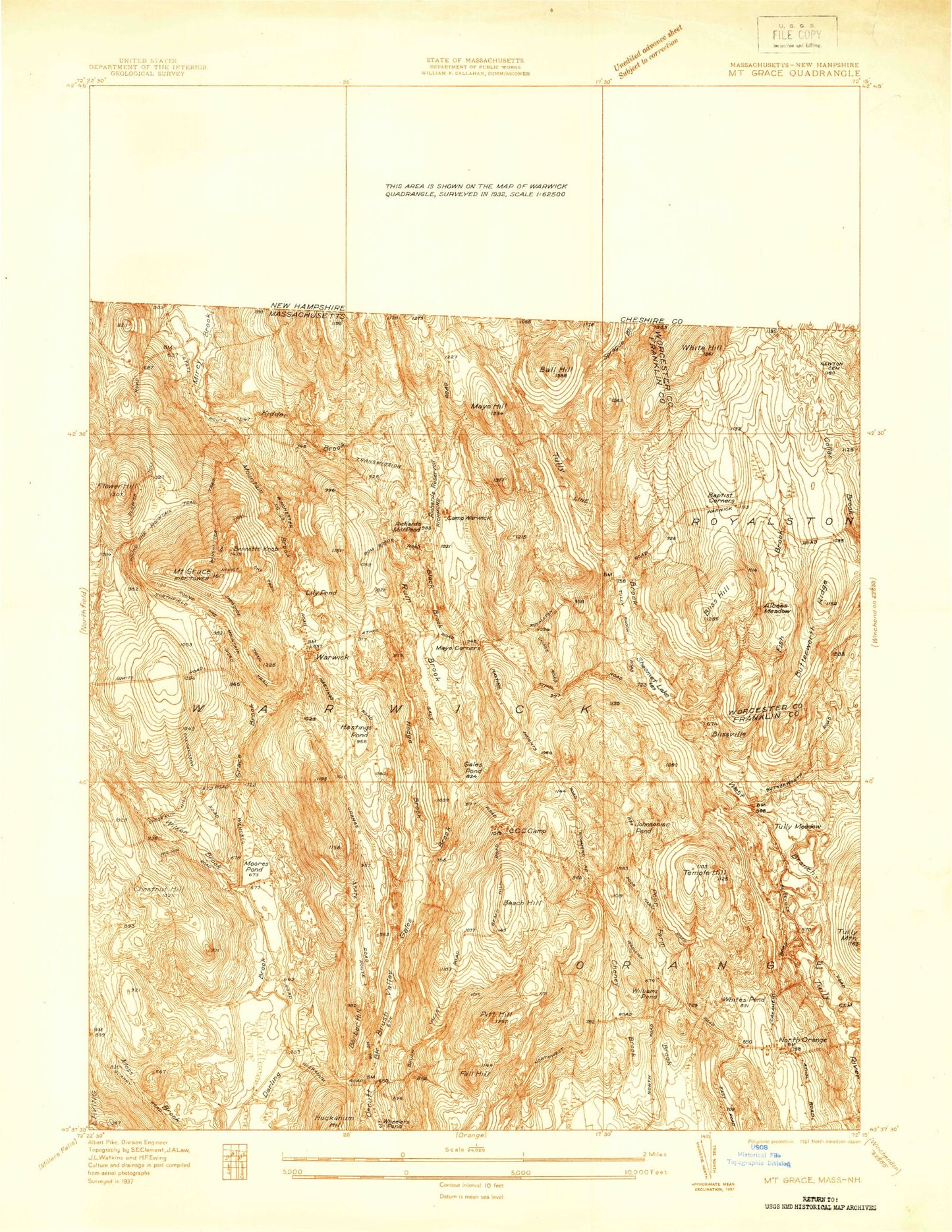
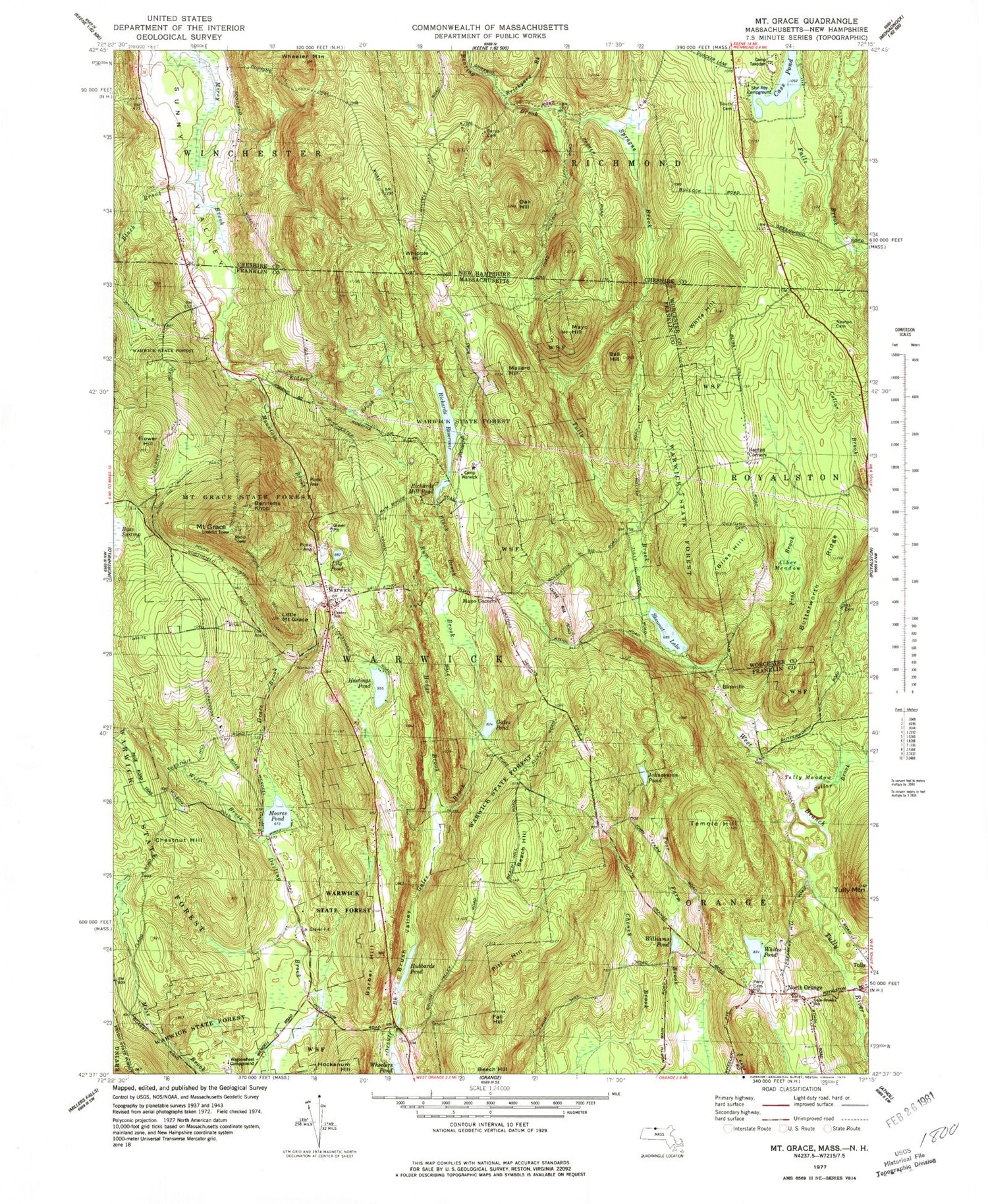
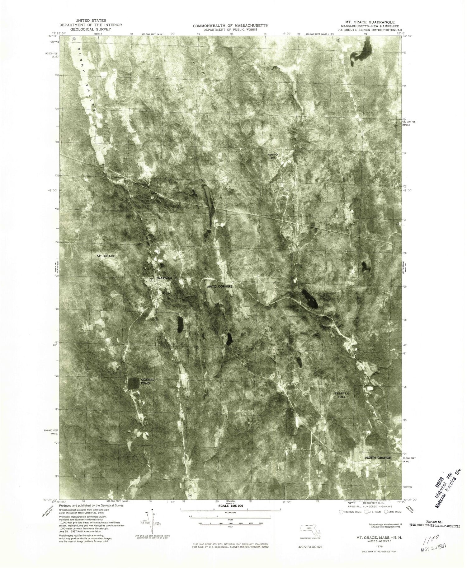
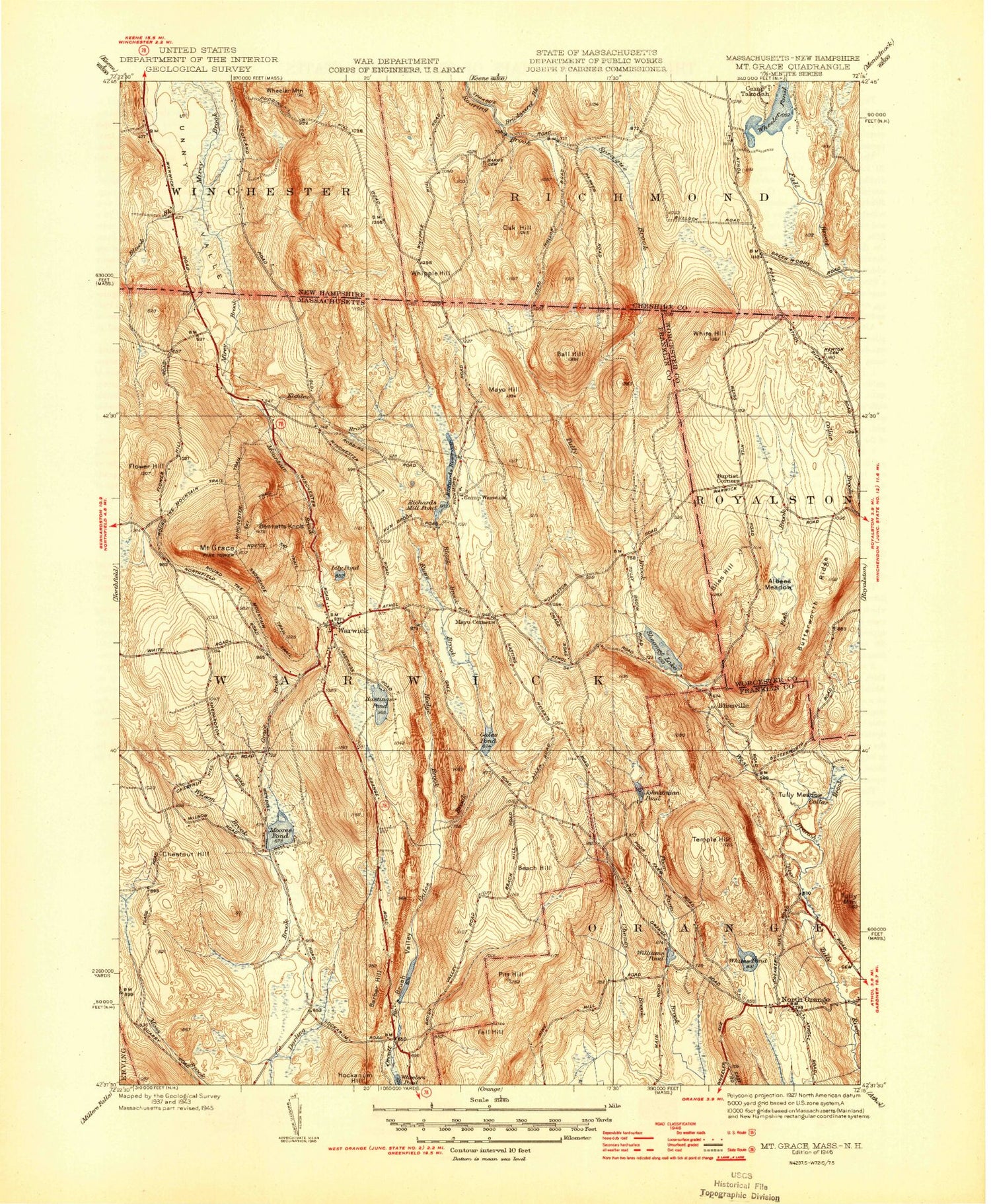
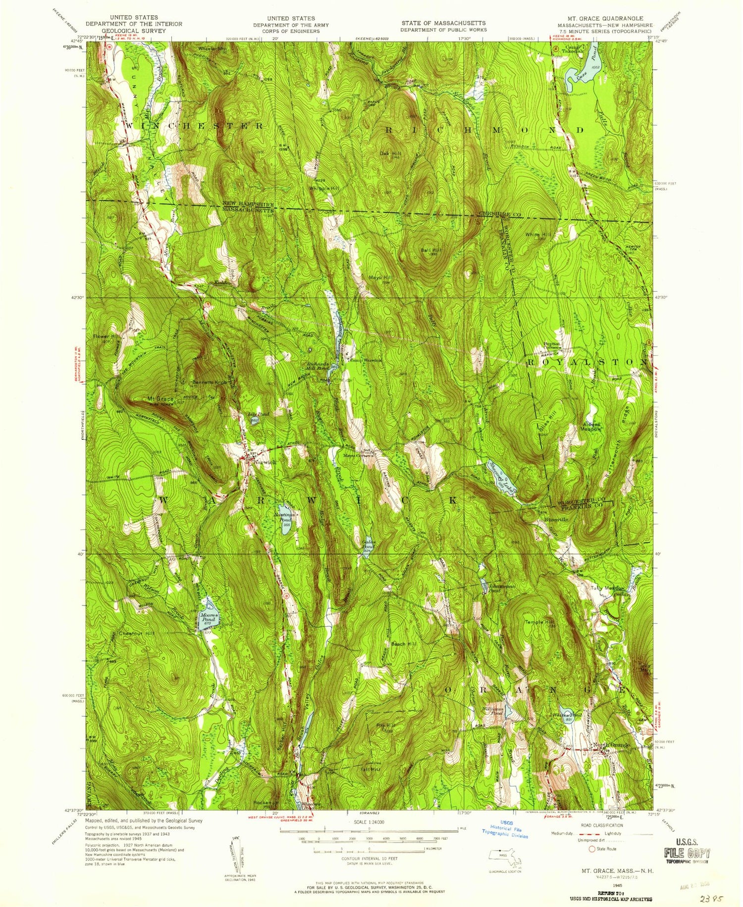
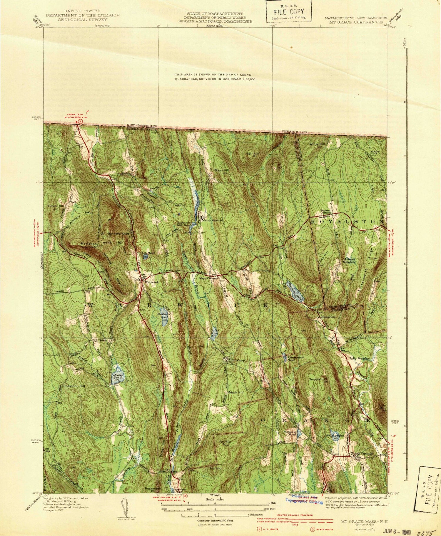
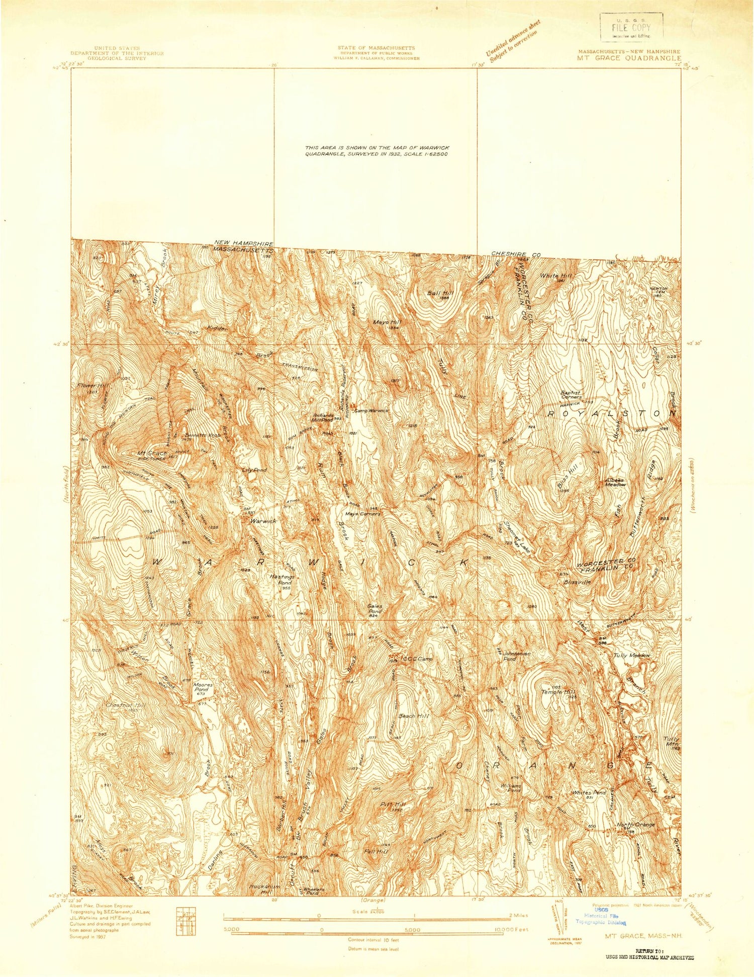
Historical USGS topographic quad map of Mount Grace in the states of Massachusetts, New Hampshire. Typical map scale is 1:24,000, but may vary for certain years, if available. Print size: 24" x 27"
This quadrangle is in the following counties: Cheshire, Franklin, Worcester.
The map contains contour lines, roads, rivers, towns, and lakes. Printed on high-quality waterproof paper with UV fade-resistant inks, and shipped rolled.
Contains the following named places: Camp Northfield, Perry Cemetery, Newton Cemetery, Warwick Cemetery, Wagonwheel Campground, Gale-Brooks School, Center School, Plazas Pond Dam, Whites Pond Dam, Moorse Pond Dam, Gales Pond Dam, Sheomet Lake Dam, Richards Reservoir Upper Dam, Albee Meadow, Ball Hill, Baptist Corners, Barber Hill, Beach Hill, Beech Hill, Bennetts Knob, Black Brook, Black Brook, Bliss Hill, Blissville, Brush Valley, Butterworth Ridge, Chestnut Hill, Collar Brook, Fall Hill, Fish Brook, Flower Hill, Gales Brook, Gales Pond, Grace Brook, Mount Grace, Harris Swamp, Hastings Pond, Hockanum Hill, Hodge Brook, Hubbards Pond, Johnsonian Pond, Kidder Brook, Lily Pond, Little Mount Grace, Mallard Hill, Mayo Corners, Mayo Hill, Moores Pond, Mountain Brook, North Orange, Pitt Hill, Poor Farm Brook, Richards Mill Pond, Richards Reservoir, Rum Brook, Sheomet Lake, Sprague Brook, Temple Hill, Tully Brook, Warwick, Camp Warwick, White Hill, Whites Pond, Williams Pond, Wilson Brook, Tully Meadow, Tully Mountain, Delvas Pond (historical), Town of Warwick, Warwick Center School, Warwick Free Public Library, Trinitarian Congregational Church, Community Church of North Orange, Warwick Fire Department, Chase Hill Farm, Warwick Police Department, Barus Cemetery, Tilsey Brook, Camp Takodah, Cass Pond, Shir-Roy Campground, South Cemetery, Wheeler Mountain, Whipple Hill, Camp Northfield, Perry Cemetery, Newton Cemetery, Warwick Cemetery, Wagonwheel Campground, Gale-Brooks School, Center School, Plazas Pond Dam, Whites Pond Dam, Moorse Pond Dam, Gales Pond Dam, Sheomet Lake Dam, Richards Reservoir Upper Dam, Albee Meadow, Ball Hill, Baptist Corners, Barber Hill, Beach Hill, Beech Hill, Bennetts Knob, Black Brook, Black Brook, Bliss Hill, Blissville, Brush Valley, Butterworth Ridge, Chestnut Hill, Collar Brook, Fall Hill, Fish Brook, Flower Hill, Gales Brook, Gales Pond, Grace Brook, Mount Grace, Harris Swamp, Hastings Pond, Hockanum Hill, Hodge Brook, Hubbards Pond, Johnsonian Pond, Kidder Brook, Lily Pond, Little Mount Grace, Mallard Hill, Mayo Corners, Mayo Hill, Moores Pond, Mountain Brook, North Orange, Pitt Hill, Poor Farm Brook, Richards Mill Pond, Richards Reservoir, Rum Brook, Sheomet Lake, Sprague Brook, Temple Hill, Tully Brook, Warwick, Camp Warwick, White Hill, Whites Pond, Williams Pond, Wilson Brook, Tully Meadow, Tully Mountain, Delvas Pond (historical), Town of Warwick, Warwick Center School, Warwick Free Public Library, Trinitarian Congregational Church, Community Church of North Orange, Warwick Fire Department, Chase Hill Farm, Warwick Police Department, Barus Cemetery, Tilsey Brook, Camp Takodah, Cass Pond, Shir-Roy Campground, South Cemetery, Wheeler Mountain, Whipple Hill, Camp Northfield, Perry Cemetery, Newton Cemetery, Warwick Cemetery, Wagonwheel Campground, Gale-Brooks School, Center School, Plazas Pond Dam, Whites Pond Dam, Moorse Pond Dam, Gales Pond Dam, Sheomet Lake Dam, Richards Reservoir Upper Dam, Albee Meadow, Ball Hill, Baptist Corners, Barber Hill, Beach Hill, Beech Hill, Bennetts Knob, Black Brook, Black Brook, Bliss Hill, Blissville, Brush Valley, Butterworth Ridge, Chestnut Hill, Collar Brook, Fall Hill, Fish Brook, Flower Hill, Gales Brook, Gales Pond, Grace Brook, Mount Grace, Harris Swamp, Hastings Pond, Hockanum Hill, Hodge Brook, Hubbards Pond, Johnsonian Pond, Kidder Brook, Lily Pond, Little Mount Grace, Mallard Hill, Mayo Corners, Mayo Hill, Moores Pond, Mountain Brook, North Orange, Pitt Hill, Poor Farm Brook, Richards Mill Pond, Richards Reservoir, Rum Brook, Sheomet Lake, Sprague Brook, Temple Hill, Tully Brook, Warwick, Camp Warwick, White Hill, Whites Pond, Williams Pond, Wilson Brook, Tully Meadow, Tully Mountain, Delvas Pond (historical)