MyTopo
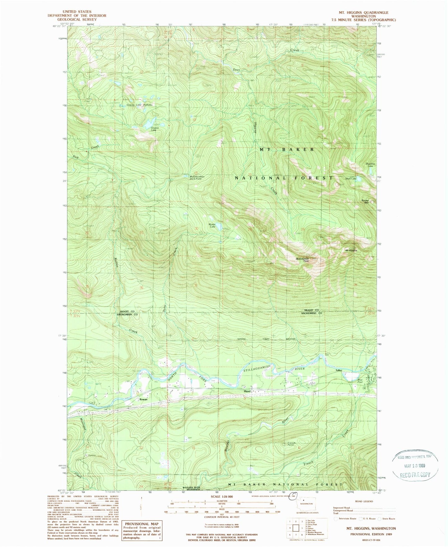
Classic USGS Mount Higgins Washington 7.5'x7.5' Topo Map
Couldn't load pickup availability
Historical USGS topographic quad map of Mount Higgins in the state of Washington. Map scale may vary for some years, but is generally around 1:24,000. Print size is approximately 24" x 27"
This quadrangle is in the following counties: Skagit, Snohomish.
The map contains contour lines, roads, rivers, towns, and lakes. Printed on high-quality waterproof paper with UV fade-resistant inks, and shipped rolled.
Contains the following named places: Blue Pool, Boulder River, Dicks Creek, French Creek, French Creek Forest Camp, French Creek Pond, French Point, Granite Lake, Granite Lake Potholes, Hawkins Lake, Hazel, Higgins Creek, McGillicuddys Duck Pond, Mount Higgins, Myrtle Lake, Rollins Creek, Round Mountain, Rowan, Shelf Lake, Skadulgwas Peak, Stillaguamish Country Club, Tulker